East Bayfront
East Bayfront is a mix-use community that supports Toronto’s economic competitiveness, as well as fulfills a growing demand for live-work-play neighbourhoods in the downtown core.
This neighbourhood with waterfront views intertwines residential, retail, institutional and commercial developments with parks and public spaces, creating an inviting gateway to Lake Ontario for visitors and residents. Located only 10 minutes from Union Station, East Bayfront is emerging as a hotbed for innovation.
Parks and Public Spaces
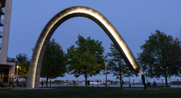
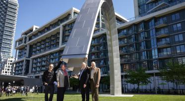
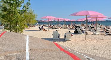
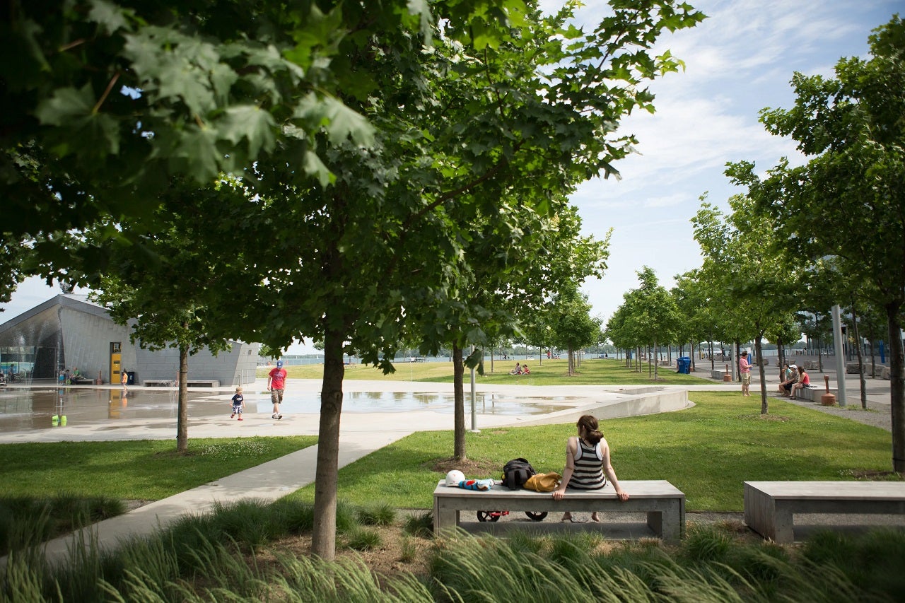
East Bayfront offers three public parks as urban refuges by the water: candy-coloured Sugar Beach, innovative Sherbourne Common, and versatile Aitken Place Park, as well as a kilometre-long continuous Water’s Edge Promenade. To enhance the cultural vibrancy of the waterfront, permanent art pieces in East Bayfront, including LIGHT KEEPER and Light Showers draw visitors from across the region to the waterfront all year round.
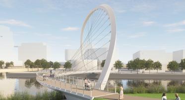
Public spaces also include public infrastructure. A new pedestrian bridge spanning the Keating Channel is being planned for the area. The Keating Channel Pedestrian Bridge will link the Quayside neighbourhood and Toronto’s downtown to an expanded regional park system along the Don River and Villiers Island. It will contribute to the creation of a continuous and publicly accessible water’s edge along the Toronto waterfront and play a critical role in providing safe, direct, and equitable access across the Keating Channel.
Innovative businesses benefit from an ultra-high-speed broadband fibre-optic network provided in partnership with Beanfield Metroconnect. This economical high-speed internet service supports the businesses in East Bayfront that require this kind of robust infrastructure such as those working in technology, creative, gaming, digital visualization and media, film and TV production industries.
Quick Facts
Boundaries: From Lower Jarvis Street to Parliament Street, Lake Shore Boulevard to Lake Ontario
Size: 23 hectares (55 acres)
Features:
- 6,000 new residential units
- 3 million square feet of commercial space
- 8,000 new jobs
- 5.5 hectares of parks and public spaces
- 1 km continuous water’s edge promenade
Proximity: 10 minute walk to Union Station
Design Team: Koetter Kim & Associates (Precinct Plan Lead)
Development Projects
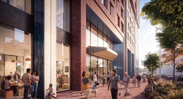
East Bayfront sets the standard for sustainable neighbourhoods. Contributing to the ambitious Green Building Standards in East Bayfront are Corus Quay (LEED Gold) and George Brown College’s Waterfront Campus buildings, the Daphne Cockwell Centre for Health Sciences (LEED Gold) and the future Limberlost Place (targeting LEED Gold). Another pillar of the innovation corridor of East Bayfront is the Waterfront Innovation Centre – a 475,000 sq. ft. purpose-built innovation workplace for creative and technology sectors that is also targeting LEED Platinum certification, having incorporated a range of sustainable building designs.
The first private sector development in East Bayfront, Monde Condominiums, developed by Great Gulf and designed by world-renowned architect Moshe Safdie, set the stage for residential developments in East Bayfront by making 5% of its units family-friendly with three bedrooms.
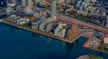
Bayside, the largest development parcel in East Bayfront, is comprised of 5.6 hectares (13 acres) and has a prominent waterfront location with extended frontage on the lake. Hines with its residential partner, Tridel, has developed the area with ambitious sustainability and innovation standards.
Four condominium developments in Bayside – Aqualina, Aquavista, Aquabella and Aqualuna – will bring a total of 1071 residential units to the area. In addition to much needed housing, these condominiums deliver a range of innovative and sustainable building designs, affordable housing units, a City-owned and operated community centre, a City-owned childcare facility, and, of course, incredible views of Lake Ontario. As part of the Bayside development, two office buildings, T3 Bayside I and II, will be built using mass timber which reduces and prevents carbon emissions, compared to standard building materials.
On another parcel of land in Bayside (R6), plans are being developed for a new purpose-built market rental and affordable housing development. In this development, affordable units would be seamlessly interspersed throughout the development, making the market units and affordable units indistinguishable from one door to the next.
Spanning across both East Bayfront and the Keating Precincts is Quayside. Quayside is a 4.9-hectare (12-acre) area located at the foot of Parliament Street and Lake Shore Boulevard East within walking distance of Toronto’s vibrant downtown core. Quayside is the cornerstone in Waterfront Toronto’s vision for the waterfront, the connection between communities to the north and west, and the future Villiers Island to the south. Quayside is an extraordinary opportunity to create an inclusive, vibrant mixed-use, mixed-income neighbourhood that offers a range of housing options and amenities and provides a high standard of living for individuals and families alike at any stage of their lives.
Waterfront Toronto launched an international Request for Qualifications (RFQ) in March 2021, resulting in a shortlist of Proponents who were invited to participate in this latest Request for Proposals (RFP) stage. In February 2022, Waterfront Toronto announced the selection of Dream Unlimited Corp. (Dream) and Great Gulf Group, known as Quayside Impact Limited Partnership, for developing the Quayside site and enter into project negotiations. Waterfront Toronto expects to complete negotiations on the project agreement with Quayside Impact by fall 2022.
Engaging the Community
The development of the East Bayfront Precinct Plan and the Class EA Master Plan was a collaborative effort with the City of Toronto, community stakeholder groups, the general public, private landowners and the school boards.
During the planning process, the community and various other stakeholder groups provided valuable feedback on the precinct designs at stakeholder and public meetings. Input from all groups was instrumental and ensured that the final precinct plan would deliver a neighbourhood for people to live, work and play.
planning east bayfront
While early planning efforts for East Bayfront can be tracked back to the Toronto Waterfront Revitalization Taskforce (2000) and the City of Toronto’s Central Waterfront Secondary Plan (2001), planning began in earnest in 2003. At that time, Waterfront Toronto began two key initiatives – the Precinct Plan and the Class Environmental Assessment (EA) Master Plan for East Bayfront.
Once the East Bayfront Precinct Plan was finalized in November 2005 and the Class EA Master Plan in February 2006, work could begin on amending the zoning by-law which up until that time had designated the area for industrial use. The new zoning by-law for East Bayfront was approved in September 2006 and is consistent with the principles outlined in the Precinct Plan.
Plans of Subdivision were required to divide larger parcels of land into development blocks, streets, and parks. The first phase Plan of Subdivision for the southwestern part of East Bayfront, known as Dockside, was registered in 2010. The first phase Plan of Subdivision for Bayside was registered in 2013 and phase two Plan of Subdivision was registered in 2017.
In addition to the Precinct Plan, Waterfront Toronto established a draft Urban Design Guidelines for East Bayfront in 2007 and a Ground Floor Retail Strategy and Cultural and Animation Strategy were also developed to ensure East Bayfront is a lively and sustainable place to live, work, play and learn.
The East Bayfront precinct plan has received several prestigious awards, including one from the Canadian Society of Landscape Architects.