Keating Channel Pedestrian Bridge
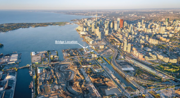
Keating Channel Pedestrian Bridge is an active transportation bridge that will connect downtown to the new island, Ookwemin Minising, and award-winning park, Biidaasige Park.
Anticipated to open in mid-2028, the bridge will provide a vital connection and stand as a striking gateway to Toronto’s next chapter of waterfront revitalization.
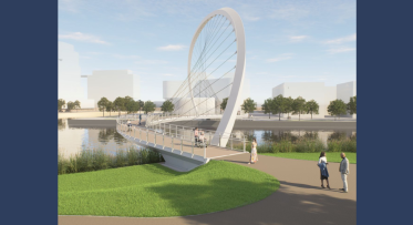
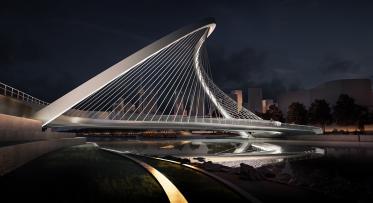
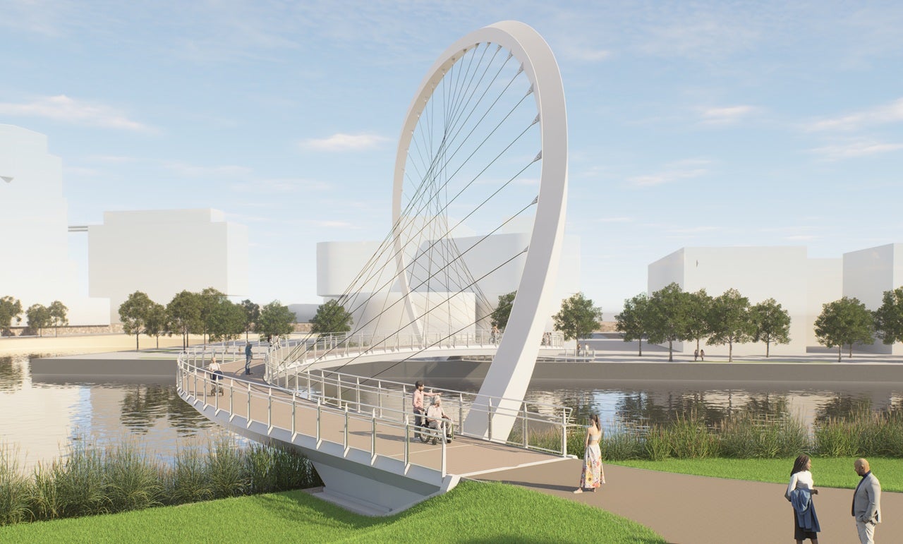
The bridge features a signature “S” shaped suspended arch bridge connected by an array of fanning cables that evokes the sun’s path during solstices and equinoxes, creating a dynamic experience that changes with each step and season.
This project is a partnership between Waterfront Toronto and the City of Toronto, in collaboration with Host Nation and Treaty Holder, the Mississaugas of the Credit First Nation (MCFN).
Quick Facts
Background
The Keating Channel Precinct Plan (2010), the Villiers Island Precinct Plan (2017), and the Port Lands Planning Framework all imagined a pedestrian and cyclist bridge that crossed the Keating Channel, linking the Central Waterfront to Ookwemin Minising and the regional park system, Biidaasige Park. These plans were informed by extensive community consultation and engagement.
In May 2023, Waterfront Toronto and its partners issued a Request for Qualifications (RFQ) and Design Competition for a bridge that would create a distinctive gateway and accessible active transportation link from downtown to Ookwemin Minising.
In keeping with the project partners’ commitment to public engagement, Waterfront Toronto established a Community Advisory Committee (CAC) to support the Design Competition stage of the project.
After a Design Competition that included a virtual public meeting and online survey that heard from over 2000 community members, the project team announced the selection of WilkinsonEyre's design, Equinox Bridge, as the chosen design for the bridge.
Waterfront Toronto and the project team continued to engage key advisory bodies, including the Accessibility Advisory Committee (AAC), Community Advisory Committee (CAC), Design Review Panel (DRP), Indigenous communities and talking circle to gather feedback as the initial competition concept was advanced.
As this work was underway, deeper insights were gained into the costs, technical demands and delivery strategy required to construct the bridge – read more about this process on our blog.
Now, as the design nears completion, the project team is finalizing construction strategies and coordinating closely with the projects on the two bridge landing sites – the new stretch of Water’s Edge Promenade at Quayside and Biidaasige Park North. Together, these coordinated efforts will help prepare the site for the bridge’s next phase of construction.
Project Goals
Together, Waterfront Toronto, the City of Toronto, MCFN and the CAC, identified six foundational project goals:
- Creating a Beautiful and Distinctive Gateway to the Waterfront
- Connecting the City and Ookwemin Minising
- Incorporating a Living Landscape Approach
- Creating with Indigenous Voice and Agency
- Embodies Sustainable Strategies and Innovation
- Creating a Place for All People
Indigenous Design and Engagement
Incorporating Indigenous design principles and engagement with Indigenous communities is key to this project. Waterfront Toronto is working with the Mississaugas of the Credit First Nation, Host Nation and Treaty Holder, and the City of Toronto’s Indigenous Affairs Office to achieve this goal and support local Indigenous arts, cultures, storytelling, histories, and traditions. The effort focuses on celebrating Indigenous Place-making and Place-keeping – the collective re-imagining of public spaces to strengthen the connection between place, community, values, culture, past, present and future.
Accessibility
The bridge will provide an accessible path of travel across the Keating Channel. It will meet AODA compliance standards and adhere to the City of Toronto’s Accessibility Design Guidelines and Waterfront Toronto’s Accessibility Design Guidelines, Version 1.
Active Transportation
The bridge will complement existing pedestrian and cycling infrastructure, including the separated bike lanes on the Cherry Street bridge that connect the Martin Goodman Trail to the bike paths on Ookwemin Minising and Toronto’s greater cycling network. This bridge will offer an additional crossing, connecting the Water’s Edge Promenade to the east of Parliament Slip to Biidaasige Park North and the larger regional park system along the Don River.
This project funded, in part, by the Government of Canada.

Rendering of the refined design for Keating Channel Pedestrian Bridge featuring the view from the south landing provided courtesy of WilkinsonEyre.