Solving Today’s Challenges and Meeting the Needs of Tomorrow
POSTED: FEBRUARY 7, 2024
In This Blog:
-
The Port Lands Flood Protection work will be completed in 2024/2025, which will create exciting opportunities on the newly created Villier’s Island.
-
In 2024/25, we will complete new parks and will pursue funding opportunities to advance PlayPark on Villiers Island.
-
Villiers Island has the potential to house thousands of residents and welcome 2.5 million visitors while maintaining abundant green spaces and parks.
-
In 2024/2025, we will break ground on Phase 1 of infrastructure and public realm at Quayside which will create a series of green corridors leading to the waterfront.
-
We will begin advancing design for the Waterfront East LRT to 60% to bring higher order transit along the eastern waterfront closer to realization.
-
In addition to advancing land-based transit, we are also exploring the feasibility of water-based transportation options.
Waterfront Toronto’s 2024/2025 Annual Business Plan outlines the ambitious goals to be accomplished in the year ahead. To date, we have carefully invested the public funds entrusted to us to deliver extraordinary transformations along the waterfront. With the Port Lands Flood Protection work set to be completed in 2024/2025, the next phase of waterfront revitalization is in view.
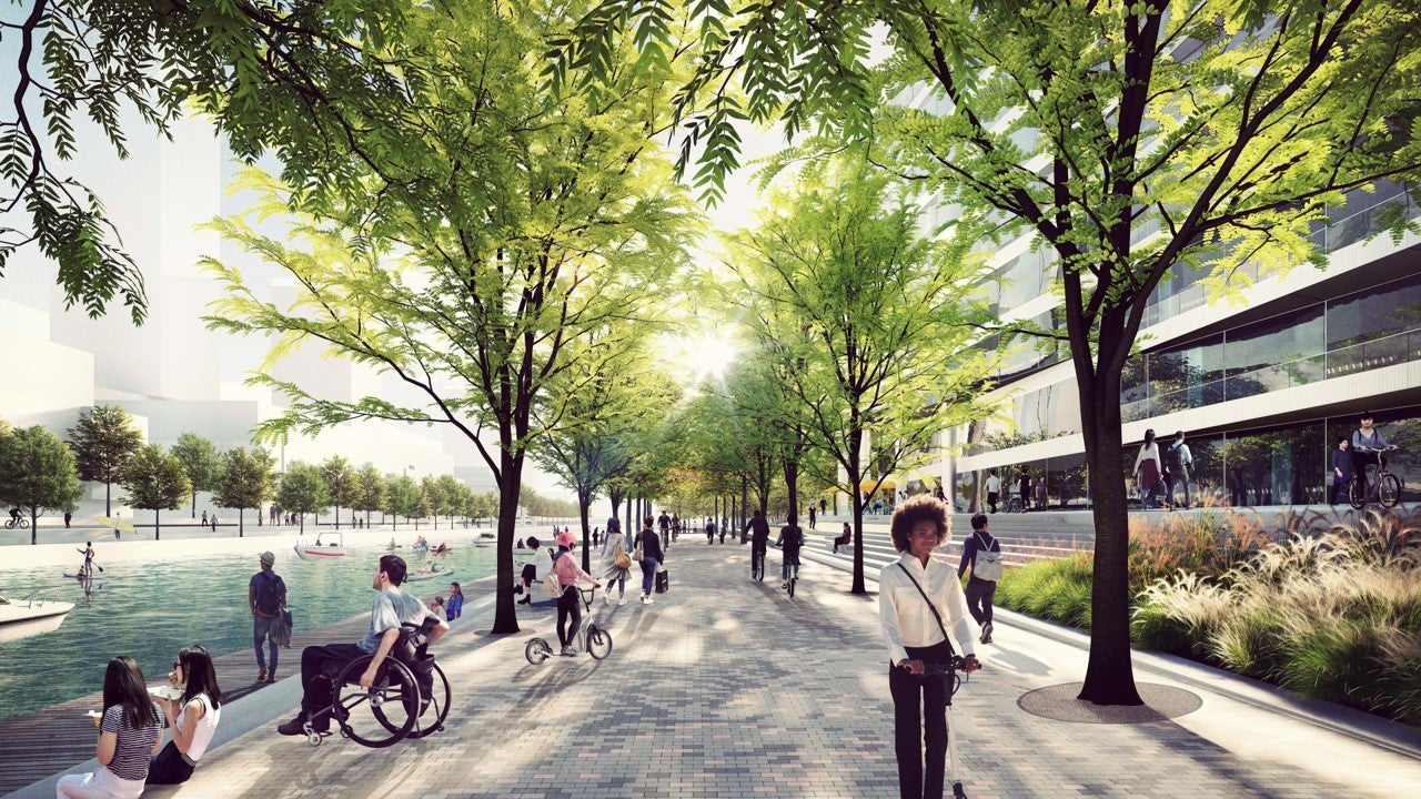
Central to completing the game-changing flood protection work in the Port Lands, water will begin flowing through the new naturalized river valley in 2024/2025. One result of this milestone is a new island, Villiers Island, which will offer 54 acres of land for new homes, destinations, parks and public spaces on the waterfront. Once the flood protection work is complete, two new parks and green spaces will be realized in 2024/2025—River Park North and River Park South at the island's southern end on both sides of the new mouth of the Don River.
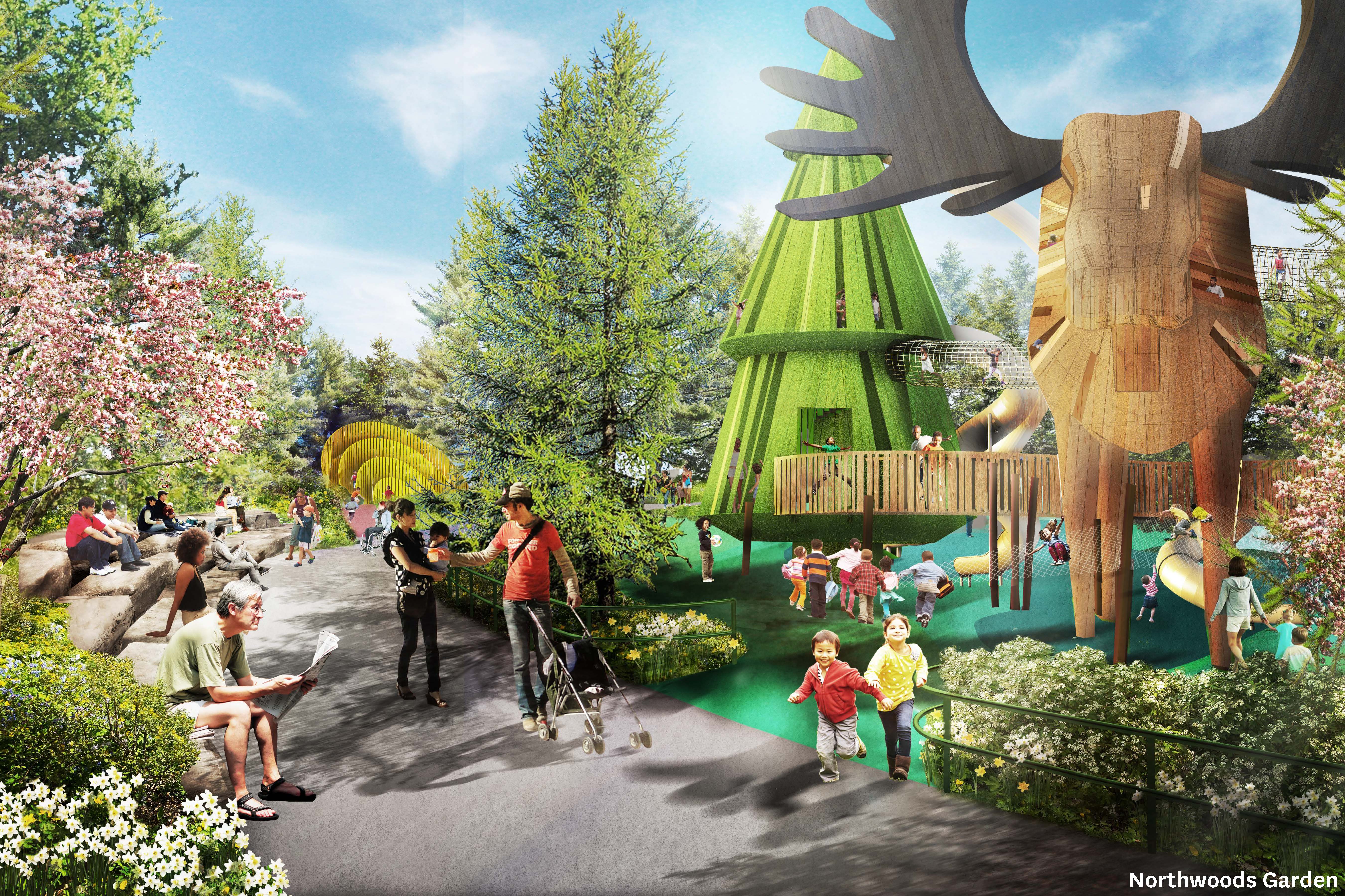
Our vision for Villiers Island includes PlayPark, a larger-than-life nature-play destination that will provide enriching play opportunities for children to support their development.
Villiers Island presents a unique opportunity to create a natural haven for residents and visitors alike to escape the busyness of daily life, with over 34 acres of land earmarked for public green spaces. One such green space will be the PlayPark. In 2024/2025, we aim to secure adequate funding to advance PlayPark, either through philanthropy or other resources. This park will complement the many other parks, green spaces and the art trail on the island, which together have the potential to welcome 2.5 million visitors a year, increasing tourism to the waterfront and supporting the city’s economy.
Villiers Island has the potential to drive tourism as a new gathering place where visitors can enjoy opportunities to play, and experience cultural and commercial destinations on the waterfront.
In addition to becoming a draw for visitors, Villiers Island will be a complete community with the potential to house thousands of residents while maintaining the abundant green spaces and parks planned for the area. Leveraging the results from the Villiers Island Density Study we conducted in 2023, we’ll work with the City of Toronto and CreateTO in 2024/2025 to update zoning by-laws to ensure that density on Villiers Island supports Toronto’s critical housing needs, especially affordable housing, without compromising the vision outlined in the Villiers Island Precinct Plan and Port Lands Planning Framework for a sustainable, complete community.
Villiers Island will transform Toronto’s waterfront — adding homes, public green space and destinations — driving economic development and reinforcing the area as a landmark in sustainable and accessible design and construction.
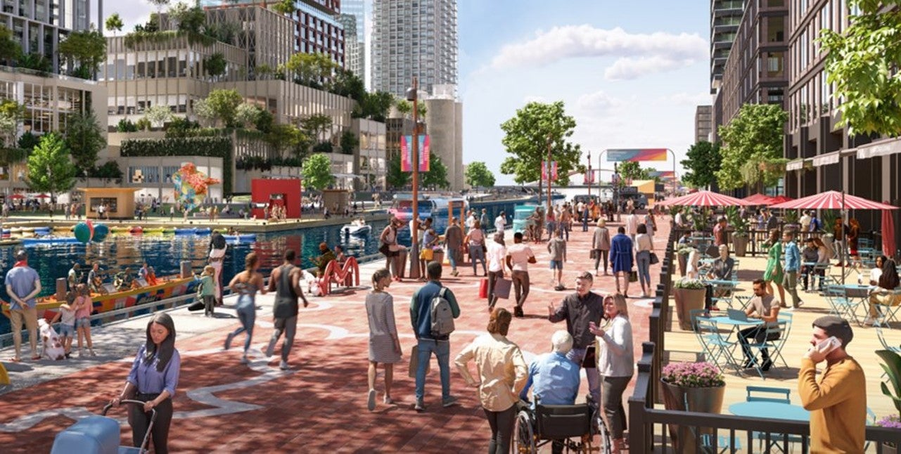
Quayside’s buildings, public realm and privately-owned public spaces will work together to support mobility and well-being.
In 2024/2025, we will break ground on Phase 1 of infrastructure and public realm for Quayside and complete work for the Parliament Slip Lakefilling. The infrastructure and public realm will create a series of connective green corridors that will extend the urban landscape from downtown to the water’s edge. The design of these spaces will be coordinated with the buildings being designed by our development partner, Quayside Impact, to create a pleasant pedestrian experience and welcoming gateway to the water’s edge.
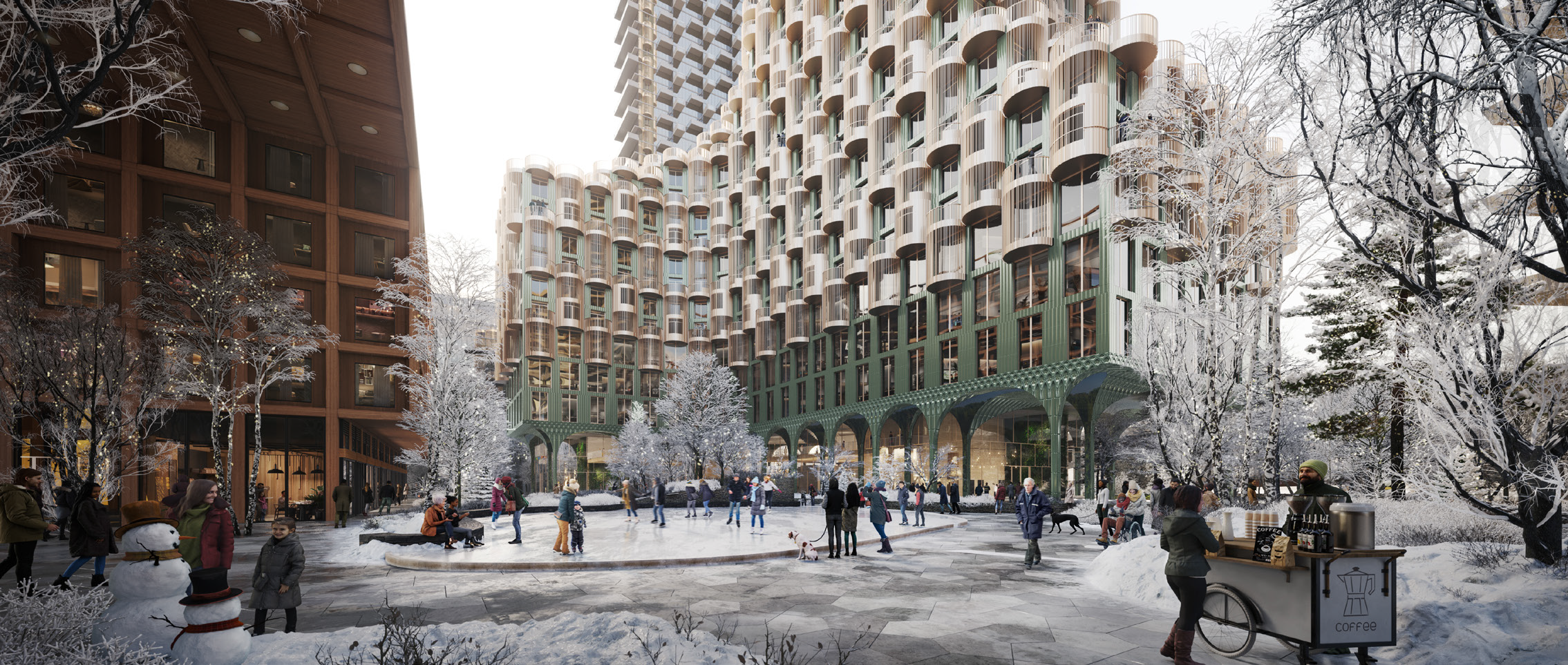
To support the development of this new community, which will be the largest zero-carbon community in Canada, Quayside Impact aims to receive the necessary zoning approvals required in 2024/2025. This important milestone will bring the development of this mixed-use community one step closer to realization. Once complete, this community will create 4,600 new homes, including more than 860 affordable homes, nearly half of which will be family-sized (2+bedroom) to support this growing need.
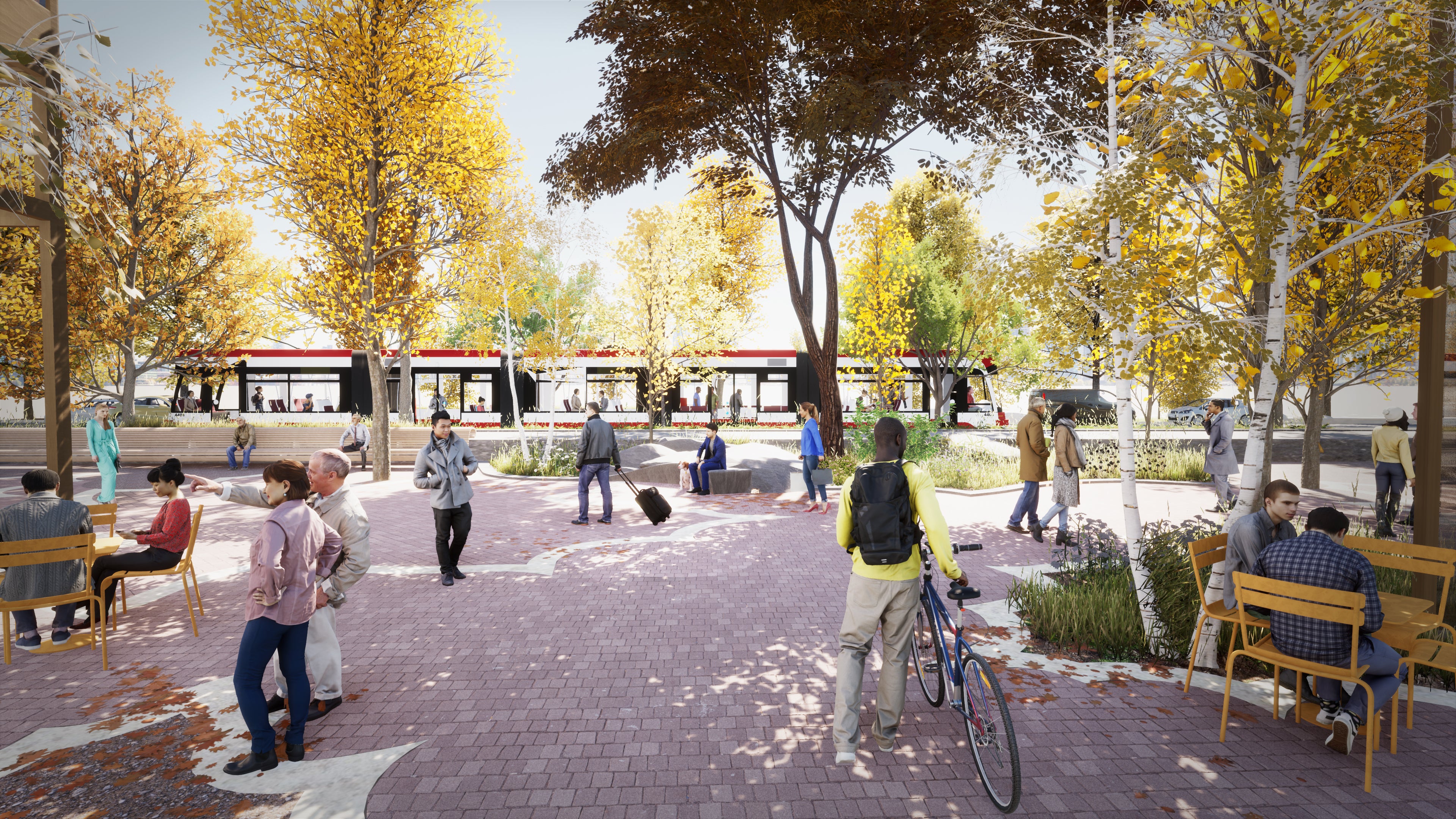
In 2024/2025 we will continue working with the City of Toronto and TTC to begin advancing the design for the Waterfront East LRT (WELRT) to 60%.
Waterfront Toronto is committed to creating complete communities with everything people need to live, work, learn and play, which includes transit so people can come and go easily. The Waterfront East LRT is a priority transit project that will connect Union Station south along Bay Street, east across Queens Quay into Villiers Island, making it an integral part of the development of new communities on Villiers Island and the eastern waterfront. Once completed it is estimated to provide over 50,000 daily trips, bringing higher-order transit to support an estimated 100,000 residents and 50,000 jobs.
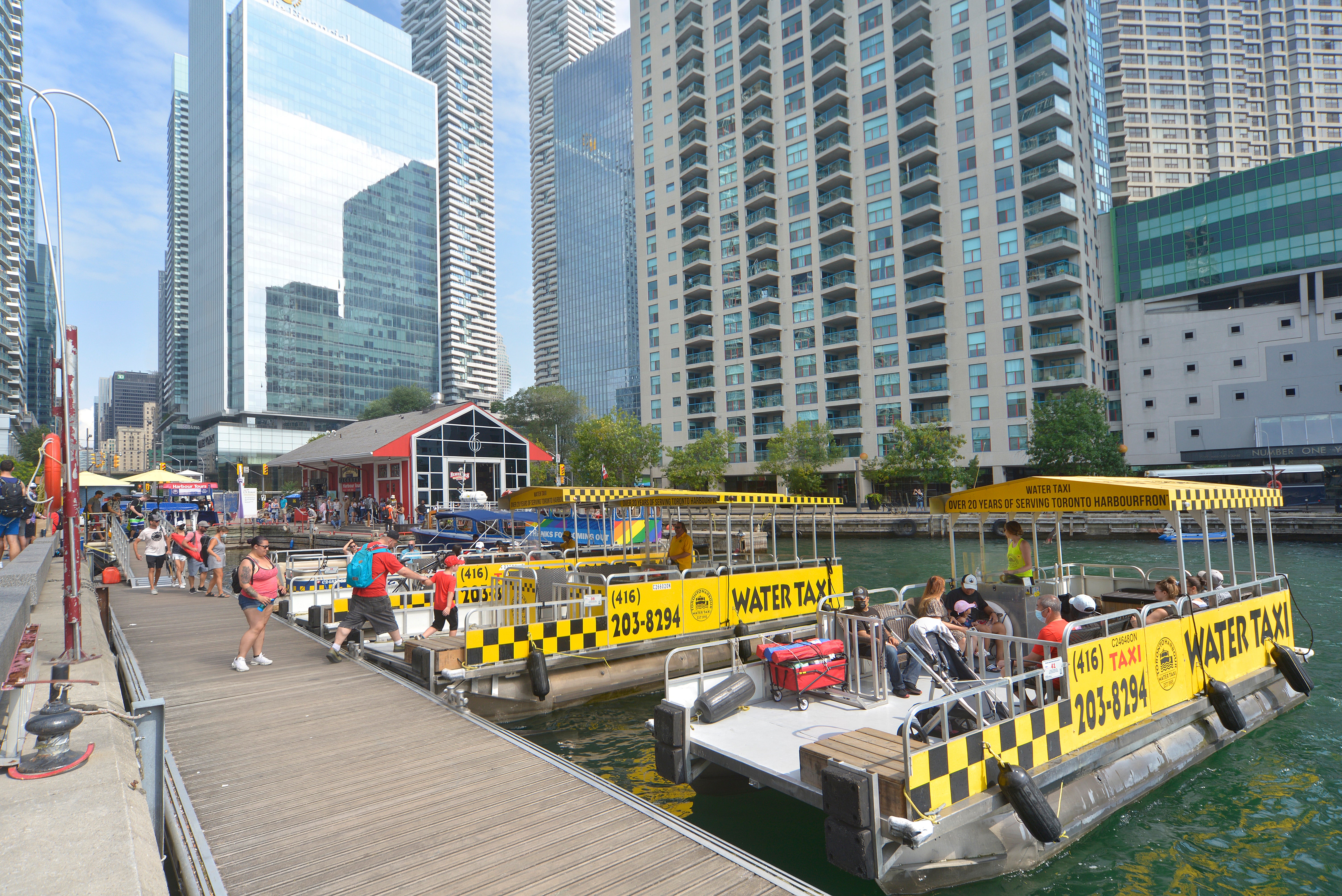
In addition to advancing land-based transit, we are also exploring the feasibility of water-based transportation options.
As part of the Marine Use Strategy, we will complete the Water Taxi and Seabus Feasibility Study in 2024/2025 and initiate a “kiss ‘n sail” pilot program, providing pick up and drop of points by the water’s edge. This pilot program could help relieve traffic congestion along Queens Quay and provide an alternate method of public transportation along the waterfront.
These are just some of the goals Waterfront Toronto has set for 2024/2025 that highlight our extraordinary vision for the next phase of waterfront revitalization. We can already see the results of our work coming to life and we are committed to continue delivering on priorities that matter to people, like housing, transit, parks and green spaces, and of course, an accessible waterfront. You can find a full list of our goals for our next fiscal year in our 2024/2025 Annual Business Plan.