Parks for the Twenty-First Century
POSTED: NOVEMBER 4, 2019 | DESIGN, INFRASTRUCTURE, INNOVATION, PARKS AND PUBLIC SPACES, SUSTAINABILITY
By: Pina Mallozzi
In fast-growing cities where parks and public spaces are becoming an increasingly limited resource, each open space needs to work hard. One way to do this is to look for opportunities for public access when designing critical infrastructure. There are lots of examples of projects where basic infrastructure can create a delightful experience for people. Like this Copenhagen waste plant that doubles as a ski hill!
Here in Toronto, we’ve integrated a park with a flood protection landform at Corktown Common. In addition to providing much needed flood protection for downtown Toronto, the park provides new greenspace for people to discover and a playground that’s regularly packed with new residents in the West Don Lands neighbourhood that grew out around the park.
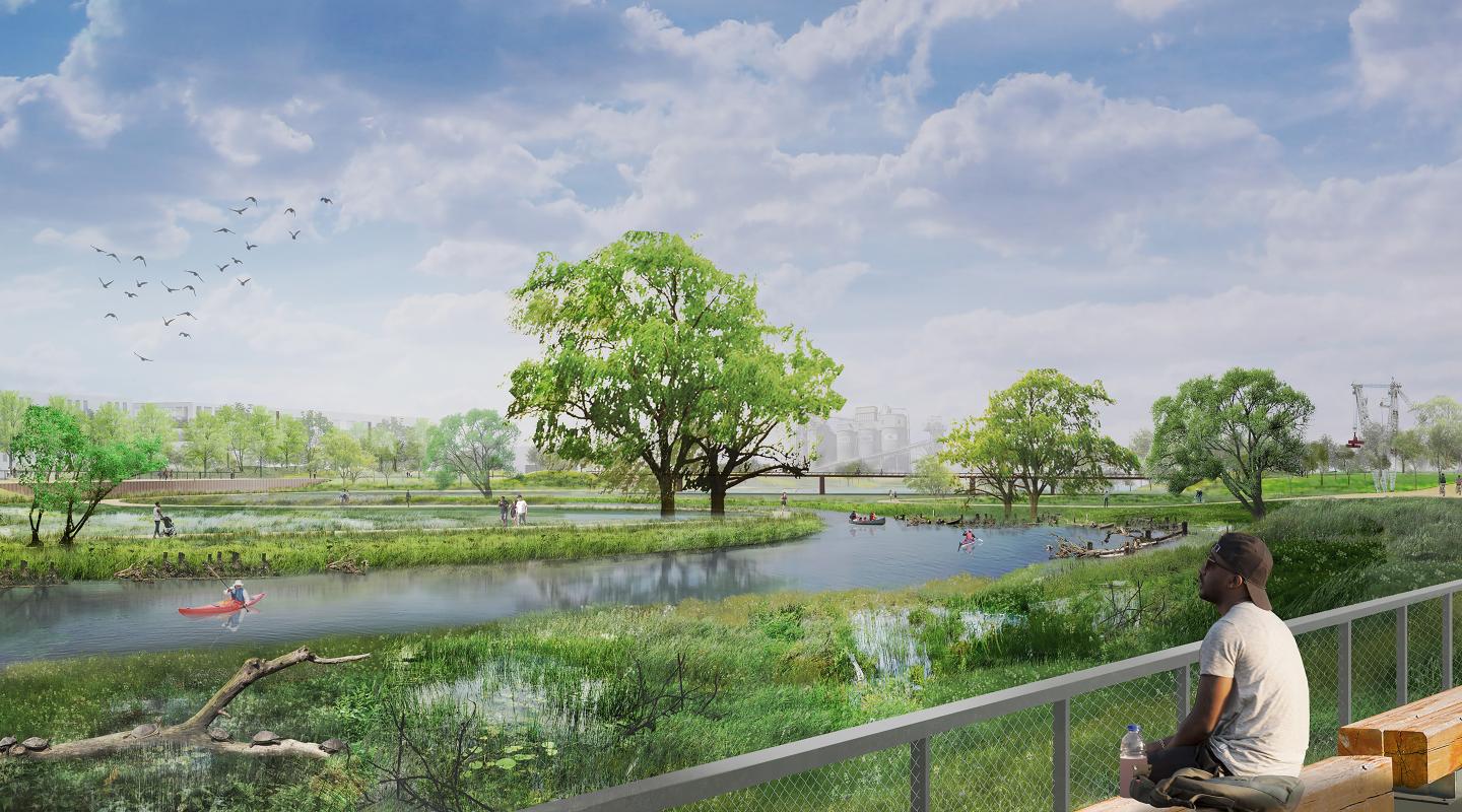
The next opportunity is in the Port Lands, where we’re once again using flood protection infrastructure to create new public space. We're building heavily-designed infrastructure, engineered to protect hundreds of hectares from flooding. Integrated into this infrastructure will be a series of connected aquatic, wetland, and terrestrial habitats. Public parks will line the banks of the new Don River. In total, this means 25 hectares of new publicly accessible greenspace.
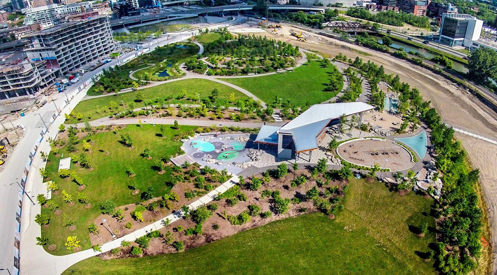 Aerial view of Corktown Common, a park that doubles as a flood protection landform.
Science and nature
To make this blend of infrastructure and public space work, we’re using bioengineering – applying principles of biology to engineering.
This new river valley we’re building needs to withstand the powerful, high water that will flow through in and out to Lake Ontario during a major storm. Unlike a natural river, we don’t want this one to erode or move when a storm of that magnitude hits. Bioengineering lets us stabilize the banks of the new river with natural elements so that, when standing on the river banks, all you will see is the type of vegetated woody edge you'd find in a natural river.
To learn more about the type of storm that could cause flooding, read Flood Risks in Toronto.
Behind the scenes is a cribwall system of large wood logs and rootwads, laid out in layers on a crisscrossing pattern, held in place with boulders creates a structurally stable edge that would not wash out with heavy flows expected during a storm. Over time, plants will mature along the edge of the river and the remaining exposed wood will provide shelter for fish or spaces for birds or turtles to hang out close to the water.
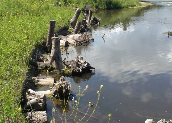
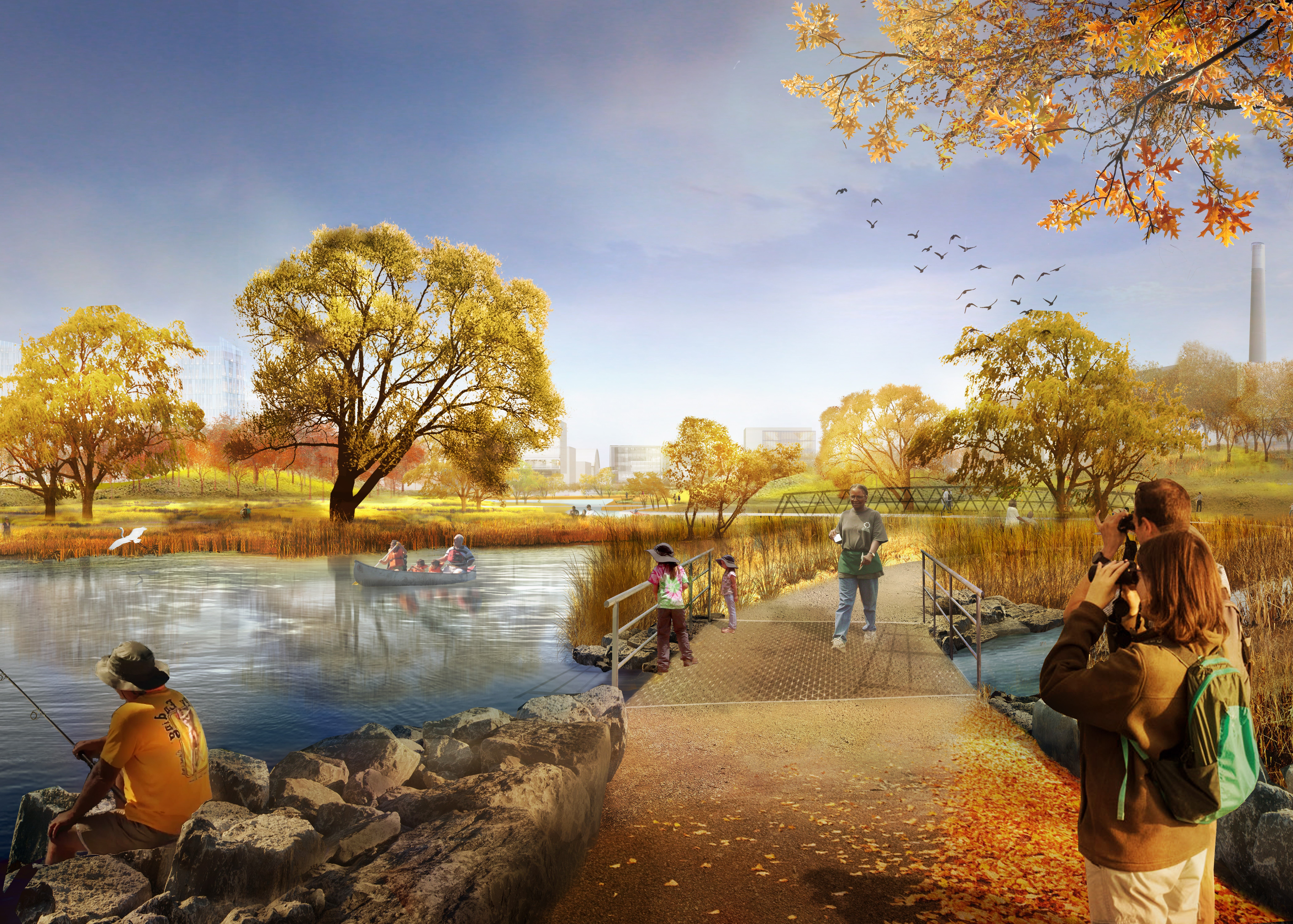
(left) A cribwall system of large wood logs and rootwads that creates a structurally stable edge that would not wash out with heavy flows brought on by a storm. (right) Trails and bridges will let people walk along the levees of the new river valley.
Because the river valley will be stable, we can design the river’s embankment (the area between the river and the top of the river banks) to include wetlands with an extensive system of pedestrian paths. Walking along the levees, it will feel very park-like, but these areas are designed to flood during a 1 in 100 year storm or stronger. The area will also take on some water in the event of high lake levels. Because of investment below your feet, the areas above the top of the banks will never flood and that allows us to build great landscapes here, including new unique playgrounds, dog off-leash areas, picnic terraces and more.
Read more about how we will excavate the new river.
Unique Play Experiences
There’s a growing body of evidence that play and time spent in nature can have a powerful positive effect on children’s health and development. This is partly why playgrounds that focus on immersing children in a series of natural play environments are increasingly common in urban regeneration projects.
We have planned for two such play spaces in our project. Once complete, the Port Lands will have a new playground carved out of the upland forest along the northern edge of the river’s banks. This playground will include immersive play areas like “Green Giant Forest” and “The Toronto Badlands” designed to reflect the local ecosystem of the Don River and Southern Ontario.
Planning has also started for a larger-scale destination playground in Promontory Park. This playground is planned to be almost two acres big (the size of two football fields) – making it the biggest in Toronto. Think Chicago’s Maggie Daley Park to get a sense of the scale we’re hoping to achieve. It is being designed as a place that will attract kids from all over Toronto. Our five-year plan includes raising funds to contribute to this playground.
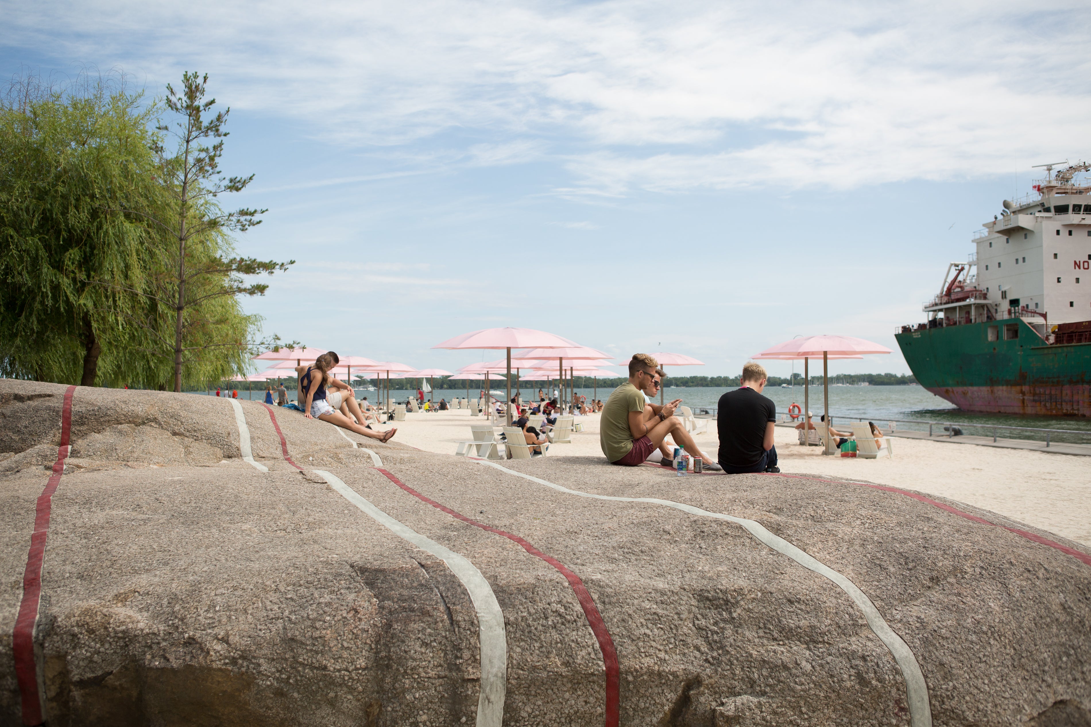 People enjoying Canada's Sugar Beach in the summer.
Components like these will make three new City Parks unlike any others in Toronto. At Waterfront Toronto, we have a history of leading our revitalization projects with the creation of public spaces. At the core of planning these spaces is establishing how people will inhabit and enjoy a place to ensure that each precious new public places will give people new delightful experiences to discover as they explore the space. Unique parks like Canada’s Sugar Beach spark new communities by creating a unique sense of place.

