Nature and Parks in the Port Lands

The Don River currently flows through a large system of ravines, watersheds and estuaries, then empties into Lake Ontario through the concrete Keating Channel in the post-industrial Port Lands.
POSTED: NOVEMBER 4, 2019 I DESIGN, INNOVATION, PARKS AND PUBLIC SPACES
By: Shannon Baker
The Don River ravine system stretches from Lake Ontario north through the city, connecting communities and habitats as it weaves its way through the urban fabric. The City of Toronto’s Ravine Strategy acknowledges the importance of this natural resource to the health of both the humans and animals that inhabit the Greater Toronto Area. It’s a major migration path for animals of all kinds and provides habitats for a diversity of wildlife, something that is critical for the city’s biodiversity.
A hundred years ago, the river spilled out into the lake through what was the largest freshwater marsh in the Great Lakes system. Right now, the place that this significant riverine ecosystem meets the lake is the Keating Channel in the post-industrial Port Lands.
When a group of citizens organized a workshop at the Science Centre in 1989, healing the Don River and surrounding systems was just a dream. Now, more than 35 years later, construction is underway on a restored river valley that will bring wetland back to the former site of the Ashbridges Bay Marsh.
A safe place for people and animals
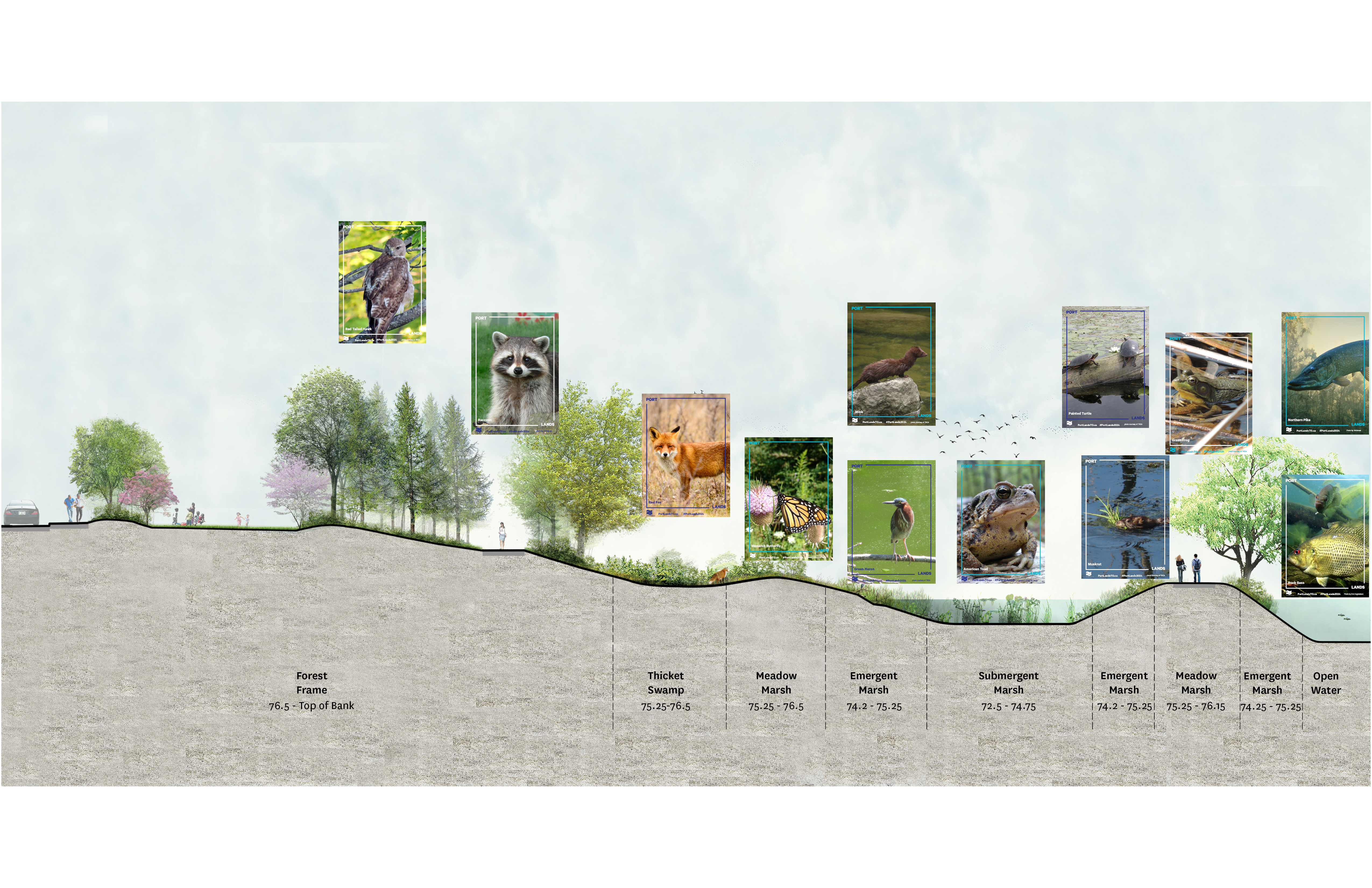
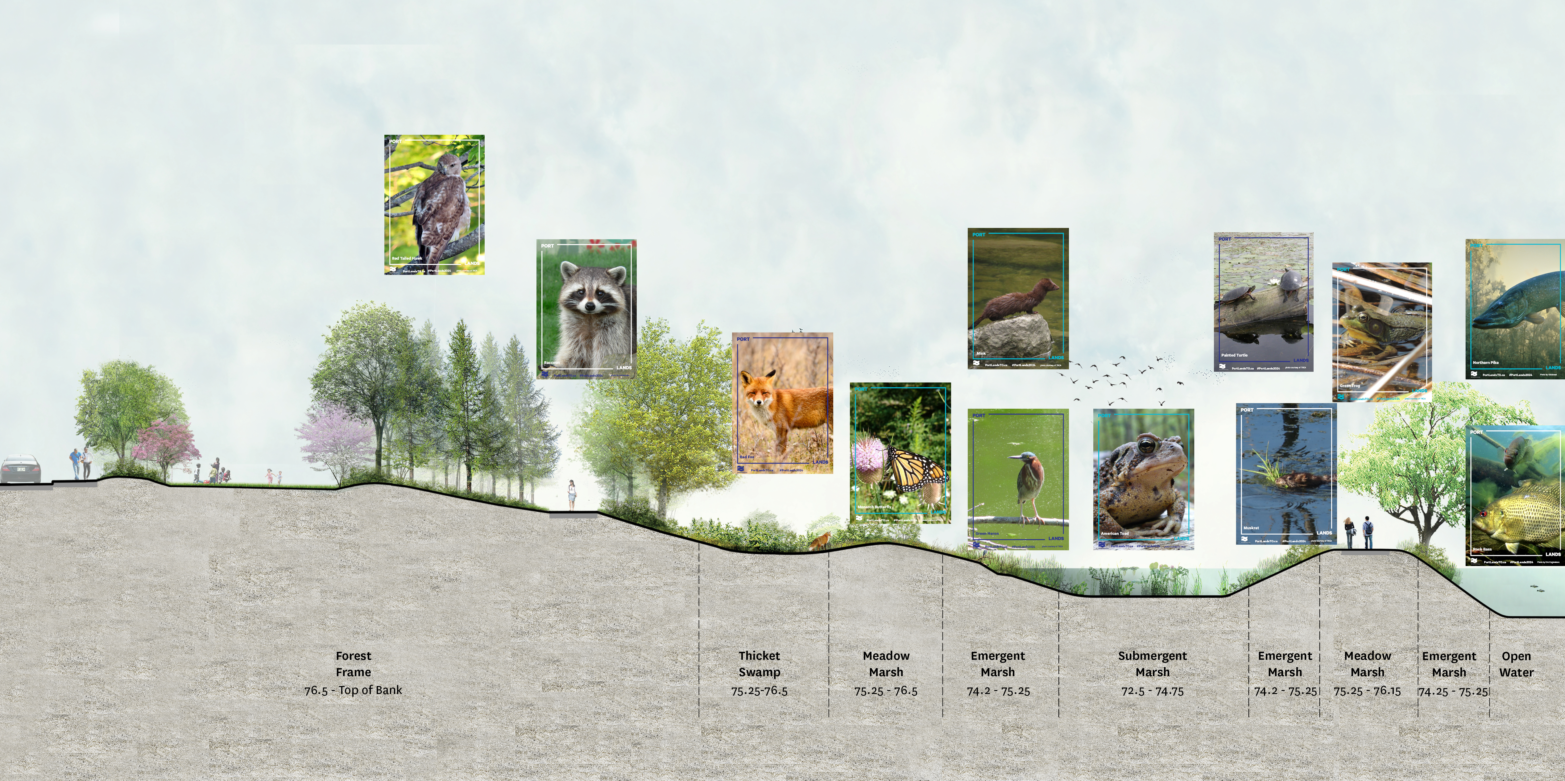 Cross section of the new Don River, showing fauna habitats it will create. (click here to enlarge the image above)
The river valley and surrounding green spaces will recreate several types of habitats in the Port Lands: aquatic habitat, submergent marsh, emergent marsh, meadow marsh and floodplain forest. Each of these will be home to a long list of animals.
How will we support these layers of ecology? Our landscape architects have looked at soil ecology as a base for the system that supports the vegetation community, ensuring that this recreated landscape will have the support it needs to grow, providing new habitat for wildlife. 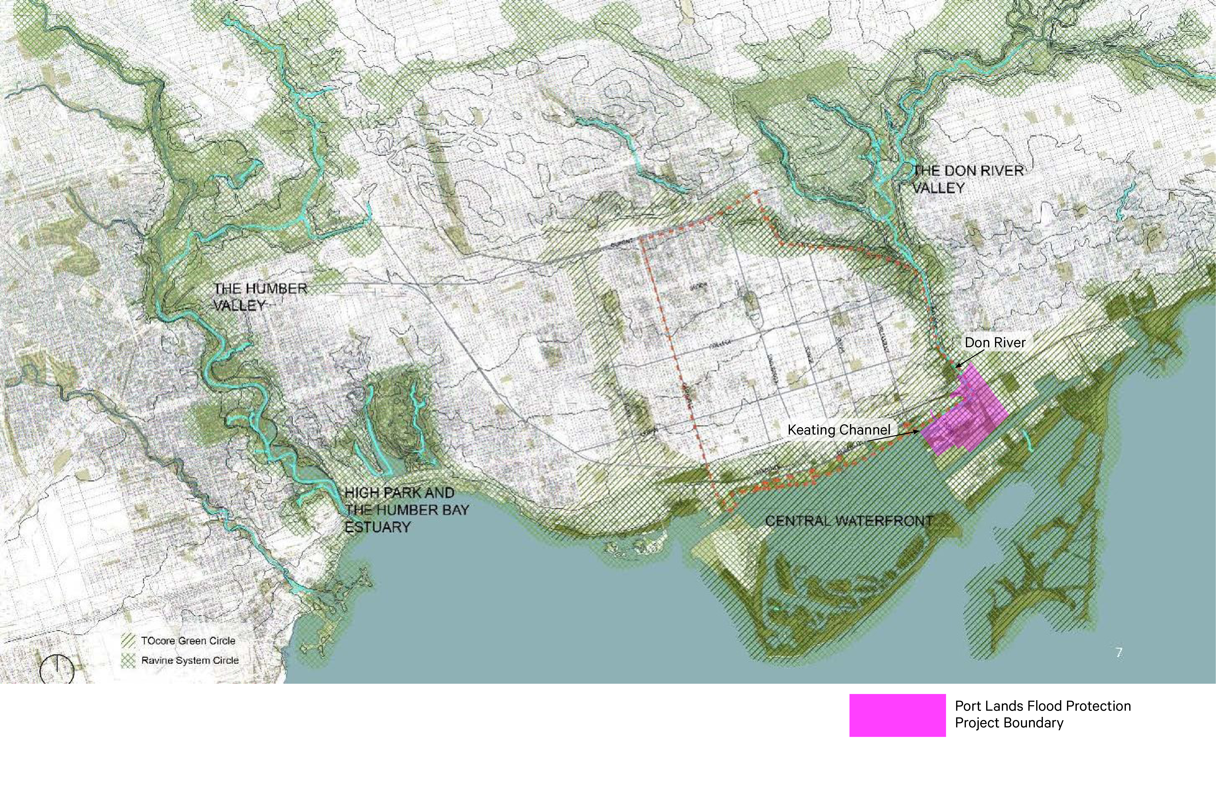
Read More about bringing natural habitats back to the Port Lands
One of the most amazing things about these new green spaces is that they will be minutes from Toronto's downtown, giving people the opportunity to more easily connect with nature. As we’ve seen with the marshes and natural habitats we created nearby at Corktown Common, building precious green spaces like these provides access to nature that is valued by the new community.
Read more about making the most of our public spaces
Green river, green streets
The river valley and park system will be planted with around 5,000 trees, 77,000 shrubs and over 2 million new herbaceous plants! This includes sedges, grasses, and rushes that live in shallow water, as well as plants that live on the banks of the river and in upland parks.
Read about how we're building North America's most unique streets
The upland park plantings will also be incorporated into the design for new Cherry Street, Commissioners Street and Don Roadway, resulting in a more connected network for wildlife that links to the much larger network of ravines that the Don River flows through – spanning multiple neighbourhoods linking places much further north of the downtown waterfront.
Learn about how nature, parks and roads will be restored by 2024 in this video.
To learn more about Port Lands Flood Protection, visit PortLandsTO.ca.
Sustainable Skyline: How Mass Timber is Shaping Toronto’s waterfront
Kiss n’ Sail Pilot Project Beginning Summer 2024 Announced
