How We're Digging a New River in the Port Lands

When the Port Lands were created, the Lower Don River was straightened to flow directly into the Keating Channel. Our work will bring the Don closer to its original state.
POSTED: OCTOBER 24, 2019 I INFRASTRUCTURE, INNOVATION, DESIGN, SUSTAINABILITY
By: Don Forbes
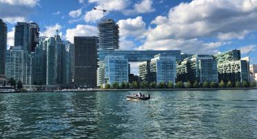
If you’ve heard of the citizen coalition called Bring Back the Don, you may have wondered – where did the Don River go? In short: it was buried in concrete.
In its original state, the Don River curved through natural wetlands. When the Port Lands were developed, the lower Don River was straightened and diverted into the Keating Channel. All this to facilitate an expanding industrial sector in the City’s port. The consequences? During a major storm like 1954’s Hurricane Hazel, a wall of water equal to about three-quarters of Niagara Falls comes rushing down the river. When it hits that 90-degree turn at the Keating Channel, it will overflow those banks and water will rush over Toronto’s eastern waterfront and the Port Lands. Read more about flood risk in Toronto.
After an Environmental Assessment, international design competition and 15-month due diligence study, we confirmed that the best way to remove the risk of flooding was to bring back the Don!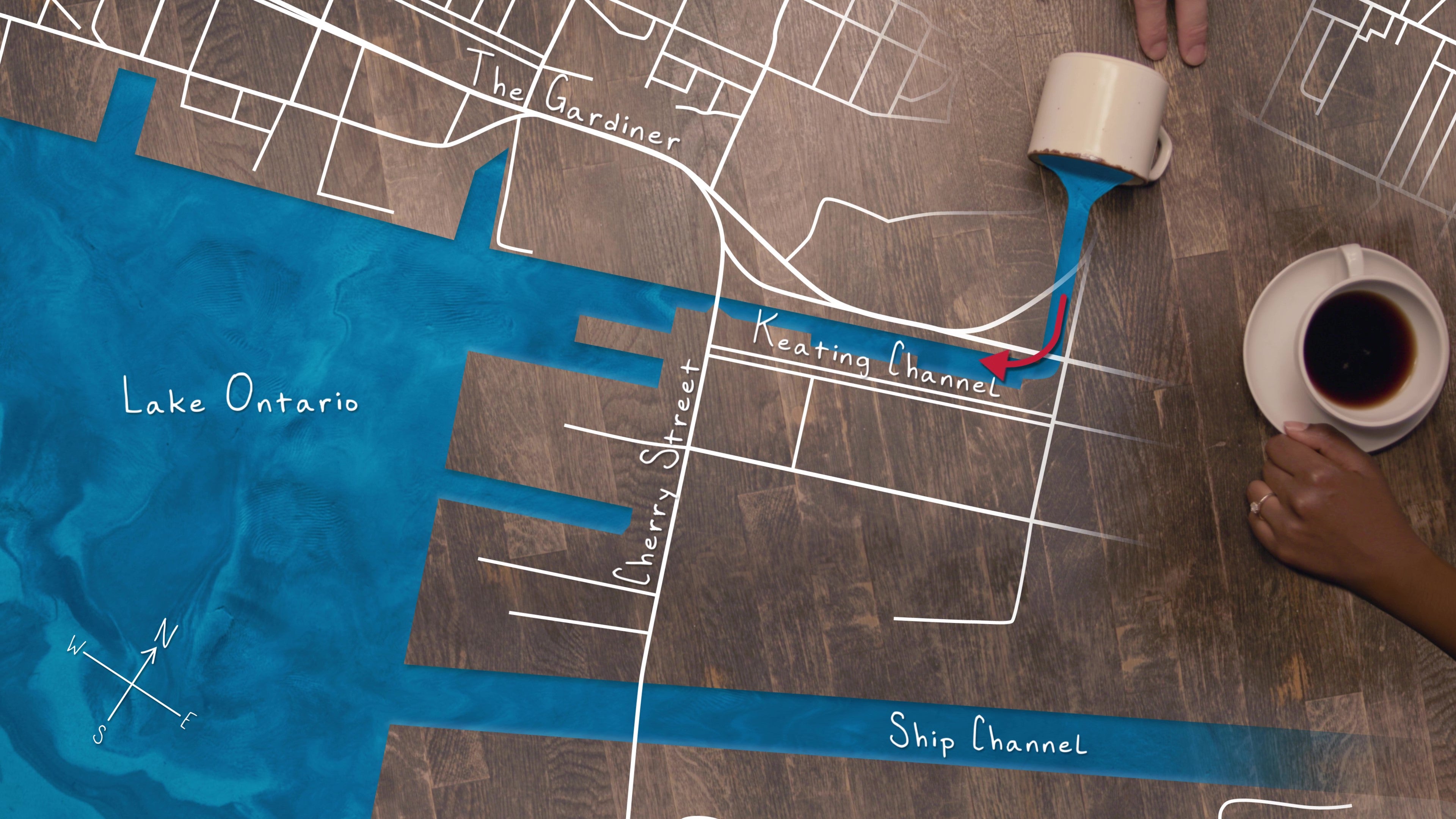
Applying fluvial geomorphology, the study of how streams naturally form and flow, our team has designed a new path for the river so that floodwaters have some place to go. This means in the event of a major storm, water would flow safely to Lake Ontario, through the three outlets for the river, rather than rushing down the Keating Channel at high speed and flowing over the Port Lands and surrounding communities.
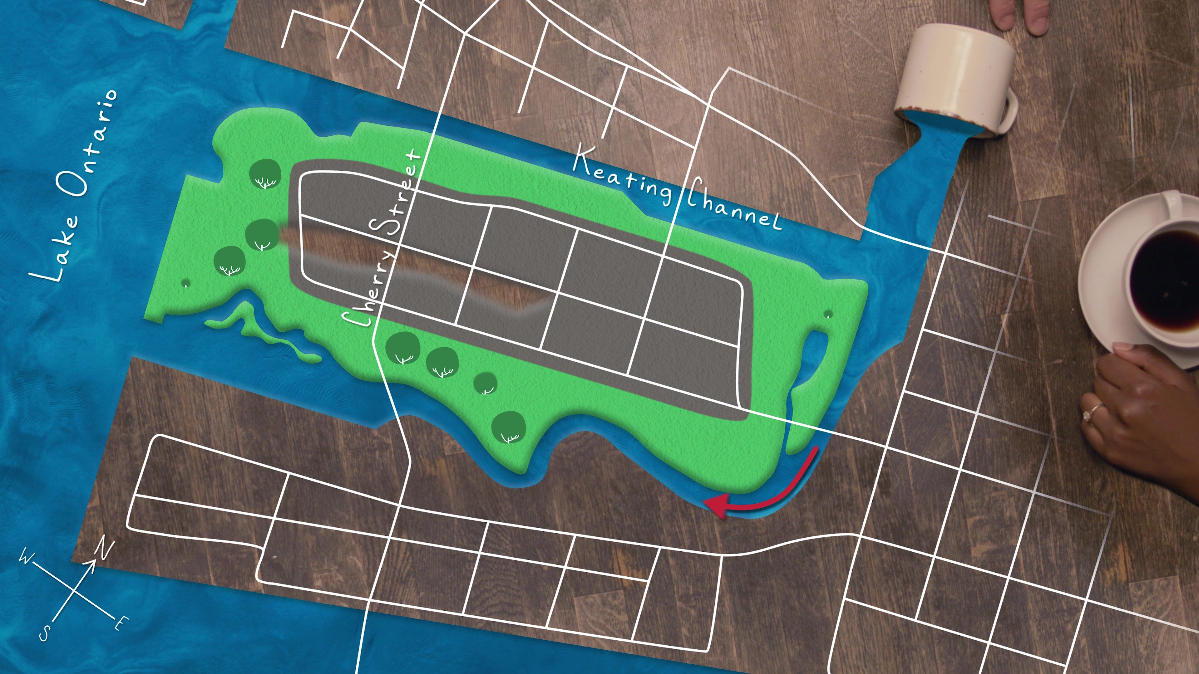 A new path for the Don River lets the water move more naturally, giving floodwaters a safe path into Lake Ontario.
This is no easy feat. We’re doing something nobody has quite done before. We’re digging a kilometer-long, 175-metre-wide river valley.
We’ll use 55-ton drill rigs, generally used for large foundation construction, and excavators and haul trucks normally recruited for mining operations.
In certain locations, crews will be working as deep as nine metres below lake level.
But that’s getting ahead of the story. Let's start at the beginning: why is this so difficult?
When this area was created by infilling in the late 1800s and early 1900s, the city used low-quality fill – and piled it on top of a marsh. That created an unstable foundation upon which the Port Lands were built. After years of industrial activity like coal storage, fuel storage and refining, the soil is now contaminated. The water table is also very shallow. This means that there’s water as close as one metre below the surface – and if you dig, that hole fills up quickly with water. Because this groundwater is contaminated, when we remove it as we dig, we also need to treat it before discharging it into the lake.
Given these conditions, it takes complex engineering to keep our excavation area stable, dry and protected from contaminants.
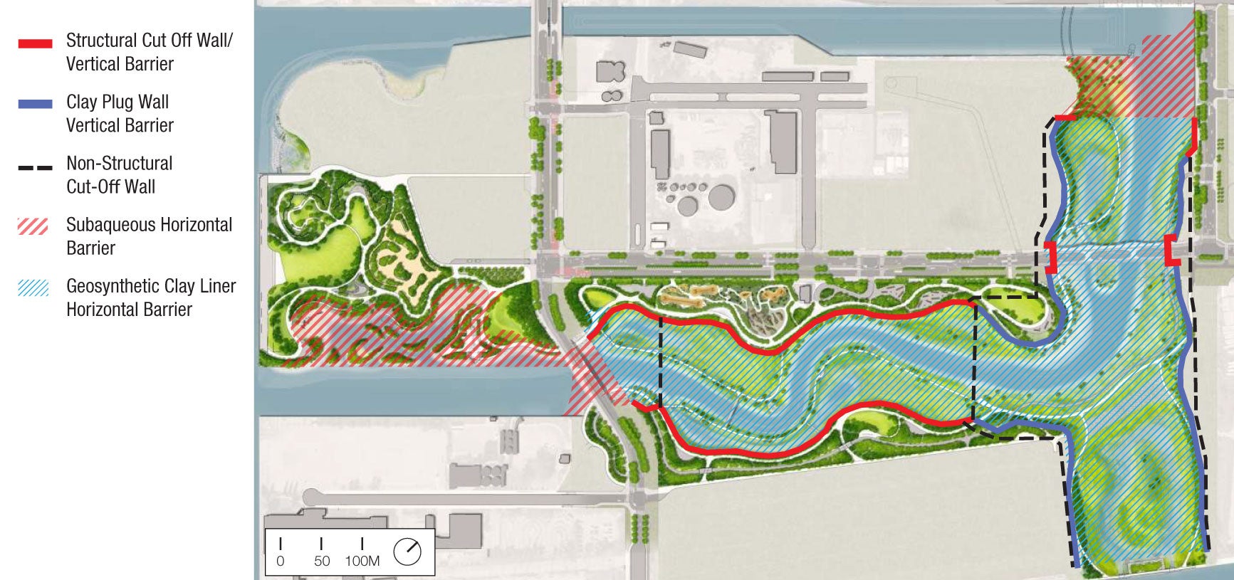 This diagram shows the contact barriers we'll need to safely create a new river valley.
Girdle, belt and suspenders
Thinking of the Don River as a body, we’ll be using a belt, suspenders and a girdle to keep our excavation area (the torso) dry.
Girdle: Robust cut off walls. We’ll install cut-off walls along the entire length of the new river (both sides) to keep the excavation dry and stable. We’re going to have the pressure of the lake and soil on all sides of our excavation, so we’re putting in structural walls to support the excavation.
Belt: Protective layers. In addition to structural supported groundwater control, the walls create a vertical environmental barrier to prevent migration of contaminants into the new river valley. It’s also far more efficient to excavate in a dry environment, plus the placement of wetland and river finishes can’t be accomplished in a flooded environment. We want to control the quality and quantity of water in the River Valley while the plants establish themselves. The cut-off walls will help prevent water from getting in, but some will. So, we will need to dewater, treat, and discharge into Lake Ontario while we dig. Some water will always enter the excavation that we will need to dewater, treat, and discharge into Lake Ontario while we dig.
Suspenders: We’ll add protective layers to keep any remaining contaminants out of the river valley. Finally, we’ll add the finishes (all the rocks, branches, etc. you would find in a river valley), horticultural soil and plants to make up the new wetlands.
We’ll treat and reuse as much of the 1.3 million cubic metres of soil we remove as possible to raise the grades across the project area as part of flood protection and create the new topography for parks.
Learn more about how this park's layer is being integrated with the engineered river valley.
We’ll watch as an entire new ecosystem develops, with new species of fish, frogs, birds and more all migrating from existing habitats in Tommy Thompson Park and the Don Valley.
To watch a video about how we're protecting the Port Lands and surrounding areas from flooding, click here.
To learn more about Port Lands Flood Protection, visit PortLandsTO.ca.

Waterfront Toronto Reaches Construction Milestone in the Port Lands: A Big Step Towards Reconnecting the Don River to Lake Ontario

Getting to Work on ‘Villiers Island’