One Step Closer to Unlocking the Port Lands

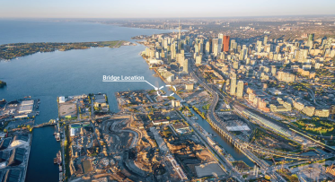
At a park overlooking Toronto’s harbour and city skyline, Waterfront Toronto and its government partners recently announced $5 million in funding to complete due diligence work on the proposal to naturalize the mouth of the Don River.
POSTED: JULY 22, 2015 I ECONOMIC DEVELOPMENT, DESIGN, INFRASTRUCTURE
By Andrew Hilton
Returning the mouth of the Don to a more natural state offers many benefits – providing critical flood protection to the area and unlocking significant economic development potential in the Port Lands including the former Unilever site, where developer First Gulf is proposing a major new mixed-use development. While two key studies have already been completed (the Don Mouth Naturalization and Port Lands Flood Protection Project Environmental Assessment and the Lower Don Lands Environmental Assessment), the due diligence work being undertaken by Waterfront Toronto will provide greater certainty on the costs and risks associated with the project thereby allowing our government partners to confirm funding decisions for this transformational plan.

The flood protection proposal addresses the fundamental challenge of transforming the underused Port Lands into a long-term asset that will support Toronto’s growth and economic competitiveness.
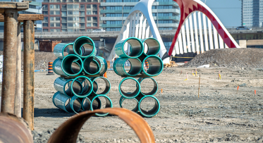
Once one of the largest freshwater marshes in North America, the Port Lands became home to landfill, industry, oil tank farms and more. The Don River’s outlet into Lake Ontario changed from a marsh to a narrow concrete channel, and the Port Lands and adjacent areas became – and still are – flood plain.

Flood protecting the Port Lands represents the second phase of flood protection on the waterfront; the first being the flood protection of the West Don Lands, the current site of the Pan Am Games Athletes’ Village. That flood protection infrastructure now protects 210 hectares of eastern downtown Toronto, including the West Don Lands, parts of the Financial District and the South Core.
At the announcement, Federal Finance Minister Joe Oliver pointed to the importance of the Port Lands as an economic development area. “Unlocking the development potential of all of the Port Lands would have positive economic benefits for the entire GTA, the province and Canada as a whole,” he said.

“It’s going to take what is essentially underused land and transform it into a valuable living asset for the city,” said Toronto Mayor John Tory.
“For a world-class province and a world-class city, our waterfront is crucial to our economic vitality. This project has unbelievable potential to transform Toronto’s waterfront into a hub of economic activity and job creation. This important due diligence work will ensure we have the best information available to make decisions on the next step in this significant project,” said Brad Duguid, Ontario Minister of Economic Development, Employment and Infrastructure.
The proposal to flood protect the Port Lands is the largest project proposed in the second phase of Toronto’s waterfront revitalization – also known as Waterfront 2.0 – and is one of the most complex urban flood protection projects in Canada. Recently, Toronto City Council unanimously adopted a staff report that included a Call to Action to governments to commit to funding a second phase of waterfront revitalization.
Key costing and risk mitigation results from the due diligence study are expected by November of this year.
For more information on the announcement and the project, please to Waterfront Toronto’s newsroom, here.

Waterfront Toronto and the City of Toronto open new Aquabella child care centre on Toronto’s waterfront
Tell Us What You Think of the Keating Channel Pedestrian Bridge Design Competition Proposals