A New Pathway to The Ferry Terminal

POSTED: JULY 11, 2017 L PARKS AND PUBLIC SPACE, DESIGN EXCELLENCE, LANDSCAPE ARCHITECTURE
BY: MIRA SHENKER
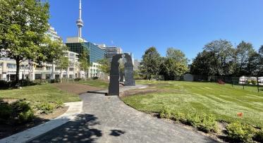
The Jack Layton Ferry Terminal gates are about 100 metres south of Queens Quay at Bay Street. Yet locals will tell you that they’re routinely stopped on that corner by visitors asking for directions to the ferry terminal. Once you find the entrance, lineups to get to the terminal mean crowds filling that main walkway, with little shade or room to move.
To fix this, we're almost doubling the width of the walkway where people queue up to buy tickets and get on the ferries. When the new pathway is finished, the Island-going experience will start with a walk through a shady archway formed by a double row of trees down a widened promenade. We’ll also remove the incline of the walkway, which currently slopes up as you walk towards the ticket booth – this will allow people to actually see the lake from the entrance of the park at Bay Street.
Construction on this new promenade is set to start this fall as part of Phase 1A of the master plan for the Jack Layton Ferry Terminal and Harbour Square Park site, which spans from Bay to York Streets.
How does this first phase of work fit into the bigger picture?
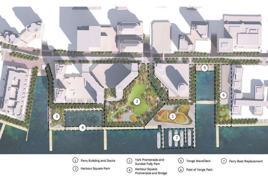
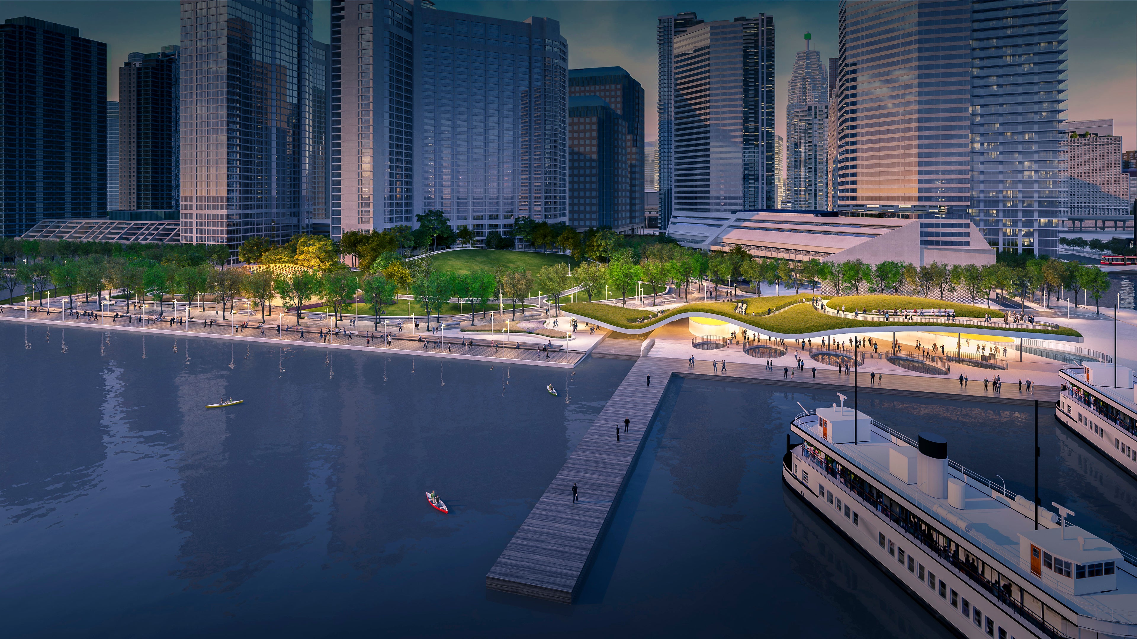
Components of the master plan include a larger terminal building with accessible green roof and a larger park with better east-west connections and views of the lake.
The ferry terminal is an important spot for Toronto. It’s where 1.4 million people annually start their journey to one of our most cherished public spaces, the Toronto Islands. That’s why we launched a design competition in 2014, to develop a vision for the long-term transformation of the Jack Layton Ferry Terminal and Harbour Square Park site. (More about the competition and winning team here.)
The resulting master plan is a multi-phase project that will have to be carried out over time. (More details about the master plan were presented at a public meeting last year – you can find those slides here.)
That vision has been broken down into bite-sized components, each of which can be designed and built as soon as funding becomes available. We worked with Councillor Pam McConnell and the City’s Parks, Forestry & Recreation department to find funding for an initial piece of work, Phase 1A. Design work on just that component of the master plan started last year, and we're now finishing up detailed design as we gear up to start construction in the fall.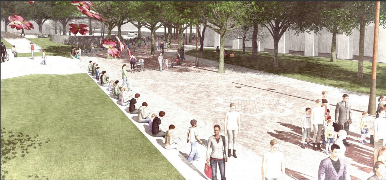
Phase 1A of the Jack Layton Ferry Terminal project will improve the main walkway from Bay Street to the terminal gates. (IMAGE: Rendering of the walkway, looking from just west of the terminal gates north to Bay Street.)
PHASE 1A
The project team, which includes staff from Waterfront Toronto and City Parks, have been working together to figure out how the funding secured for Phase 1A will be best put to use. The project team has been meeting with the Technical Advisory Committee (TAC) and Stakeholder Advisory Committee (SAC) to get feedback, which helps us to ensure that we have the right priorities.
Part of our process includes considering that what we build today must be there tomorrow – to create a foundation for the future steps.
The scope for Phase 1A includes:
- New promenade to replace the worn concrete that currently extends south from Queens Quay at Bay Street, including a double row of trees planted in soil cell technology, new benches and lighting.
- Wayfinding signage: Previous renderings showed an airy wooden structure will frame the entrance at Bay Street. The design team is rethinking this in favour of less subtle wayfinding, which is still in development.
- The lighting: As part of this new walkway, new light poles will replace existing lighting that is in need of repairs and updating. We will also replace some of the existing lighting throughout the site.
The promenade
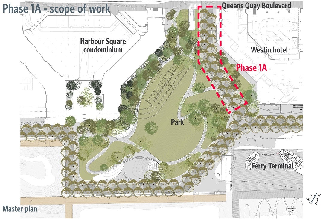 The alignment of the new promenade fits into the master plan for the Ferry Terminal and adjacent park.
A new promenade will take people from Bay Street all the way to the existing terminal gates. Removing a planter and other obstacles will nearly double the space along this walkway, taking it from 9.5 metres to 15 metres. A double row of trees will also be planted along the walkway using soil cell technology to make sure a tree canopy quickly develops and thrives like it did at Sugar Beach and along the Water’s Edge Promenade.
Lighting
Much of the lighting around the ferry terminal site and in Harbour Square Park is old and needs replacing. We'll replace 16 lights throughout the site with new signature light posts – the same ones you see along the revitalized Queens Quay and on the water's edge promenade.
Wayfinding
The proposed wayfinding approach for the entire site would include a beacon at Bay and Queens Quay. An initial design was presented to our Design Review Panel this June, but the final solution is still being developed. Check out that full presentation to the Panel here.
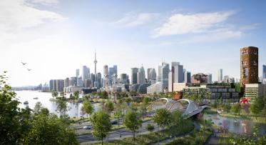
The future of this place
The full master plan includes expanding the site further south, building new ferry docks and finger piers that will accommodate more people and make it easier to get to the ferries and the Island.
This is just the beginning. We know that there's a lot of work to be done.
While operational efficiencies aren't part of the design team's scope of work, City staff has been working closely on this project with operations in mind. This collaboration means that design changes will also be in service of operational efficiency. So, while the design team isn't changing ticketing technologies, for example, they are thinking about how the walkway can best manage crowds. For example, the area directly in front of the ticket booth and gates will be widened, and no trees will be planted there – leaving maximum space and visibility at a known pinch point.
More importantly, the work we're doing fits into the master plan, which does aim to improve operations by creating more space where it's needed, better access to and from the ferry docks.
What to expect this fall
Construction is scheduled to start in September 2017. At that point, the main pathway will be closed but the ferry terminal will always be accessible via a secondary pathway. More details about this will be posted as we get closer to construction. The main pathway will reopen in May 2018.
To get updates about this and other projects, sign up for our monthly e-newsletter here.
Spring Maintenance for the Heart of Love Park
6 FAQs about Villiers Island