The Future of the Gardiner East: What Can We Learn from Other Cities?

Toronto isn’t the first city to be saddled with a crumbling expressway. Here’s what we can learn from other cities that have been faced with similarly expensive 100-year decisions. (Image credit: Darren Calabrese/National Post)
POSTED: MAY 26, 2015
BY: CHRISTOPHER MCKINNON
About six years ago, when the environmental assessment for the future of the Gardiner East was just getting started, the team of consultants beginning the study began by looking at twelve other cities that have faced similar situations with crumbling elevated expressways. Among those cities were Seattle, San Francisco, Chattanooga, Buffalo, Montreal, New York, Washington, Paris, Amsterdam and Seoul.
A common theme was that their elevated expressways were functionally obsolete, relics of another era that were rapidly reaching the end of their useful lives, much like the situation we face with the Gardiner East. In some cases, a natural disaster had made the highway unsafe, forcing cities like New York and San Francisco to come to grips with the issue. Another common theme is that nearly all of these cities had a highway separating the city’s downtown from its waterfront.
The report makes for interesting reading, so we thought we’d share it again in the context of Toronto’s looming decision on the future of the eastern Gardiner Expressway. It offers a balanced consideration of the pros and cons of the decision we’re about to make.
Below is a summarized version, or click here to download the full report in PDF.
Comparing Urban Expressways
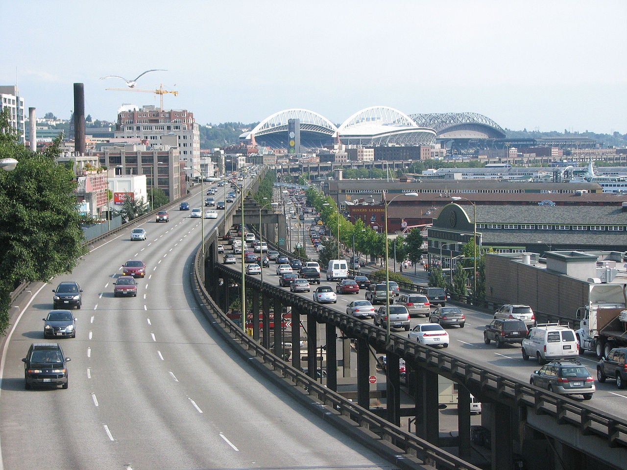
Alaskan Way Viaduct – Seattle, WA (Image credit: Rootology/Wikimedia Commons)
Year built: 1959; Length: 3.2 km; Vehicles per day: 110,000
This four-lane double-stacked highway runs along Elliott Bay in downtown Seattle. It creates a physical barrier between the city’s baseball and football stadiums and its port area. It serves primarily local traffic, which by-passes downtown on the way from Seattle’s north and south neighbourhoods. After being damaged by an earthquake in 2001, the expressway settled, raising alarms that it could soon become unsafe and that the city’s seawall might have sustained damage as well. In 2009, a plan was announced to replace the expressway with a deep bored tunnel, which was originally scheduled to open in 2015. The elevated expressway remains in operation and the tunneling project has been mired in controversy. Work on the replacement tunnel has been stopped since 2013 when the tunneling machine was damaged, with no clear indication of when or how the tunneling may resume.
Lessons learned:
Replacing the expressway with a combination of deep bored tunnel and urban boulevard would have enabled significant improvements to the urban environment, including new light rail and improved facilities for walking and cycling. However, the costs are extraordinary at over $4 billion and the risks associated with underground construction can quickly translate into schedule and budget overruns, as Seattleites have discovered the hard way.
West Side Highway – New York, NY (Image credit: Flickr user m.joedicke)
Year built: 1937; Length: 8.2 km; Vehicles per day: 140,000
In 1974, a section of this elevated highway along the Hudson River collapsed and prompted the closure of about six kilometers of the highway. With no time to plan for alternate routes or new public transit to replace the road’s capacity, the road’s traffic count dropped from 110,000 vehicles per day to just 51,000 vehicles per day. About 12,000 vehicles were found to be diverting to parallel routes, however the remaining 48,000 vehicles could not be found, suggesting that the trips were simply not made.
Plans to rebuild the highway and redevelop the entire area were in legal limbo for the better part of two decades. Finally, with the industrial Hudson waterfront in decline, the highway was reconstructed as a boulevard with a new bicycle greenway and pedestrian path. This generated new demand for adaptive reuse and infill development along the West Side. Many former industrial buildings were converted to residential and area property values rose by 20 percent. To this day, traffic in the corridor remains 30% less than pre-collapse volumes, or the equivalent of 80,000 vehicles per day.
Lessons learned:
The West Side Highway is an illustrative case of “disappearing traffic,” a phenomenon often noted in situations where traffic capacity is removed. When lanes of traffic are removed, individual drivers are likely to respond in a range of complex ways, from taking an alternate route to shifting the time of travel, to in some cases not making the trip at all. The key lesson is that replacing a highway with a boulevard and multi-modal corridor has less traffic impact than most people typically expect – and that it can create dramatic opportunities for redevelopment, adaptive reuse, and economic development.
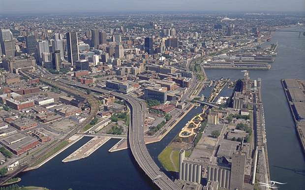
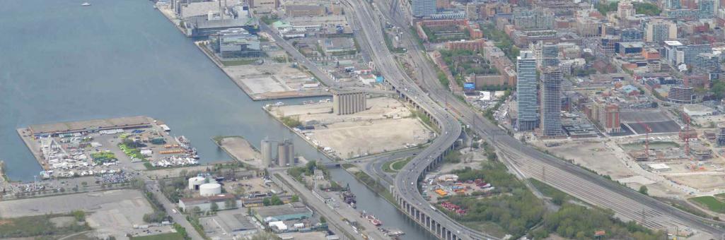
Bonaventure Expressway – Montreal, QC (Image credit: Montreal Times)
Year built: 1967; Length: 1 km; Vehicles per day: 55,000
This one-kilometer elevated expressway extends east from downtown Montreal to the Lachine Canal. Along with the CN Railroad viaduct, the highway separates the neighbourhoods of Griffintown and Cite Multimedia. Rebuilding the expressway as an urban boulevard was proposed in 2005 as part of the city’s overall waterfront development strategy. Reclaimed land is to be redeveloped as office, residential and hotel space, along with improved public transit and new waterfront public spaces.
Lessons learned:
Rather than evaluating the highway removal project only in terms of motor vehicle transportation, this project sets ambitious goals for improving urban design and public realm, as well as opening up new parcels of land for redevelopment. Removing the expressway will reduce the capacity for motor vehicle traffic in the area, but increased public transit, rush-hour demand management and optimization of the local road network seek to reduce automobile traffic overall. Improved cycling infrastructure and pedestrian routes seek to further shift people away from car-dependency, in line with Montreal’s sustainability objectives. The project is now under construction.
Riverfront Parkway – Chattanooga, TN (Image credit: FHWA)
Year built: 1960s; Length: 2.7 km; Vehicles per day: 20,000
This four-lane parkway was constructed in the 1960s in order to carry industrial truck traffic through the city of Chattanooga. Its limited access and median dividers prevented pedestrian access to the city’s waterfront, separating the medium density city core from the Tennessee River. The decline of industry left the expressway vastly over capacity by the 1990s, leading the city to initiate a redesign of the expressway as an urban boulevard. The project recalibrated the roadway to current traffic volumes and in doing so it opened up the riverfront for new development. This led to the city’s plan for the “21st Century Waterfront,” which created six open space and development districts on both sides of the river. The downtown side includes a reconstructed park with terraced public spaces leading to the river edge and amphitheater there. Piers provide boat launches and river views. The plan is characterized by strong landforms and active shapes that provide both flood control as well as recreation space, illustrating how integrated design can produce infrastructure that serves multiple purposes.
Lessons learned:
Chattanooga’s example demonstrates the importance of gaining project support from the highest levels of political and municipal leadership, with both the mayor and the city’s planning and design studio advocating strongly for the vision. It is also an important example of how the role of a highway can shift in the current of larger demographic and economic changes. In this case, an outdated highway was reconfigured from a thoroughfare for industrial trucking to a more permeable boulevard that provides pedestrian access to a series of cultural and natural amenities.
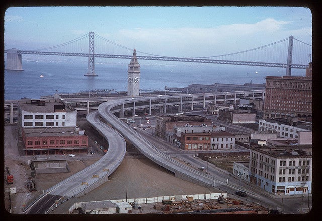
Embarcadero Freeway – San Francisco, CA (Image credit: Lost SF)
Year built: 1957; Length: 2.5 km; Vehicles per day: 80,000
The Embarcadero Freeway was a 2.5-kilometer double-deck highway built to connect automobile traffic between the Bay Bridge and the Golden Gate Bridge. It wound through medium density residential neighbourhoods, including Chinatown, Rincon Hill and Transbay, as well as San Francisco’s central business district. Following damage caused by an earthquake in 1989, California’s state transit agency spent two years studying options for replacement. In 2001, the freeway was demolished and replaced with a six-lane at-grade boulevard, as well as a new waterfront promenade, pedestrian and bicycle paths, and a streetcar line. Fifty percent fewer cars now use the boulevard than used the old freeway, with no significant increase in downtown traffic congestion. Clear design guidelines and a public art program shaped the new boulevard’s consistent and unique character, creating a walkable urban place with generous public gathering spaces. The freeway removal opened up 100 acres of land for redevelopment – including the Ferry Building, which was reopened as a local food market – and other nearby projects attracted new retail and office development. More than 9,000 new housing units were constructed in the surrounding areas and today, more than 83 percent of the residents living in the area moved there after 1990. Concern over congestion increases downtown did not materialize, despite the fact that the freeway’s closure represented an immediate 25 percent reduction in road capacity. Fourty-two percent of drivers found alternate routes or modes of transport (such as walking, cycling or public transit) within six weeks of the earthquake. Other drivers reduced discretionary trips.
Lessons learned:
Urban design plays a key role in successful highway removal. The boulevard design slowed traffic, creating an environment that was more conducive to retail and residential development and the creation of public gathering spaces. The values of property adjacent to the new boulevard increased by 300 percent. Jobs in the area increased by 23 percent.
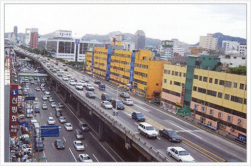
Cheonggyecheon Expressway – Seoul, Korea (Image: Preservation Institute)
Year built: 1958-76; Length: 6.1 km; Vehicles per day: 120,000
The Cheonggyecheon Restoration Project transformed a 6.1-kilometer elevated expressway corridor in downtown Seoul into a linear park and stream. Between 1958 and 1976, the original stream had been covered over with a ten-lane at-grade street and a four-lane elevated highway above that. The Cheonggye office and retail district soon became among Seoul’s most congested areas for automobile traffic. In 2002, a new mayor initiated a plan to demolish the highway from the central business district eastward, to restore the buried stream and create a series of pedestrian esplanades and gardens, complemented by new bus rapid transit. In the year following its opening, the new park attracted 90,000 visitors daily, with thirty percent of those visitors coming from outside Seoul’s metropolitan area. The freeway removal was coordinated with a system-wide upgrade to the city’s public transit system, including a new bus rapid transit route to replace the 120,000 cars that used the freeway daily and increased bus rapid transit on feeder routes. In the previous decade, the city had created incentives to encourage commuters to use transit by raising user fees for downtown parking. In combination, these transportation strategies led to a nine percent decrease in overall automobile traffic into Seoul’s central business district. The project was guided by sustainability principles that ensured that ninety-six percent of the freeway demolition debris was recycled as paving material. Removal of the freeway and greening of the area appears to have lowered summer temperatures in the vicinity by as much as seven degrees. The value of properties adjacent to the restored Cheonggyecheon are estimated to have increased by thirty percent. The long-term economic benefits of the project are estimated to be between US $8.5 and $25 billion.
Lessons learned:
Removal of the highway was coordinated with system-wide transportation strategies – including bus rapid transit, a form of congestion pricing and parking user fees – all aimed at reducing traffic in Seoul’s downtown. The economic benefits of creating new public spaces and parks has dramatically outweighed the cost of losing road capacity for automobiles.
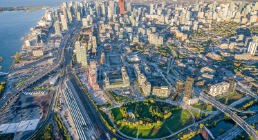
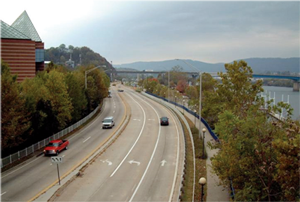
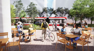
Gardiner Expressway – Toronto, ON
Year built: 1965; Length: 2.4 km; Vehicles per day: 120,000
At 2.4km long and carrying about 120,000 vehicles per day, the eastern Gardiner Expressway is most comparable to the Embarcadero Freeway in San Francisco, the Bonaventure Expressway in Montreal, and the Alaskan Way Viaduct in Seattle. Yet, we can learn lessons from all the examples above about what works and doesn’t work when considering whether to remove or rebuild a deteriorating urban expressway.
Solutions come in different shapes and sizes
One thing is clear from looking at the case studies in other cities. There is no single right solution to addressing the issues of an elevated highway that has reached the end of its useful life. The strategies undertaken by these other cities depend on a range of factors, from physical context and transportation needs to public realm goals and the resources at their disposal. New York City, for example, had over $1 billion in federal funds at their disposal to create an 8.3km urban boulevard with abundant landscaping and a bicycle greenway. By contrast, Zaanstadt, a suburb of Amsterdam, opted to improve the space beneath their expressway by adding a grocery store and recreation spaces – for just €2.7 million. Both have become important public spaces in their respective cities.
Transportation solutions should be seen through the lens of city-building and quality of life
While decisions about whether to maintain or remove an elevated expressway are conventionally measured against transportation criteria – like how much vehicular traffic can move through or travel times – some cities have been more ambitious. Both San Francisco and Montreal viewed their highways in terms of promoting waterfront access, improving public realm and public transportation, sustainability and real estate development potential. All of these things have a significant impact on the vibrancy and economic activity of cities, exponentially more valuable than just the aforementioned transportation criteria.
Transportation uses are continually evolving – changes in demographics, economics and lifestyle affect traffic demand
Many of the highways in these cities are – like the Gardiner – the product of the mid-20th century. They were designed and built to connect city downtowns to the suburbs, industrial waterfronts to systems of interstate highways. In a number of cases, cities found that those objectives no longer applied with downtowns growing dense once again and industries having left the city cores and moved to the periphery. In Chattanooga, for example, Riverfront Parkway was no longer a key through-route for industrial trucking and had excess capacity. They decided to redesign it as an at-grade boulevard that was more cost-effective and better suited to handle that reduced demand.
Traffic demand can be managed
Cities that have successfully reconfigured their elevated highways have complemented them with a range of measures to help manage demand – from adding new transit infrastructure to instituting user fees or congestion pricing. For example, Seoul created new bus rapid transit when it took down the Cheonnggyecheon Expressway, which served 120,000 vehicles a day.
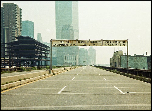
Transportation infrastructure offers extraordinary opportunities for design, creativity, and new public realm
Highway reconfiguration provides rare opportunities for cities to strengthen waterfront connections and create new public realm there. At the same time, some cities have learned that they need not always turn their back to infrastructure. New York City is developing a new public esplanade under the elevated F.D.R. Drive in Lower Manhattan. Through lighting, program diversity, surface materials, and noise attenuating cladding, the space under the highway will be transformed into an inviting, active space. Moreover, innovative design will give the East River Esplanade a unique character, making it a one-of-a-kind public space in the city.
Infrastructure does not have to be single-purpose or boring
Cities are transforming both de-commissioned and active infrastructure into new civic landmarks and unexpected spaces for urban activity. Paris closes the Georges Pompidou Expressway in summer to create an urban beach along the banks of the Seine. Both Paris and New York have re-imagined elevated railroads as linear parks. The design of the High Line in New York integrates landscape with an iconic industrial-era elevated structure.
The public sector must be strategic in order to capture value of investments in infrastructure to serve both community and development goals
Public investment in highway reconfiguration and removal creates benefits – from development parcels to increased property values to improved quality of life. The public sector must act strategically in order to capture this value. In Montreal, for example, parcels created by removing the Bonaventure Expressway will be sold to the private sector for mixed-use development. Highway removal will also enhance the value of recent redevelopment in the neighboring Cite Multimedia.
Conversely, opportunity costs accumulate when decision-making processes drag on
In Seattle, real estate speculators acquired properties along the Alaskan Way Viaduct during a decade of transportation studies. The public sector lost the opportunity to acquire these properties itself, then increase revenue through disposition.
City-building projects of this magnitude require vision and active commitment at the highest levels of leadership
Mayors, governors, and city councils must provide vision and active commitment. Moreover, the full range of stakeholder input, from support to opposition, must be understood and responded to substantively. City leaders need to support and advocate for integrated approaches to infrastructure design. Their vision must embrace the full range of urban design, public realm, transportation, and economic development opportunities. Visionary leadership is complemented by an informed and engaged public that has an active role in developing design solutions.
Extending the Waterfront East LRT to Villiers Island
COP26 and Local Action: Villiers Island, Toronto’s Climate Positive Neighbourhood