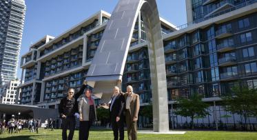
Extending the Waterfront East LRT to Villiers Island

POSTED: JANUARY 25, 2023
BY: SARAH CHAPIN
In This Blog:
- Together with the Toronto Transit Commission (TTC) and the City of Toronto, Waterfront Toronto is working on design for the Waterfront East Light Rail Transit (WELRT) route from Union Station to Villiers Island along Queens Quay East and the future New Cherry Street.
- The planned LRT turnaround point has been reprioritized from Polson Loop to Villiers Island to improve transit service to the planned mixed-use community and future parks.
- After a thorough evaluation process, an on-street loop alignment was selected as the preferred option, and we’ll now proceed with preliminary design of this alignment.
- Waterfront Toronto, City of Toronto and TTC will be hosting public consultation this spring to seek public feedback on the preliminary design for the complete project before reporting to City Council in mid-2023.
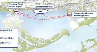
Waterfront Toronto is working closely with the City of Toronto and the TTC to complete the Waterfront Transit Network, linking the Central Waterfront, East Bayfront, West Don Lands, Lower Don Lands and the Port Lands.
The Waterfront Transit Network project includes two components:
- The link running from Union Station to the foot of Bay Street
- The East Bayfront Light Rail Transit (referred to as the WELRT) between Queens Quay to the Distillery Loop on Cherry Street and into the Port Lands
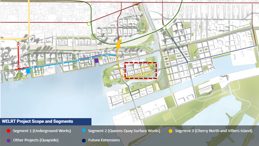
The area outlined by the red dotted square is what will be discussed in detail in this blog.
Transit will make new homes, jobs and cultural destinations on the waterfront more accessible. It will make the waterfront a more affordable place to live and is a critical part of our strategy to make new developments sustainable.
What’s Happened So Far?
Waterfront Toronto is currently working on the preliminary design and engineering for the on-street portion of the project along Queens Quay East between Bay Street and the future New Cherry Street, and on Cherry Street from the Distillery Loop south into Villiers Island.
In 2021, the project team examined options to extend the WELRT south on Cherry Street with a loop in the Port Lands as a replacement for the Distillery Loop. In July 2021, Waterfront Toronto, the City of Toronto and TTC sought feedback through the Waterfront East LRT Summer 2021 Virtual Community Consultation meeting, an online survey, and emails received by the project team about the project. Since the last public meeting, the project team has continued to engage with stakeholders and landowners on the design development for this piece of the project.
Designing the LRT Loop
To improve transit access to the new parks we’re building as part of the Port Lands Flood Protection Project, mitigate construction impacts across the future new riverbed, and optimize project costs, we undertook a study to find an alternative turning location within Villiers Island. Through this study and evaluation, the original LRT turnaround was reprioritized from Polson Loop to Villiers Island. Polson Loop, however, remains in the network plan for the future.
The alignment options in the diagram below were considered for the Villiers Island loop:
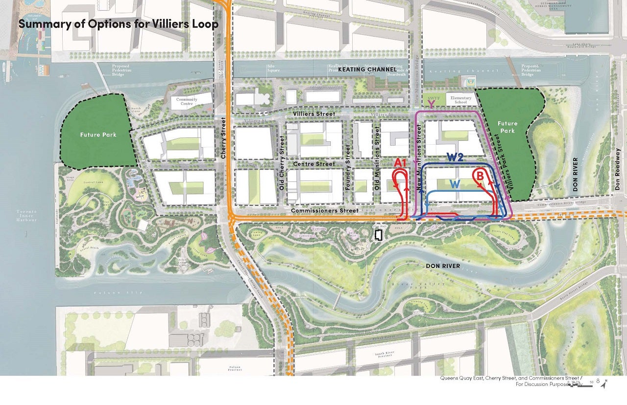
Final Loop Alignment into Villiers Island
After a thorough evaluation process, the project team selected the option shown below as the preferred loop alignment on Villiers Island to move forward with preliminary design. This is Option W2:
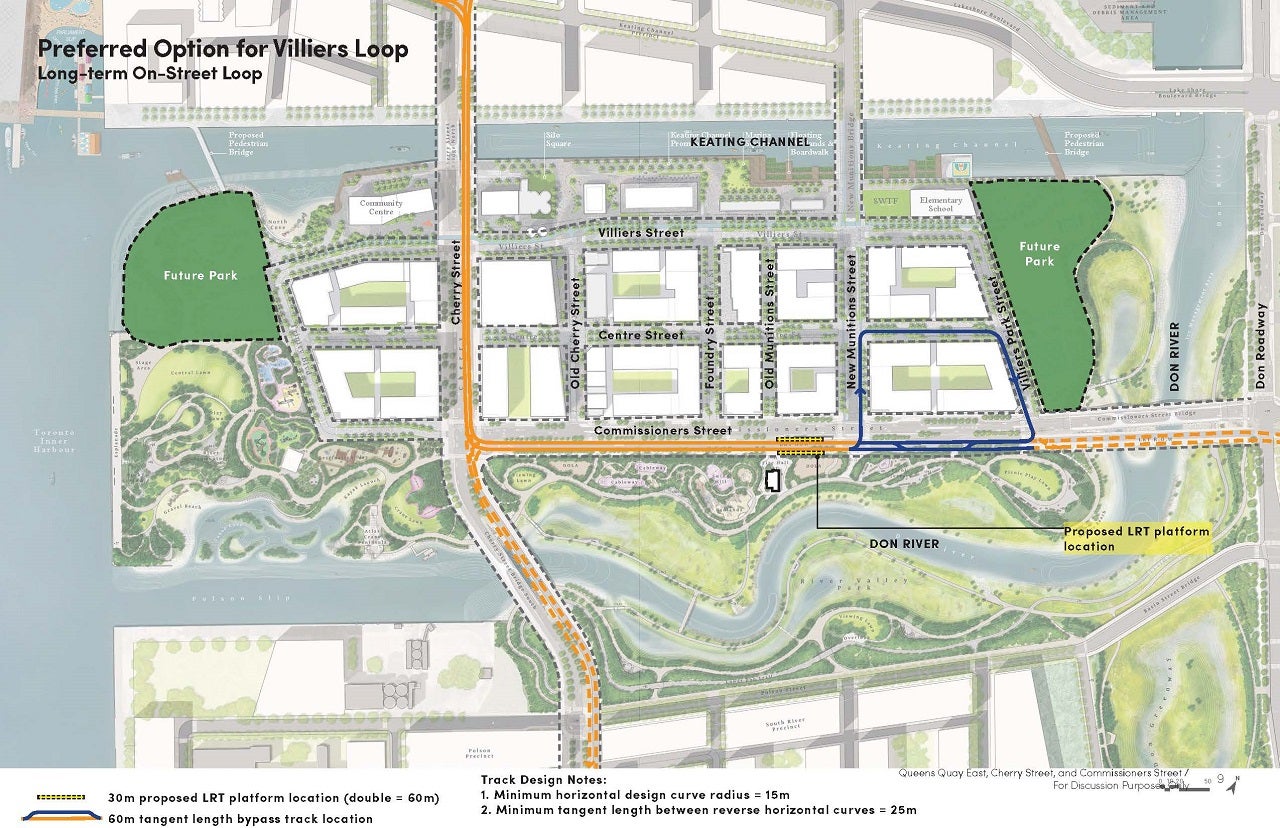
The on-street loop route on Villiers Island shown above in this image was selected as the preferred LRT loop alignment.
Why did we choose this option?
Option W2 is an on-street loop configuration, which travels on a dedicated right-of-way along the future New Munitions, Centre, Villiers Park, and Commissioners Streets on Villiers Island. The dedicated lane reduces impacts on pedestrians, cyclists, and drivers and ensures efficient transit service.

Several alignment options were considered for the Villiers Island loop, including both on-street and off-street alignments in various configurations. Two preferred options were short-listed, including the selected on-street alignment and one off-street alignment. Preliminary functional design drawings and street cross-sections were assessed for each loop option which illustrated appropriate paths for pedestrians, cyclists, and transit vehicles.
Loop options were evaluated on:
- Technical and operational implications, such as feasibility, long-term uses and street configurations
- Development coordination and project delivery impacts, including delivery phasing timelines, planned development blocks and future density
While both loop options were deemed feasible from an operational perspective, the off-street option presented significant concerns in terms of its impact to the development of Villiers Island by occupying an area designated for future housing in the Toronto City Council-approved Villiers Island Precinct Plan. In contrast, Option W2 provided added benefits as a potentially permanent piece of infrastructure to support TTC operations long term. Based on this, our team selected Option W2 to proceed with preliminary design.

On January 25, 2023, the Waterfront Design Review Panel (DRP) will review the schematic design for the LRT extension on Commissioners Street to the preferred turnaround loop location on Villiers Island. The purpose of the DRP review at this stage is to evaluate the schematic design for this portion of the project and give the design team feedback on how the LRT is integrated with the public realm.
The presentation materials from the DRP meeting and a video recording of the presentation will be available online shortly after the meeting.
What’s Next?
Following the DRP meeting, the project team will complete the preliminary design and engineering and costing for all project components. These details are needed to complete the business case to present to Toronto City Council and move the overall project forward.
We will be hosting stakeholder and public consultation updates this spring to seek feedback on the complete design before staff report to City Council in mid-2023. This will be followed by the official Notice of Commencement for the Transit Project Assessment Process.