Summary: Community Consultation on Port Lands Flood Protection

POSTED: FEBRUARY 26, 2018
BY: MIRA SHENKER
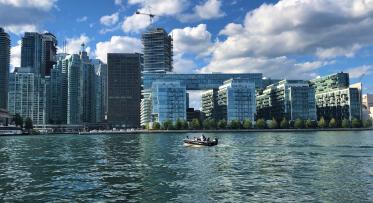
On February 22, 2018, we hosted a community consultation for the Port Lands Flood Protection project. The Port Lands Flood Projection Project is about taking action to prevent Toronto’s southeastern downtown area from flooding. Right now, in an extreme weather event, floodwaters from the Don River would overwhelm portions of the Port Lands, South Riverdale and Leslieville. Over the next six years, our main objective is to let the Don River flow freely into Lake Ontario. To return the river to the way it once was, we need to embark upon one of the biggest infrastructure projects in Toronto’s history.
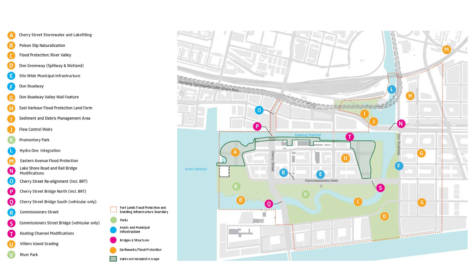
What are we building? This map shows the different pieces that make up Port Lands Flood Protection. They can be separated into four categories: parks, roads and municipal infrastructure, bridges and earthworks/flood protection.
In addition to creating a naturalized river valley, a crucial part of this project involves building new public spaces, roads and bridges, as well as flood control weirs and flood protection landforms. The work we need to do as part of Port Lands Flood Protection can be grouped into four larger categories: parks, roads and municipal infrastructure, bridges and earthworks/flood protection. You can see a breakdown on the map below. The new river will also create a new island—Villiers Island. The plan for turning Villiers Island into a complete urban community was developed in partnership with the City of Toronto and adopted by City Council in October 2017. Development of the complete community we envision can start once we complete Port Lands Flood Protection.
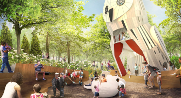
New parkland will be built on the north and south sides of the kilometre-long river valley we're creating. Top: Looking east at Cherry Street just south of Polson Street. Bottom: Future view at this location, which will be the south side of the river valley.
The meeting took place at Daniels Spectrum. Julie Dabrusin, Member of Parliament for Toronto–Danforth, and Councillor Paula Fletcher (Ward 30) welcomed members of the public. Waterfront Toronto’s SVP of Planning and Design, Chris Glaisek, began with a history of the Port Lands and an overview of the feedback we’ve gathered about parks and green spaces in the Port Lands over the last ten years. Chief Project Officer, David Kusturin, then walked us through the Port Lands Flood Protection project. This included an overview of our 15-month Due Diligence exercise, which confirmed what we’ll build, how we’ll build it, how long it will take, and what it will cost.
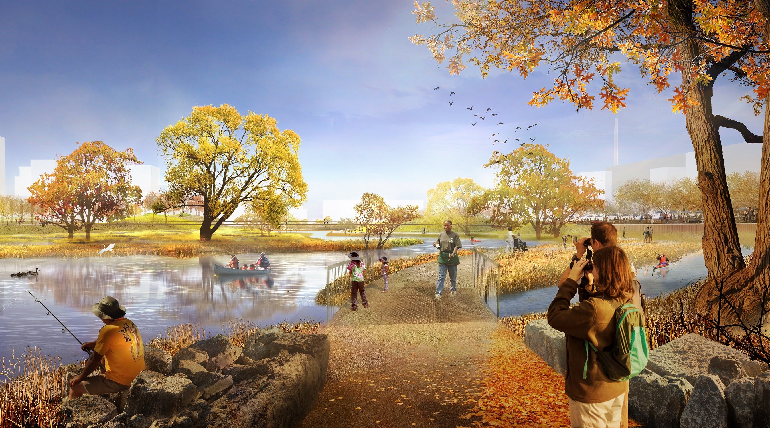
Our focus for this meeting was the design of parks and naturalized green spaces. We're creating 29 hectares of naturalized green space (including coastal marshes and wetlands) along with 16 hectares of parkland. Presenters Herb Sweeney and Matthew Urbanski from MVVA walked us through their proposed programming for that 16 hectares of parkland and their approach to creating natural green spaces.
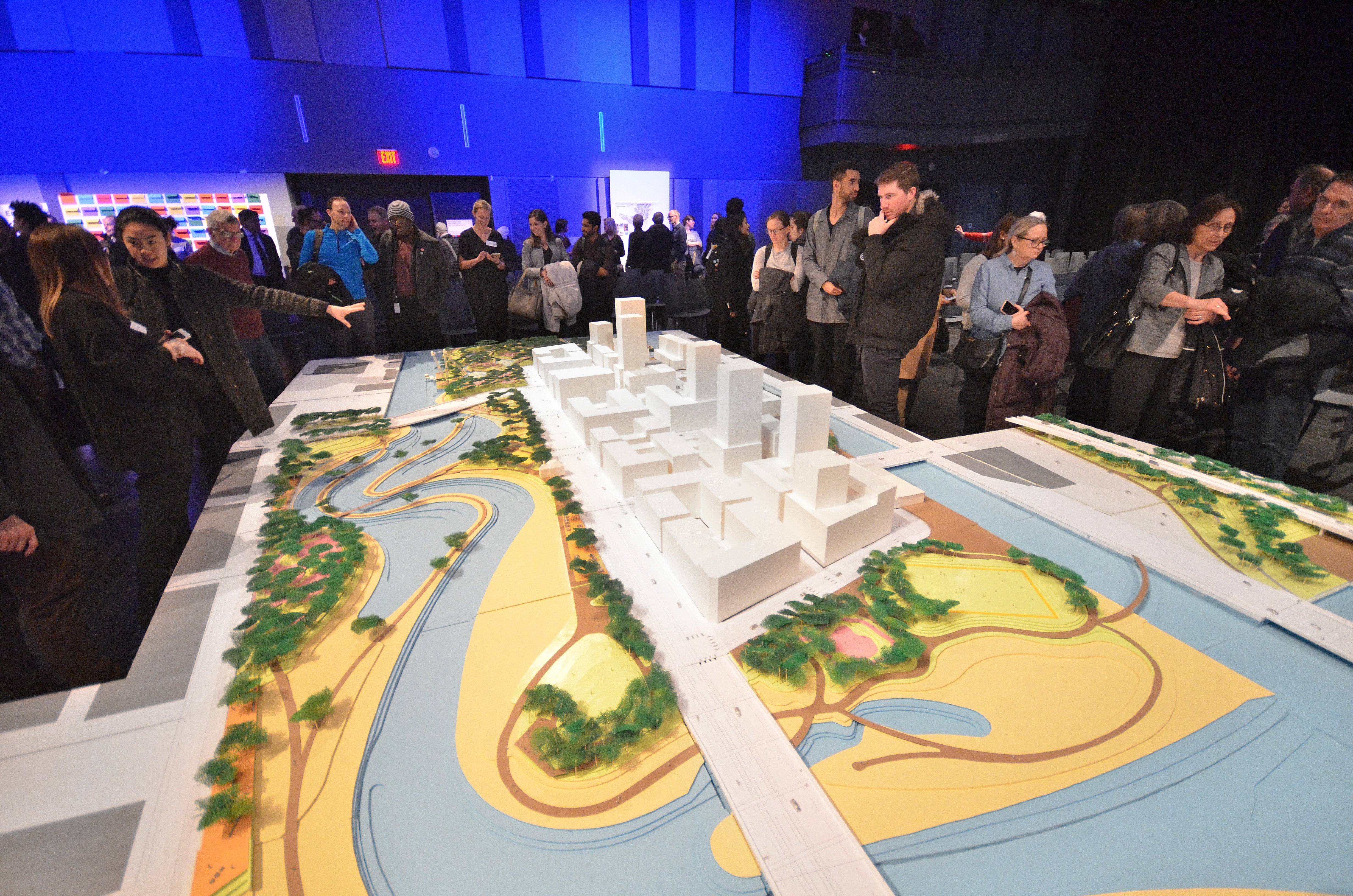
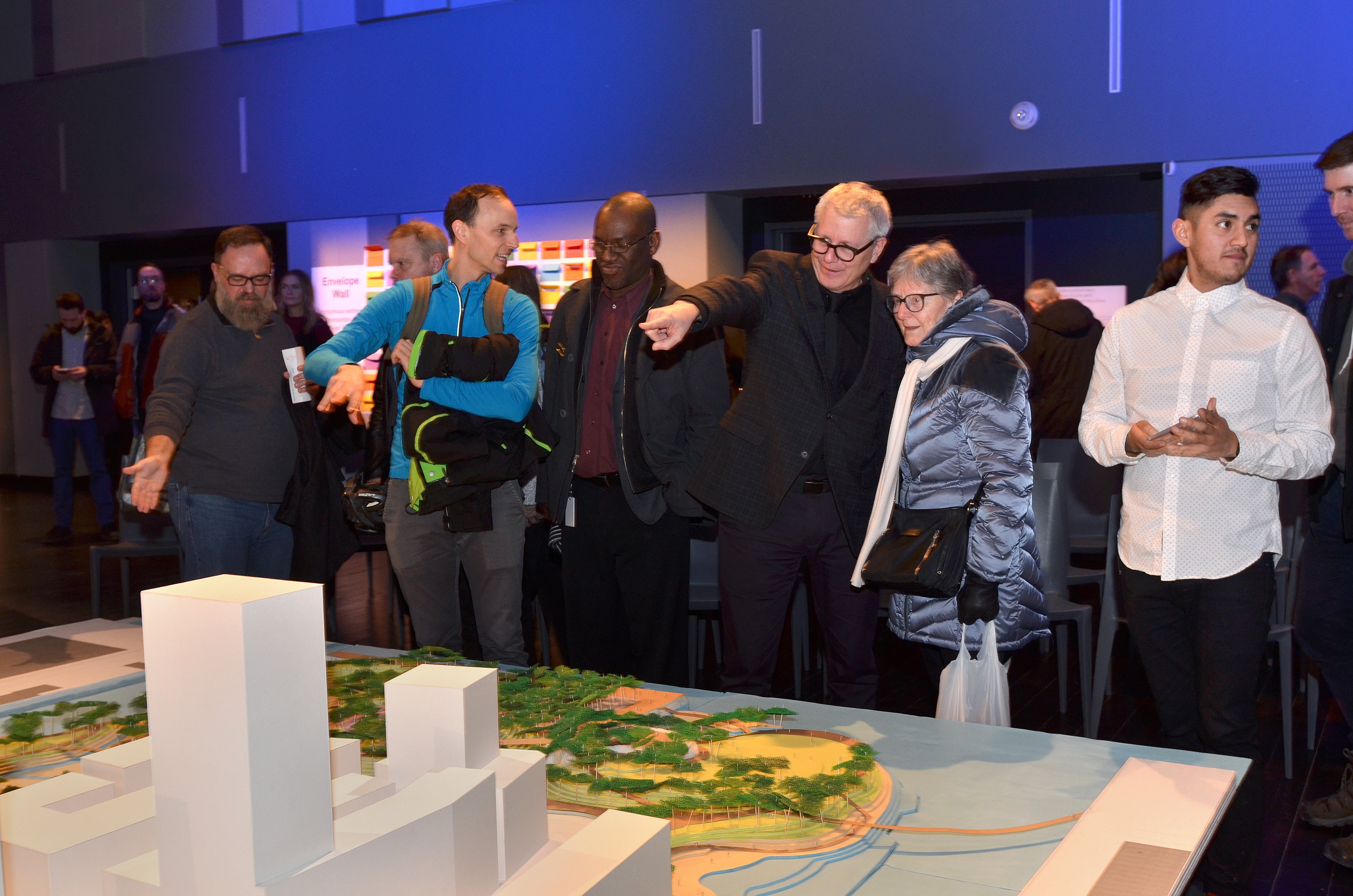
Design team MVVA’s large model of our future river and parks captured everyone’s imagination.
Staff from Waterfront Toronto, City of Toronto and Toronto and Region Conservation were on hand to chat. We also organized a variety of activities to help us better understand your waterfront experience – “interview a neighbor,” image inspiration, and a map scavenger hunt.
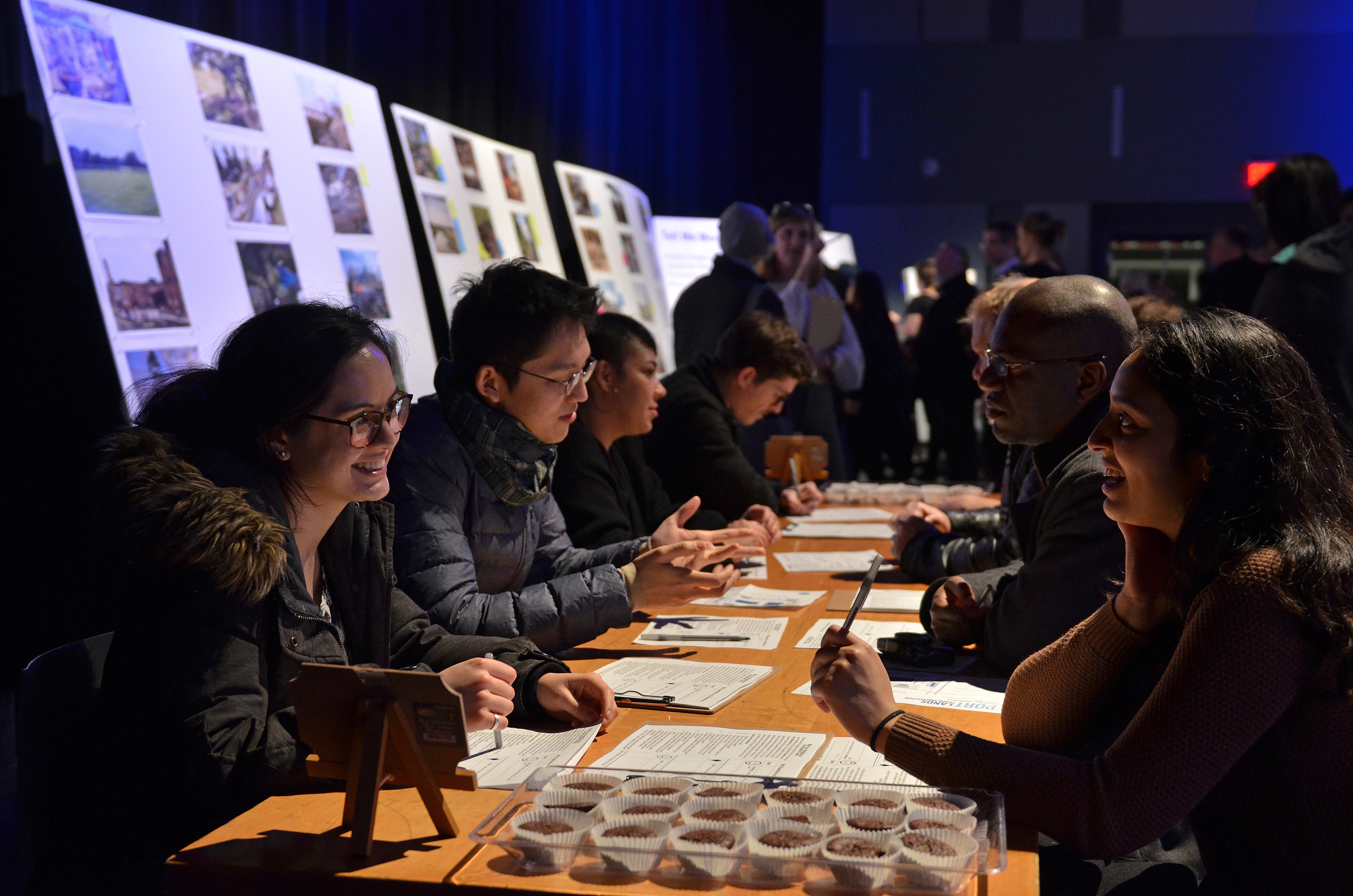
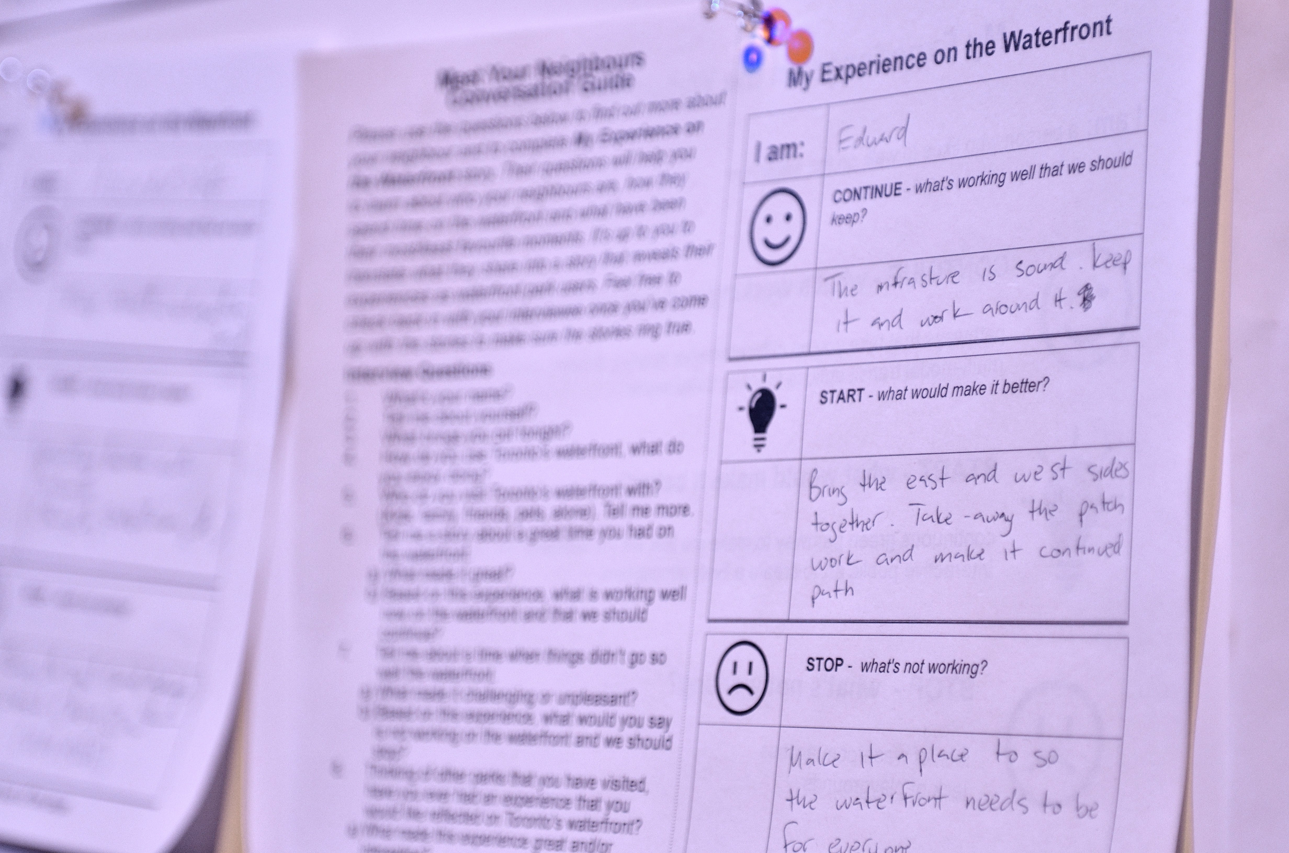
Top image: "Interview a neighbour" activity asked you to talk to someone you didn't know about your waterfront experience. Bottom image: One of several stories displayed after you interviewed your neighbours.
Many thanks to everyone who joined us at Daniels Spectrum or tuned in live on Facebook for the presentations and Q&A. If you missed it, you can watch the videos below:
You can also look at the display material and presentations here:
- Presentation (Waterfront Toronto Introduction) PDF
- Presentation (Design Team) PDF
- Display Panels (Context) PDF
- Display Panels (Aerial) PDF
- Display Panels (Perspectives) PDF
- Display Panels (Proposed Programming) PDF
- Display Panels (Scale Comparison) PDF
- Display Panels (City-Wide Open Space Program Inventory) PDF
To sign up to receive updates on this project, email info@waterfrontoronto.ca. You can also sign up for our monthly newsletter to get updates on this and other projects.
Kiss n’ Sail Pilot Project Beginning Summer 2024 Announced

New Floating Artwork Features Messages About Water