Understanding the 2020 Marine Use Strategy

Our 2020 Marine Use Strategy will identify what actions are needed to best accommodate & balance the diverse uses of Toronto's harbour.
POSTED: NOVEMBER 10, 2020
BY: KALEIGH WISMAN
We’ve extended the survey for our 2020 Marine Use Strategy until November 18, giving you more time to provide feedback.
We’ll be taking public feedback into account as we put together the final report and thank those who have already provided valuable input. As always, we want to hear from everyone who uses the waterfront – and from those who wish to use it more!
One area where we have been receiving a lot of feedback is around the “future potential water-based transportation map” included in the draft report. To help those still looking to complete the survey, here is some information about this part of the study.
In this map, marine nodes (which would be like docking structures) have been proposed that could potentially support future transportation systems on the water (ferries, water taxis or sea buses). These future potential marine nodes are long-term considerations that wouldn’t be built for approximately three to five years. At this stage, they’re a part of a longer list of recommendations the project team is making to help balance uses in Toronto’s harbour. We’re taking feedback to help inform our final recommendations. Whatever we include in the final report would require a feasibility study before moving ahead.
To participate in the 2020 Marine Use Strategy survey and view supporting materials, please visit this page or the links below.
Learn about the contents of the Draft Report by exploring these materials:
- Public Information Centre #2 Pre-recorded Video Presentation (approx. 50 minutes)
- 2020 Marine Use Strategy Draft Report
- Draft Summary Guide
Provide your feedback through this survey:
For further reference:
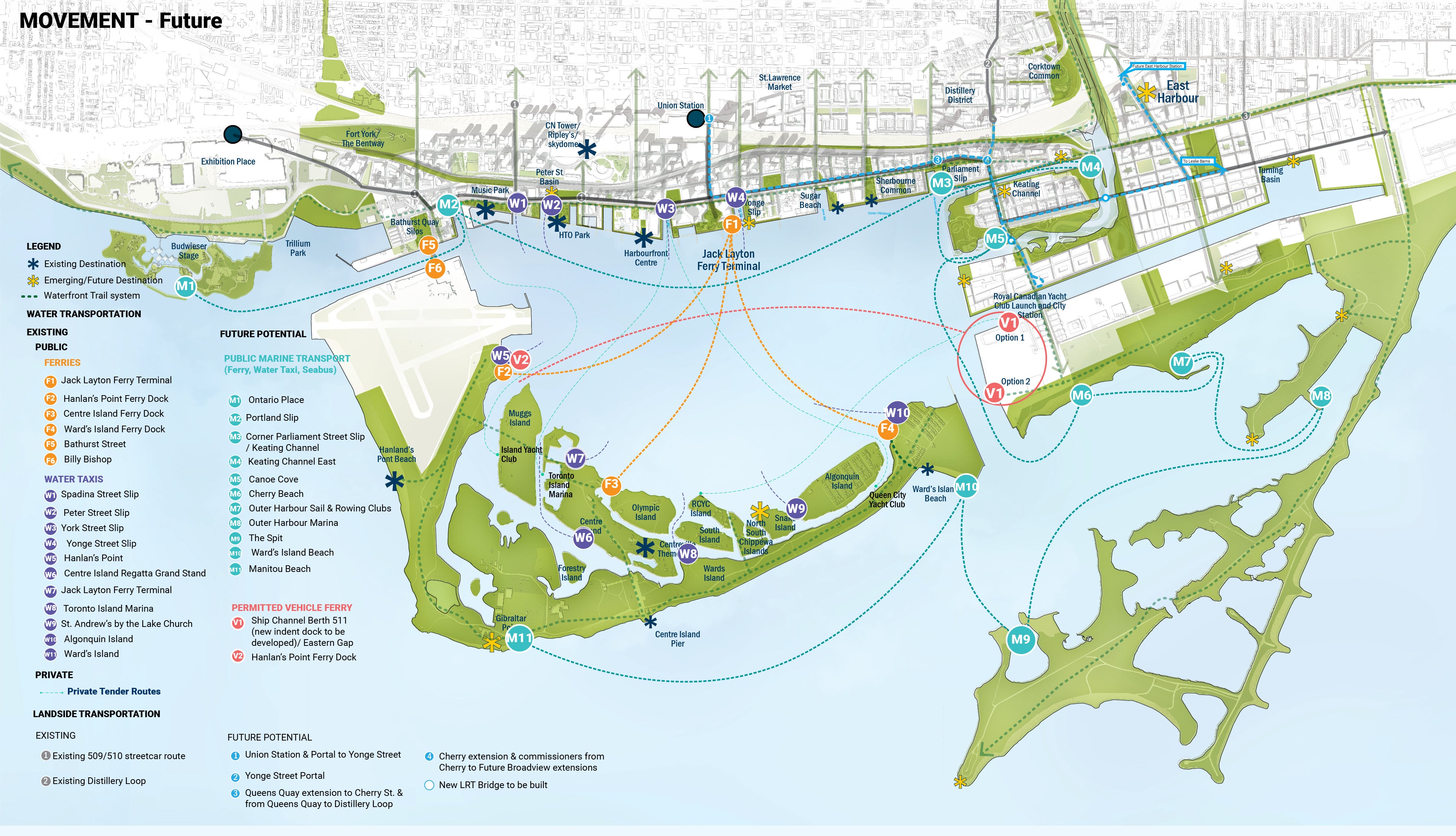
From page 56 of the report, this diagram outlines the proposed marine nodes in discussion.

Fueling Appetites and Small Businesses with Interim Events

Waterfront Toronto Launches International Competition for Quayside Development Partner