Healthy and Resilient Neighbourhoods, By Design

Our city-building efforts will lead the way for a vibrant community on Villiers Island.
POSTED: FEBRUARY 10, 2021 I COMPLETE STREETS, DESIGN, PARKS AND PUBLIC SPACES, WALKABLE NEIGHBOURHOODS
By Kaleigh Wisman
Despite the challenges presented by COVID-19, our city is growing and will continue to do so in the years to come. According to the Ministry of Finance, Toronto’s population is projected to rise from 2.97 million in 2019 to 3.73 million in 2046—a 29 per cent increase. To make this growth successful, it’s more important than ever that we make the most of our waterfront, which is one of the world’s most promising city-building opportunities. This means we need to continue fuelling economic growth and innovation while prioritizing inclusion, enhancing quality of life and setting new standards in sustainability—exactly the things Waterfront Toronto was established to do.
This is the final blog in our series spotlighting our updated Rolling Five-Year Strategic Plan and what we will accomplish this year and beyond. Our first two blogs explored planning for the public good and jobs and innovation—here we focus on city-building.
The Best Communities Are Complete Communities
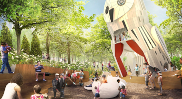
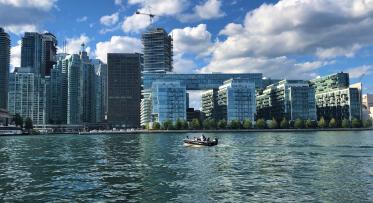
 The West Don Lands is an example of a thriving complete community that we designed from scratch.
A complete community is one that works for the many, rather than the few. These holistically planned communities provide a range of housing types that accommodate varying family sizes and incomes, include great public spaces that facilitate recreation and cultural activities, and deliver highly valued infrastructure such as childcare, elder support and transportation options that connect to the rest of the city.
Over the next year, in East Bayfront, an emerging complete community on the waterfront, we will advance our work with the City of Toronto to add 215 affordable housing units to a development parcel in Bayside and will begin the interior fit-out work for a childcare centre in Aquabella.
We will also be crafting a new accessibility strategy that will shape future public spaces and communities across the waterfront. This strategy will ensure we go above and beyond the existing requirements for accessibility to make Toronto’s waterfront one of the most accessible in the world.
As we look forward to the next year and beyond, we are excited to continue working on a new complete community at Quayside that will meet the demands of our growing city and present the opportunity to set precedents for what is possible when engaging in modern day city-building.
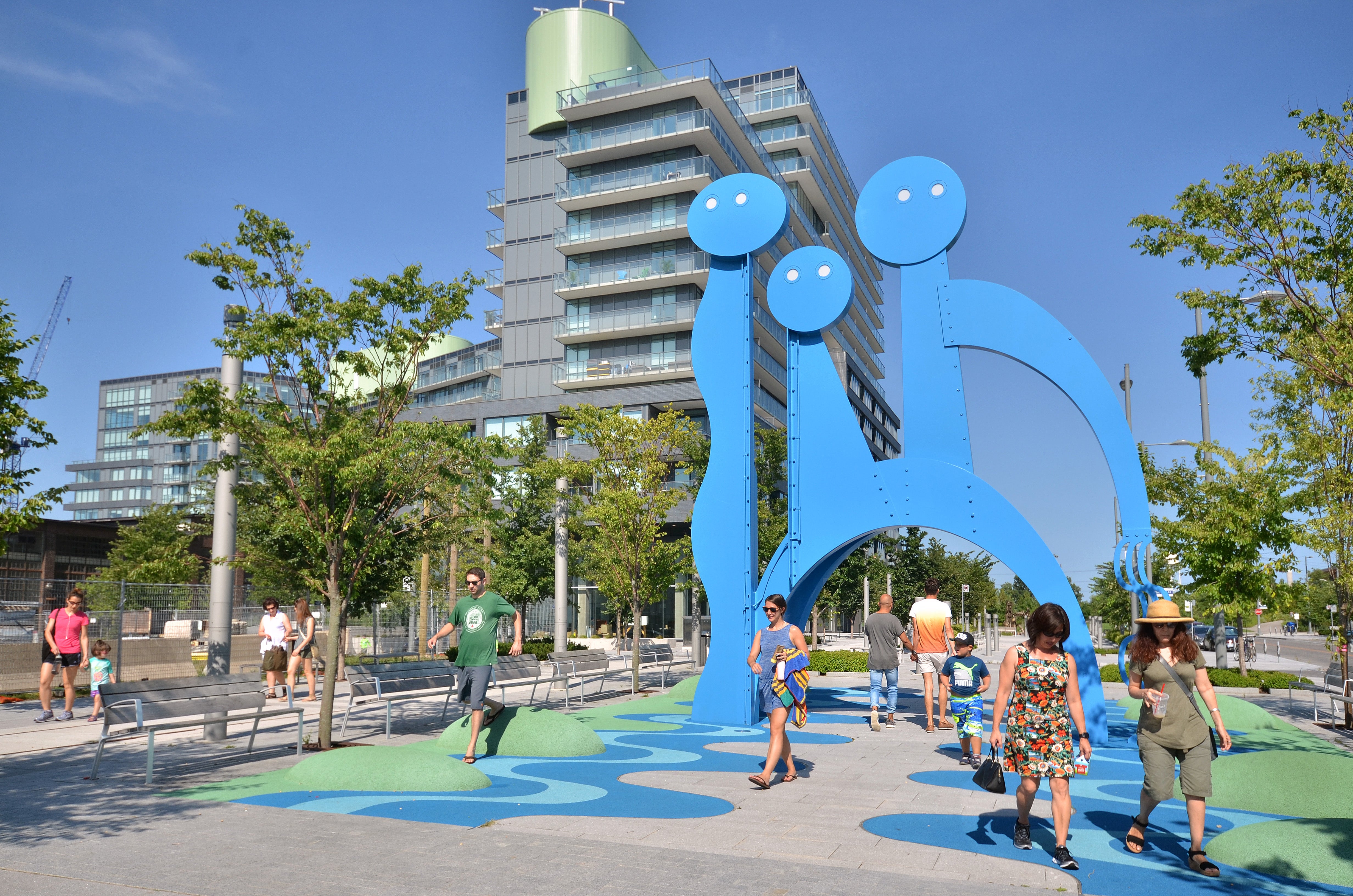
Quayside — A Vibrant Hub Connecting the City with the future Villiers Island
 With the West Don Lands, St. Lawrence and the Distillery District to the north and the future Villiers Island to the southeast, Quayside will help this entire area become more than the sum of its parts.
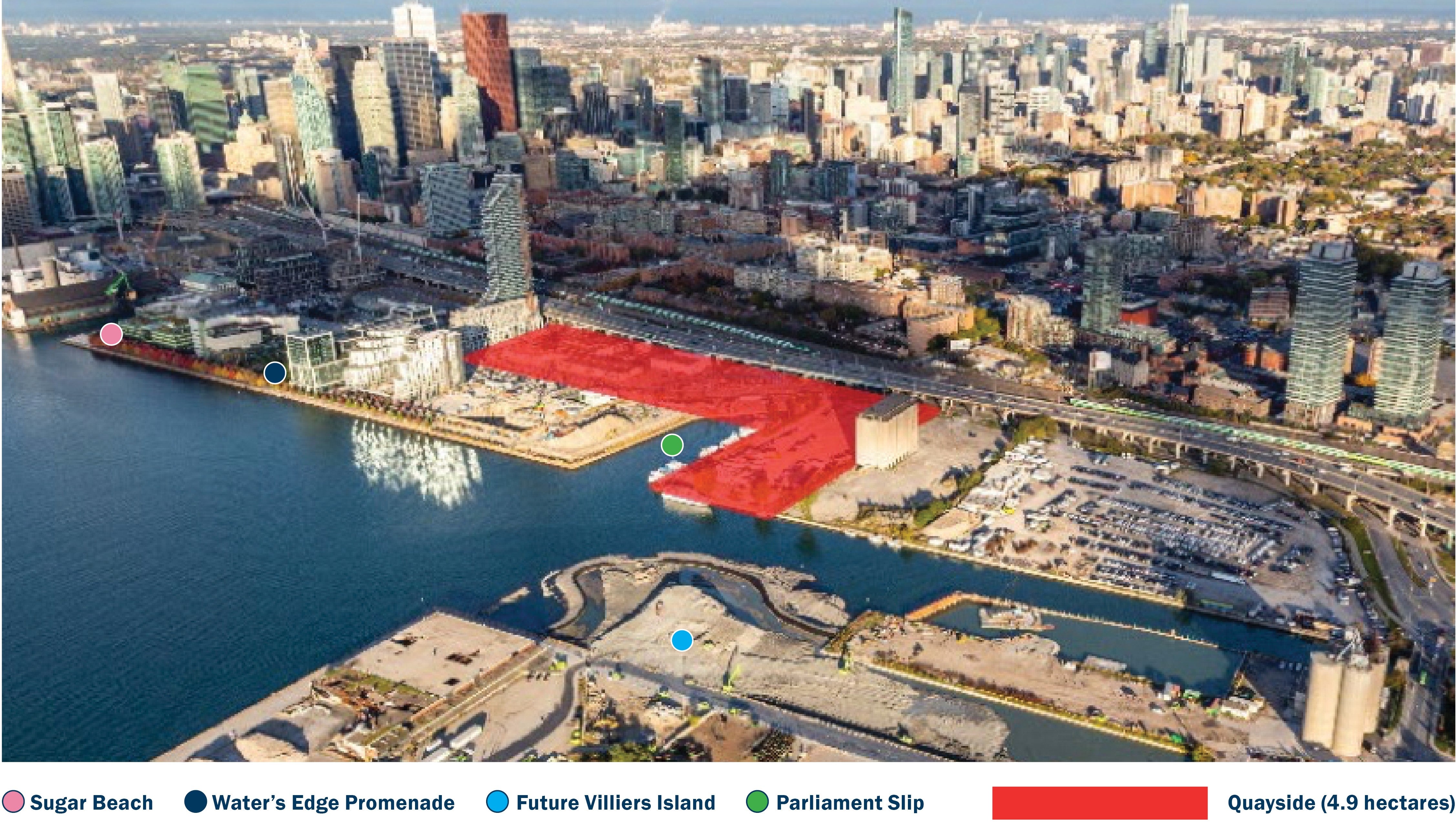
This 4.9 hectare parcel of land at the foot of Parliament Street is ideally situated to be a vibrant hub, linking the city to the water’s edge and connecting new waterfront neighbourhoods like the West Don Lands to future development in the Port Lands.
This year, we will select a development partner for Quayside and work with them, the City of Toronto and CreateTO to ensure that the new neighbourhood will accommodate a range of housing options, amenities and provide a high standard of living for individuals and families at any stage of their lives.
As part of a vibrant waterfront, Quayside also has the potential to accommodate a diversity of retail and non-residential development, including community-based and cultural uses. And, building on our past successes in advancing green building requirements and healthy spaces, we will strive to raise the bar yet again demonstrating climate leadership.
As we pursue the development agreements for Quayside over the next year, we will be advancing the Affordable Housing Program at Quayside and expect to deliver between 600 and 700 units of affordable housing when the community is complete.
Creating New Opportunities with Villiers Island
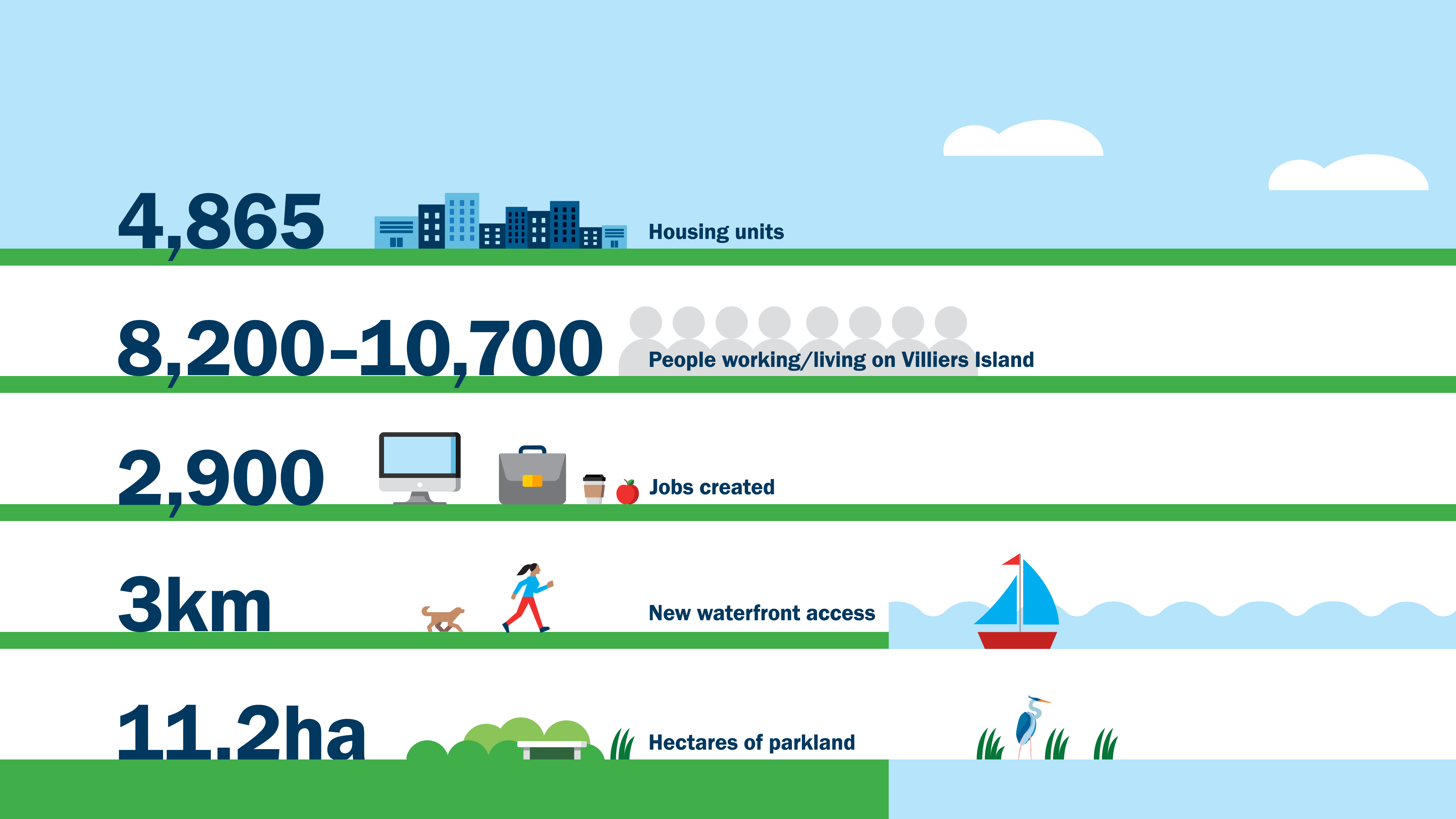 These forecast figures drawn from the Villiers Island Precinct Plan illustrate the impact this new community will have on our city including new affordable housing, green space and jobs.
Toronto is getting a new island and, with it, the opportunity to build an extraordinary community. Villiers Island will be created as part of the Port Lands Flood Protection Project. This prime land located a short bike ride from downtown will be unlocked for development as a result of flood protection, creating incredible potential for economic growth. In 2021/22, we aim to create the equivalent of 2,394 years of employment mostly through construction on Port Lands Flood Protection. Once Villiers Island is fully developed, an estimated 2,900 people will work there, with new retail and commercial spaces expected to line the new waterside promenades and local streets.
Thoughtful city-building will help accommodate the growth Toronto is expected to undergo in the years to come. We are committed, now more than ever, to making the most of our waterfront and creating communities that are for everyone. As plans for new waterfront communities unfold, we are working closely with the Mississaugas of the Credit First Nation to build our own track record of placemaking that integrates historical identity with contemporary issues.
We hope you explore the plan to learn more about the direction Waterfront Toronto will be taking over the next five years.
The complete Rolling Five-Year Strategic Plan can be found here.
Kiss n’ Sail Pilot Project Beginning Summer 2024 Announced

New Floating Artwork Features Messages About Water