Why the Port Lands are Vital to Toronto’s Future

The above map is circa 1894 (courtesy of Wikipedia). Notice the large area at the eastern edge of the inner harbour labelled "Marsh". After decades of infilling that began in the early 1900s, this marsh became the Port Lands.
POSTED: FEBRUARY 17, 2016
BY: CAROL WEBB
As a student of history, I’m fascinated by how our waterfront has evolved over the past century. The Port Lands was once the largest natural wetland in Lake Ontario. Beginning in the 1900s, this area was gradually infilled to make more land available to serve the city’s growing industrial and shipping sectors. Today, the Port Lands still serves as a working port and is also home to a variety of light industrial and other services; but, for the most part, it’s a massive underutilized, contaminated brownfield site that neighbours Toronto’s vibrant downtown core.
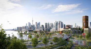
Part of Waterfront Toronto’s mandate is to help Toronto compete at the global level to attract and retain top talent, jobs and investment. As our downtown experiences the pressures of continued population growth, the Port Lands and the adjacent First Gulf/Unilever site remain the last significant undeveloped spaces within walking distance of the city’s core. The trouble is that much of this area is at risk of flooding and its potential cannot be reached until this risk is addressed.
Some would argue that there’s nothing wrong with “undeveloped”. In certain cases I would agree, however, there are many distinctions that set the Port Lands apart. Aside from Tommy Thompson Park and the Baselands, the Port Lands is not a wild or naturalized place within our city. It is a valuable, underutilized, man-made area that offers immense potential for jobs, investment and growth, reducing urban sprawl, and for demonstrating global leadership in sustainable city building ─ achieved in a manner that also reduces greenhouse gas emissions. There is a significant opportunity here to create resilient city infrastructure - in the form of a new river channel, restored wetlands, parks and open spaces - that will mitigate the risk and costs associated with major flooding, and for the development of vibrant, complete and sustainable mixed-use communities.
Waterfront Toronto has a plan for how to make the most of this opportunity, and we think that now is a good time to describe this complex project in a way that’s easy to understand. After all, you may have heard a lot of talk about the Port Lands recently, perhaps in relation to the federal government’s plan for infrastructure investment, or Toronto’s possible bid to host Expo 2025. 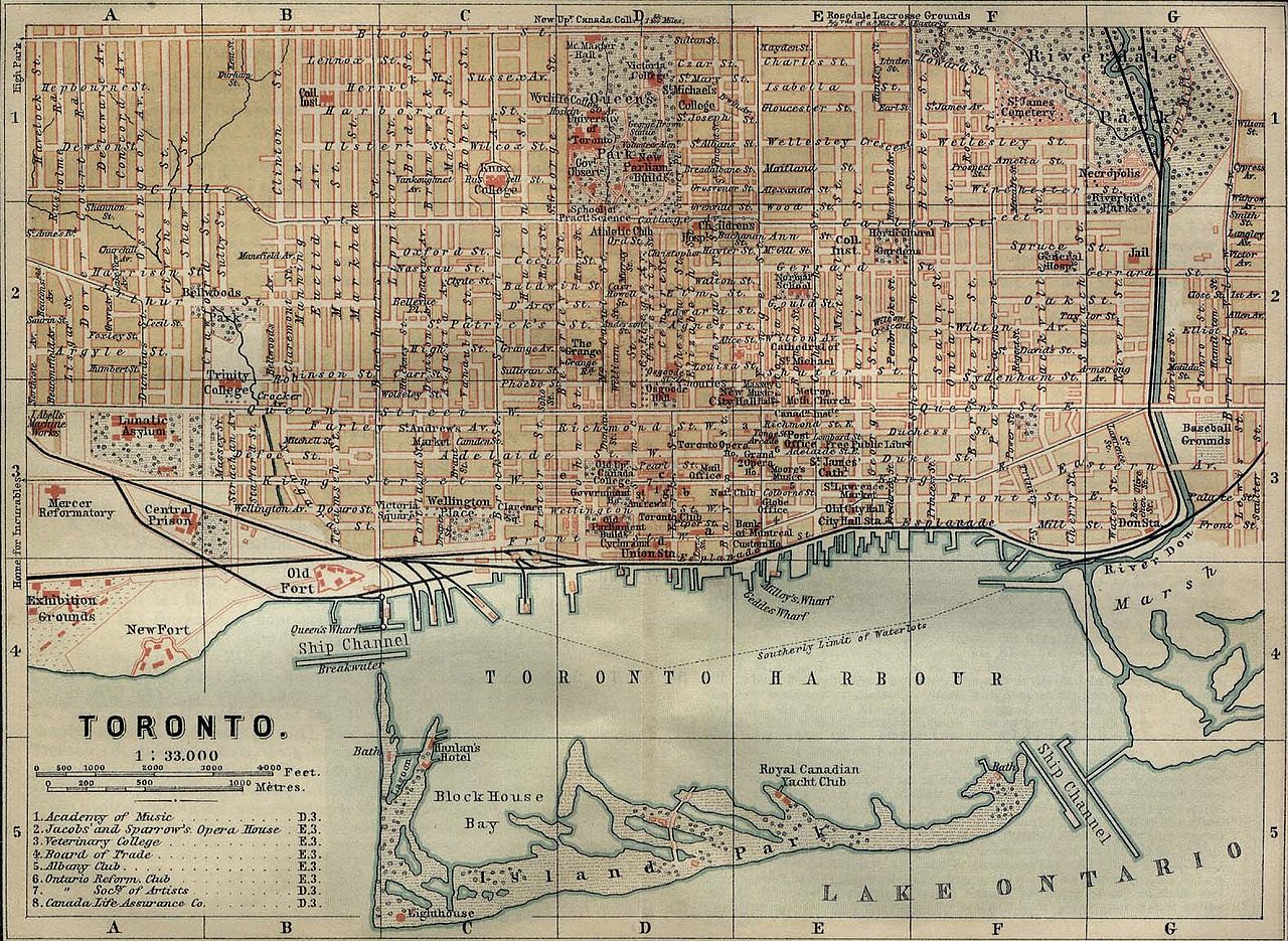
Watch this short video and you’ll see the opportunity that is before us and get a glimpse of the plans that are well underway.
We’ve been hearing increasingly more about resilient cities and resilient infrastructure. What does this mean? By definition, resilience is the ability to recover from adversity. In today’s reality, in terms of cities and infrastructure, resilience means having strategies in place to manage the future shocks and stresses to our urban infrastructure systems associated with climate change.
More frequent extreme weather events within Canada and globally have raised the risk of more prevalent and severe flooding. Continued urban growth can make the situation even worse. In the last few decades, the proportion of paved land in the Don River watershed has increased from 15 per cent to 85 per cent significantly increasing the volume of rainwater heading down the Don River into the Keating Channel in the Port Lands.
This animation shows the extent of flooding that would happen in the Port Lands today if a Hurricane Hazel-like event were to occur in the Don River Watershed.
The video illustrates the 290 hectares of land ─ from Eastern Avenue out to Leslie Street, down to the Ship Channel and then east to the Inner Harbour – that are at risk of flooding. Under this scenario, flood waters would be up to three metres deep within portions of the Port Lands.
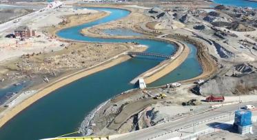
Waterfront Toronto’s plan for the Port Lands – which has been developed with our partners, the City of Toronto and the Toronto and Region Conservation Authority – will create a new river mouth by rerouting the existing river from its current location at the Keating Channel on the eastern side of Toronto’s inner harbour, to the middle of the Port Lands between the Ship Channel and the Keating Channel. In addition to maintaining the Keating Channel, the project will create a new river outlet as well as a green spillway – a wetland that will double as an overflow outlet – that together will channel flood waters safely into Lake Ontario and protect the nearby lands.
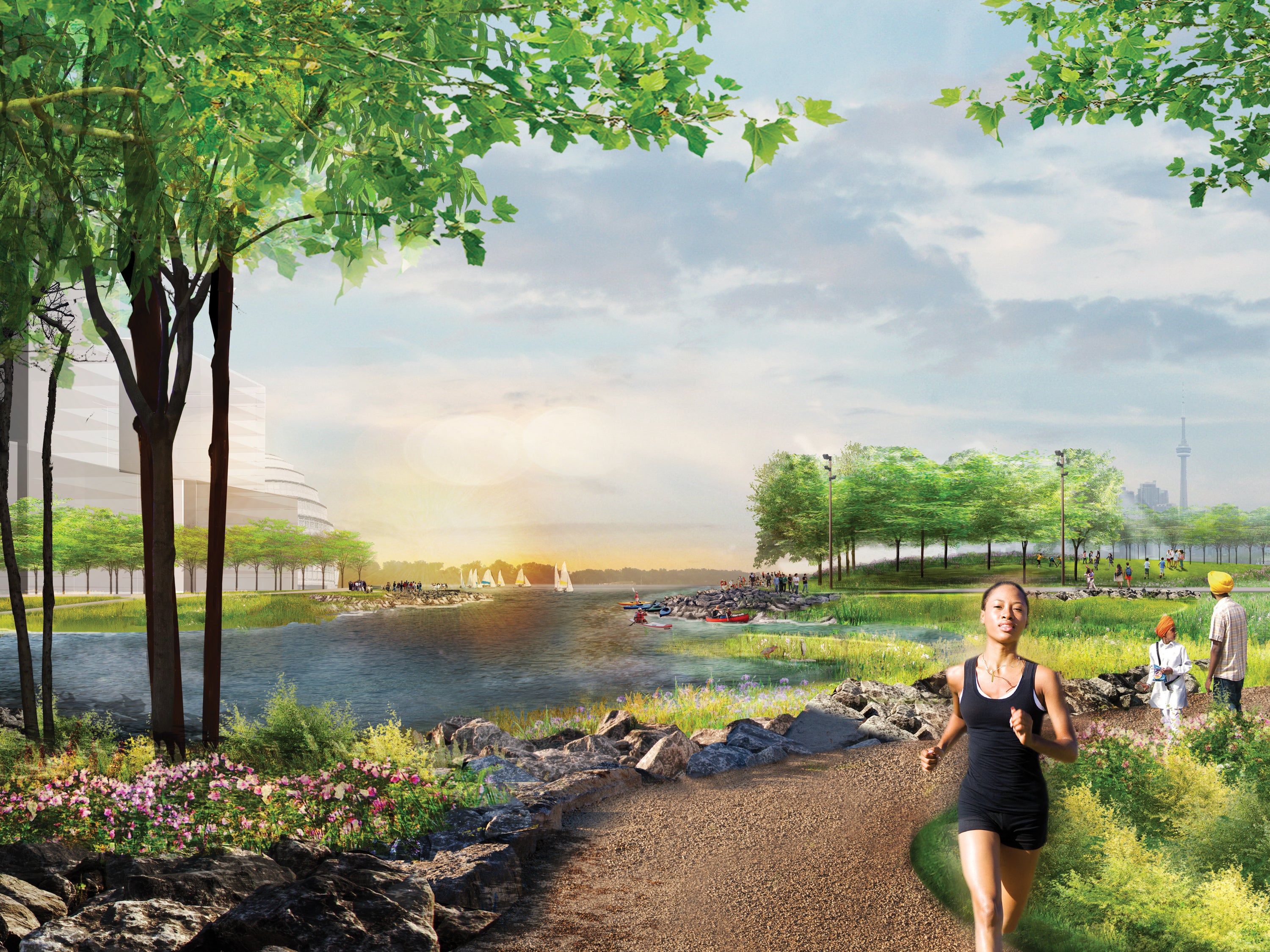
The new river valley looking west from the Don Roadway.
In completing this project, we will remove and manage the contaminants in the soil – remnants of its past and current uses – restore the vital wetlands and create new green spaces, providing a variety of plant species, shoreline treatments, natural habitats and ways for water to move that will enhance healthy and sustainable living. Over 1,000 metres of new river channel, 13 hectares of new coastal wetland and four hectares of terrestrial habitat will result from this project, strengthening biodiversity that will help clean our air and water.
Currently, governments continue to assume the risk and costs associated with major flooding to this area. Further, the lack of flood protection prevents the Port Lands from reaching its potential as a long term asset – one that supports the economic growth and competitiveness of Toronto, Ontario and Canada. Together with our partners, we have investigated the jobs and larger economic benefits that are triggered by the project, the smart city-building options it creates and the opportunity to deliver sustainable urban infrastructure while addressing key climate change objectives.
The design and construction phase of the project alone offers the potential for significant returns on investment. A 2014 independent study estimated that construction of the new river valley, including soil management and remediation, and providing critical infrastructure will generate:
- $1.7 billion in value to the Canadian economy
- 7,672 person years of employment; and
- $327 million in tax (direct, indirect and induced) revenue to all orders of government.
Naturalizing the mouth of the Don River is a resilient approach to addressing the pragmatics of flood protection. And, in creating this green infrastructure, a beautiful river valley arises around which new neighbourhoods can emerge.
The opportunities presented in the Port Lands are compelling, multifaceted and vital to the future of Toronto. This post has just begun to scratch the surface. Stay tuned for Part II, which will talk more about our collaboration with the C40 climate positive development program (a global project aimed at reducing our carbon emissions to below zero), the sustainability strategies that will influence this project, and our plans for inclusivity and maintaining strong public transit and cycling connections with the rest of the city.
Follow us on Facebook and Twitter – and join the conversation about waterfront revitalization using the #TOtheWaterfront hashtag.
Spring Maintenance for the Heart of Love Park
6 FAQs about Villiers Island