Research Project Seeks to Improve Transportation Model and Reduce City’s Carbon Footprint

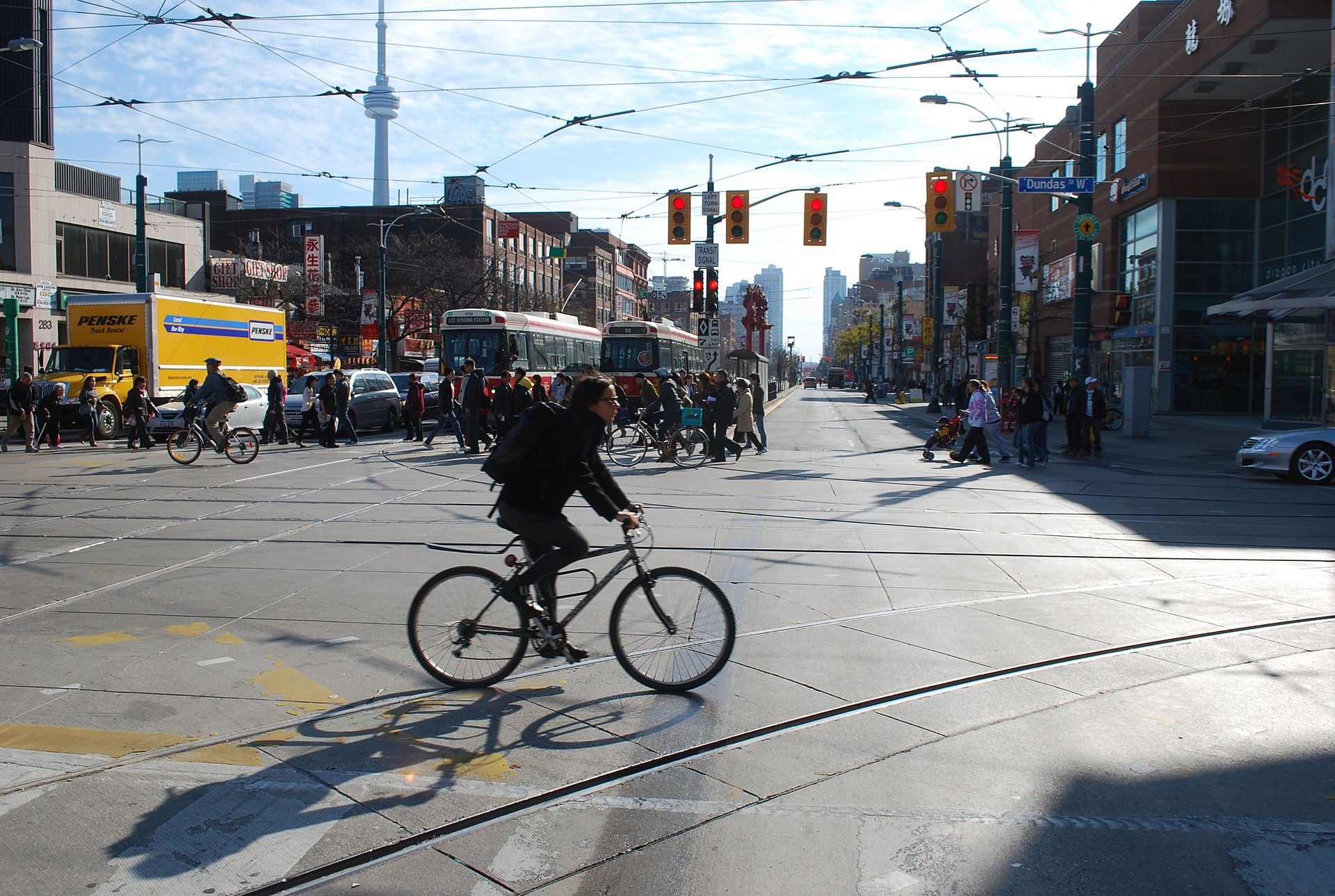
The University of Toronto Transportation Research Institute has developed a new app for iPhone and Android that tracks travel behaviour. The data collected will help develop a new transportation model that could help us solve Toronto’s transportation challenges. (Image by Hallgrimsson from Wikipedia)
One of Waterfront Toronto’s key objectives is protecting and enhancing the natural and social environment and making Toronto a model of sustainability for cities around the world. This involves building sustainable communities that help residents reduce their greenhouse gas emissions.
Human activities like fossil fuel combustion for energy production and automobile use have caused the concentration of greenhouse gases in the atmosphere to increase to dangerous levels. This leads to rising global temperatures, which in turn create more frequent and severe weather events such as heavy rainfall, heat waves and droughts. Besides causing catastrophic flooding, like we’ve seen in places like Calgary, or flooding and ice storms in Toronto, global warming is also threatening species extinction and impacting agricultural production. Carbon dioxide is the main greenhouse gas produced through human activities. It is also the most concentrated in the atmosphere and can persist for over 100 years, making this the most dangerous greenhouse gas. Reducing the amount of carbon dioxide emissions from human activities – also called our “carbon footprint” – is essential to halting global warming.
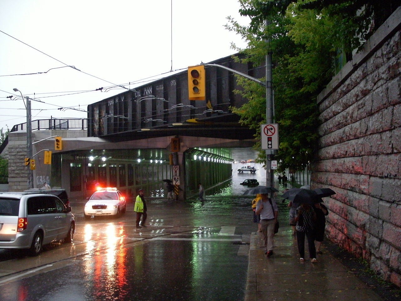
Rising concentrations of greenhouse gases, like carbon dioxide, in the atmosphere are contributing to more extreme weather events like this storm that caused flooding in Toronto in July 2013. (Image by Eastmain from Wikipedia)
Understanding the carbon footprint of large development projects can require a complicated set of mathematical calculations. To help make this easier, we created a Carbon Tool that simplifies the process. The user simply inputs key information and the tool compares the effect of various sustainable decisions to a “build-as-usual” scenario, or what would happen with normal building practices alone. The tool estimates how much carbon is emitted based on choices in transportation, energy, waste, water, materials and land use. Once we have an understanding of how much our projects are emitting and from what sources, we can explore ways to reduce those impacts. For example, when we ran the carbon tool in the West Don Lands we learned that we are reducing carbon emissions by 29% because of the sustainability policies we have implemented such as requiring energy efficient buildings. We also learned that energy and transportation have the largest carbon impact, so now we know where to focus our carbon reduction efforts.
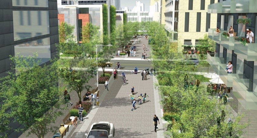
Waterfront Toronto’s Carbon Tool showed that planning the West Don Lands, pictured above, with sustainability in mind – with walkable streets, accessible transit and minimum green building requirements – will reduce carbon emissions by up to 29 per cent compared to a “build-as-usual” scenario.
With this knowledge, we decided to figure out how we can further reduce the carbon impact of transportation in our new waterfront communities and beyond. To help us with this, the University of Toronto Transportation Research Institute (UTTRI) is updating our Carbon Tool with a more advanced transportation model. The new model will do a better job of predicting non-motorized modes of travel, specifically walking and cycling and use actual data on travel behaviour that is gathered via an app downloaded to your smartphone. The app records the trips that people make and how they make them, helping us develop a deeper understanding of when, where and how people move around the city. The data collected in this study will help to build a better transportation model, allowing us to make more informed decisions about how to solve our city’s transportation challenges.
Already, after just a little over a week since launch, more than 500 "person days" of travel have been logged through UTTRI’s apps. That’s a great start, but to gather the range of data required, we need your help. Download the app and help us build a better transportation model for Toronto. For participating, you’ll automatically be entered in weekly draws for up to $1,600 in prizes, from now until December 21st.

Click here to download the Travel Survey app.
Learn more about the University of Toronto Transportation Research Institute and Waterfront Toronto's Carbon Tool.