The Future of Waterfront Revitalization: Priority Projects

West-facing aerial view of downtown Toronto, the Port Lands, West Don Lands, East Bayfront and inner harbour.
POSTED: APRIL 15, 2019 I COMPLETE STREETS, PARKS AND PUBLIC SPACES, DESIGN, PUBLIC ART, WALKABLE NEIGHBOURHOODS
By: Meghan Hogan
Last week Waterfront Toronto launched its next Five-Year Strategic Plan and the first in a series of blog posts showcasing how we propose to create a world-class waterfront for generations to come. The first post, called “A Legacy of Achievement, An Exciting Future”, began by examining the history of Toronto’s waterfront and the events that lead to the creation of Waterfront Toronto. If you haven't had a chance yet, you can read that blog post here.
The Five-Year Strategic Plan is a comprehensive guiding document that outlines past accomplishments, documents the exciting work currently underway on the waterfront, and proposes a series of aspirational projects for the future. The plan has three goals for the corporation over the next five years:
Goal 1: complete funded Priority Projects including Port Lands and 20+ others
Goal 2: imagine Canada's Next Generation Community
Goal 3: generate excitement—and funding—for projects to make ours one of the world’s great waterfront cities
In this post, we’ll take an in depth look at our Priority Projects and what we intend to deliver by the end of 2023/24.
Priority Projects
Over the next five years, we have more than 20 projects to complete along the waterfront. Each of these projects are either currently underway—shovels are in the ground—or are funded and planned. These include projects like the Port Lands Flood Protection, York Street Park and Rees Street Park, and the Jack Layton Ferry Terminal among others.
To help streamline this roster, each project has been placed into one of three categories that are in keeping with our overall mandate and guided by our core commitments:
- Port Lands Flood Protection
- Complete Communities
- Public Places
Port Lands Flood Protection
 Artists’ rendering of the future river valley in the Port Lands.
Waterfront Toronto was created to unlock the extraordinary potential of the Toronto waterfront and flood protection is an essential part of that mission. As extreme weather becomes more frequent, there is an increasing need to protect the city from surging flood waters.
Our most substantial flood protection project, the Port Lands Flood Protection initiative got underway in 2017 with a $1.25 billion contribution from the governments of Toronto, Ontario and Canada. To be completed by 2024, this project is an urgent contribution to the prosperity and well-being of Toronto. This work will protect large areas of the city from flooding, unlock the development potential of 290 hectares of prime land, and improve the natural environment around the Don River to create new opportunities for residents and visitors to connect with nature, wildlife and the lake.
Our work over the next five years involves extensive soil remediation and earthmoving around the mouth of the Don River, adding important infrastructure to manage stormwater, laying foundations for new transit, and creating new parks and natural habitats.
When complete, this project will add $5.1 billion in economic output to the Canadian economy, create 51,600 full-time years of employment and generate $1.9 billion in government revenue.
Want to learn more about the Port Lands Flood Protection project? Check out www.portlandsto.ca for more information, upcoming consultations and access to project documents.
Complete Communities
 The West Don Lands features eight public art installations that celebrate the industrial heritage of the site and its sustainable future. (Image by Nicola Betts)
Through careful planning and partnerships, Waterfront Toronto makes large parcels of land available for development – turning them into vibrant, thriving mixed-use communities. It’s our goal to ensure that new neighbourhoods include the support and amenities that people and businesses need to thrive. This means providing more than just housing and commercial space, but also high-quality infrastructure, services like child care and elder support, and transportation links to the rest of the city.
The West Don Lands is an excellent example of how we walk the talk. In 2001, this neighbourhood was underutilized and contaminated from past industrial use. Waterfront Toronto revitalized the area by remediating the soil and developing a community-informed master plan. After working diligently with government partners and developers, the community today features sustainable buildings, affordable housing, social services, award-winning parks and neighbourhood assets like a YMCA. It also features the TTC’s first new streetcar line in 16 years and a cohesive collection of public art installations that are accessible to all residents and visitors.
Notable projects that contribute to the development of complete communities along the lake that are already underway or expected to commence over the next five years include:
- A complete-community plan for the future Villiers Island
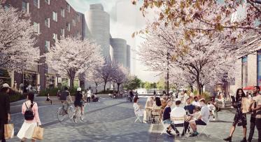
- Extending the Queens Quay revitalization work eastward to Parliament Street
- Completing infrastructure such as roads, stormwater systems and dock reinforcements in East Bayfront
- Extending the Water’s Edge Promenade all the way to the Parliament Slip
Moving forward, we’ll stay committed to working closely with our stakeholders and the public as we continue to work towards a vibrant, prosperous and connected waterfront where people can live, work and play.
Public Places
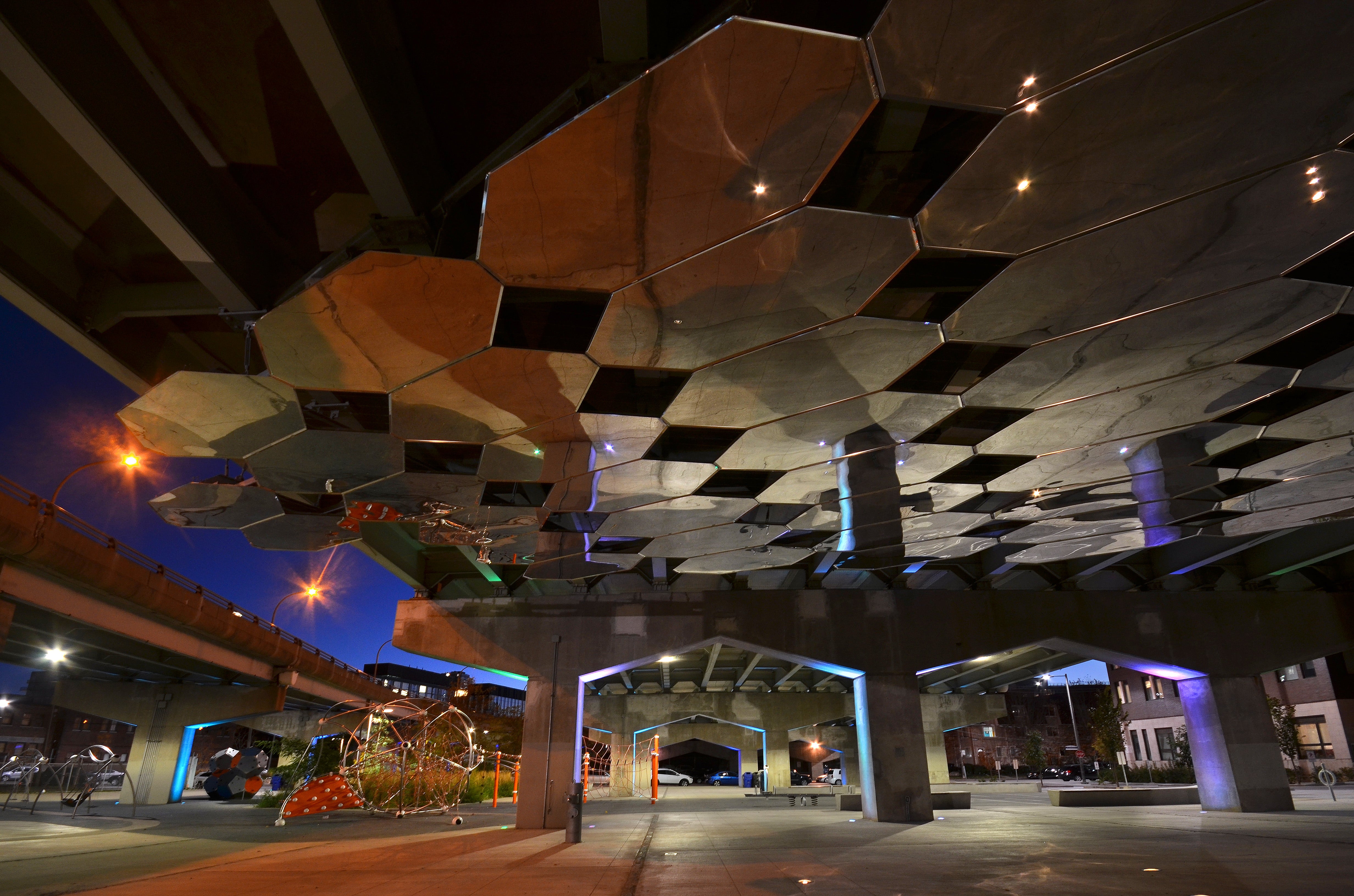
Top image: Corktown Common is an award-winning, multi-use park designed to meet the needs of all ages and abilities. Above image: Underpass Park was the first park built beneath an underpass in Canada and continues to draw visitors from across the city. (Images by Nicola Betts)
Waterfront Toronto has been creating great parks and public amenities that respond to local needs and strengthen the urban fabric. We’ve created or improved 25 hectares of parks in waterfront districts through the use of meaningful public consultation and an unwavering commitment to design excellence.
Our award-winning parks have become beloved public spaces. Parks like Canada’s Sugar Beach and Corktown Common are fan-favourites that provide year-round enjoyment for residents and visitors, along with spaces like The Bentway and Underpass Park that bridge barriers and provide new opportunities for play and relaxation in otherwise overlooked spaces.
Our focus for the next five years will be on expanding our already successful portfolio of parks and public spaces along the waterfront. This includes projects like:
- Completing work on York Street Park and Rees Street Park – which will add a combined 1.74 hectares of green space along the popular Queens Quay West
- Completing The Bentway’s pedestrian and cycling bridge
- Completing enhancements to the Jack Layton Ferry Terminal to create a more appealing and functional entrance plaza
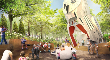
- Continuing to roll out our internationally-recognized public art program in the West Don Lands and East Bayfront
This work will help Waterfront Toronto further strengthen connections around the harbour by providing increased pedestrian access, creating new parks that make the water’s edge more inviting, and connecting people to their neighbourhoods.
To learn more about any of our priority projects and what’s to come over the next five years, we encourage you to read the full 5-Year Strategic Plan, which can be found here. Next week, we’ll examine the report’s second major goal - Imagining Canada's Next Generation Community – and what it means for the future of waterfront revitalization.
Larger-Than-Life Wildlife Coming to the Port Lands
What’s changing in the Villiers Island Precinct Plan?