Four Reasons to Stop Comparing Toronto's Waterfront to Chicago

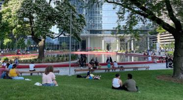
The Toronto skyline as seen from Snake Island Park (Image credit: Jamie McCaffrey on Flickr)
POSTED: JANUARY 27, 2015 I PARKS AND PUBLIC SPACES, DESIGN
By Meghan Hogan
Waterfront revitalization brings up a lot of emotions for Torontonians – excitement, frustration, pride and even jealousy. Mixed emotions are justified considering we’re a bit of a latecomer to the revitalization game. It’s only natural to draw comparisons to other successful waterfront projects around the world. But while comparisons do give us the opportunity to learn from the triumphs and challenges of others, they aren’t always helpful because the truth is this: Not all waterfronts are created equal.
In Toronto’s case, one city’s waterfront stands out and seems to be unavoidable in drawing comparison. Some of us may know it as our sister city and others as the Windy City, but most of us simply know it as Chicago. In fact, it’s one of the most common critiques of our waterfront and a subject we are no stranger to here at Waterfront Toronto. Here are just a few examples of the types of comments (yes, we do read the comments!) we often see and hear:
“If anyone thinks Toronto has a nice waterfront, they don’t get around much. Visit Chicago…” – Matt on 680news.com
“Our waterfront is 25 years behind Chicago's” – Toby Buckets on BlogTO
“Toronto's population is now larger than Chicago’s, but we are nowhere near the world class design and planning of Chicago! Where is our Millennium Park? – galintoronto on Toronto Star
“Still nowhere near as good as Chicago's lakefront…Google Chicago lakefront and see what Toronto is missing” – dakerie on Toronto Star
If you’re unfamiliar with the complex and unique histories of both cities' waterfronts, perhaps you’re nodding your head in agreement. And if you are, allow us the opportunity to set the record straight. We’ve whittled down the major arguments and come up with the top four reasons we should all stop comparing Toronto’s waterfront with Chicago’s.
1. HISTORY
Today, these sister cities have plenty in common – from a train station named Union and rivaling population sizes to similar geography and skyscrapers designed by world-renowned architects, not to mention both waterfronts were built on infill. But from there, each waterfront has its own distinct history and is the product of a specific time and place. For starters, Chicago began thinking about its waterfront much earlier than Toronto.
During the mid-1800’s, Chicago received significant federal funding to improve the mouth of the Calumet River in the city’s south end. This helped to steer manufacturing industries away from the downtown core, leaving the central waterfront open for recreational use. And even though it would take decades before any development resembling today’s waterfront would take place, this industrial development along the river was significant in molding Chicago’s landscape at the time.
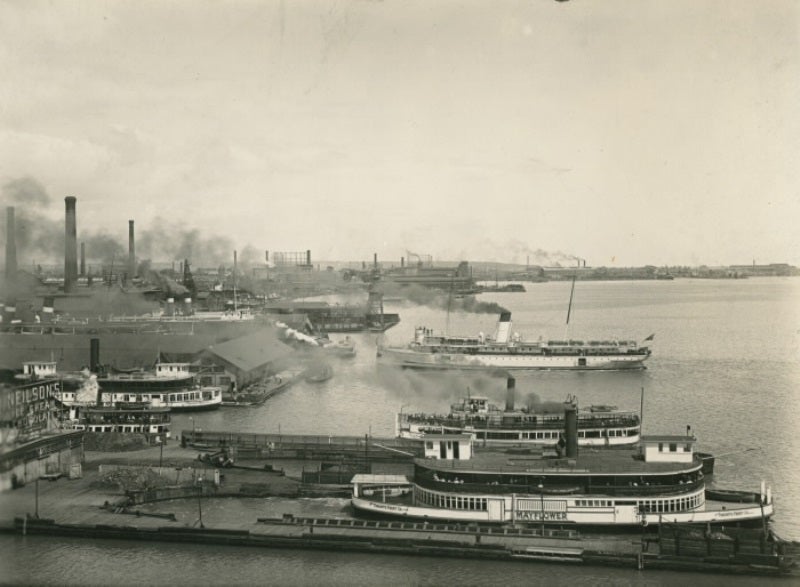
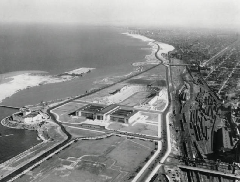
On the left: Toronto’s waterfront was a heavily used industrial hub during the 1920’s. On the right: Chicago’s waterfront during the same time period paints a different picture, with Soldier Field beginning to take shape south of Michigan Avenue. (Images from the Toronto Public Library and the Art Institute of Chicago).
By 1900, Chicago was a mammoth city of 1.7 million people with a booming economy, while Toronto was a town of only 200,000 people. Chicago parks during this time were the product of a different era – a time when leisure space was believed to be very separate from work space, and planners were designing grand public spaces that allowed people to escape from their hectic lives in the polluted city.
Toronto’s waterfront began similarly with the Walks and Garden Trust, established in 1818 by John Graves Simcoe who fell in love with the shores of York and fought to preserve a strip of land south of Front Street between Peter and Berkeley as a public park. But as time went on, Toronto’s main priority shifted towards building up its economy. The waterfront was our greatest asset and since much of our trade was by boat, it made sense to build manufacturing facilities adjacent to the lake because it allowed for easier shipping and transportation.
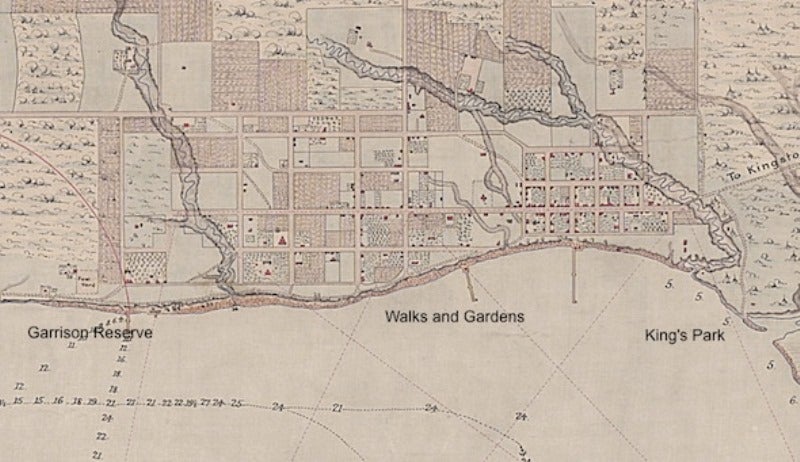
A map outlining the area of John Graves Simcoe’s Walks and Gardens along Toronto’s shoreline (Image from BlogTO.com)
The city attempted to upgrade parts of the waterfront, but the arrival of the railway in the 1850’s destroyed Simcoe’s plan as the land was gradually used to accommodate the increase in rail traffic. Fast forward to the 1950’s when our population finally hit one million and by that time not only was the waterfront an industrial hub with an extensive railway system, but the Gardiner Expressway had effectively cut it off from the city (which at one time might have made sense, but that’s a story for another day). It wasn’t until the 1970’s that interest in urban waterfront revitalization became an international hot topic and Toronto would face an uphill battle in overcoming the barriers that had become entrenched on the waterfront.
2. VISION
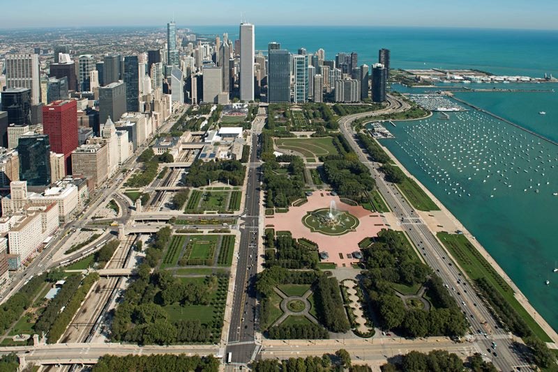
Chicago owes its signature waterfront to many dedicated city fathers and civic champions who envisioned and fought for the grand, open concept it is today. This vision first appeared in 1836 when the Canal Commission set aside a large parcel of land east of Michigan Ave as “public ground – a common to remain forever open, clear, and free of any buildings, or other obstructions whatsoever.” In this way, Chicago set itself apart from other cities, like Toronto, who frequently used their waterfronts for manufacturing and transport.
For the next century, individuals like Daniel Burnham and Aaron Montgomery Ward championed this vision and upheld the legislative law that protected the park land. Burnham’s Plan of Chicago laid the ground work for the expansion of waterfront park land throughout the 20th century, while Ward (aka the watchdog of the lakefront) aggressively campaigned to protect the land from development, going so far as to sue the City of Chicago twice to remove buildings on the waterfront. These individuals were pivotal in cementing this vision; a vision that continues to play a significant role in current waterfront development issues.
But Chicago’s waterfront is the product of another time and place, and Toronto is establishing its own unique vision that is taking our distinct situation into consideration as we carry out a unified plan for the waterfront. Despite our similarities, we are two world-class cities with very different personalities.
A crucial distinction to note is the role of the economy. On one hand, Chicago has a well-established and concentrated economy that focuses on traditional business and manufacturing, as well as emerging industries like information technology and research and development. It’s also important to note that in recent years, Chicago’s population growth has slowed and is shifting from growth in its urban core to suburban areas like Cook County.
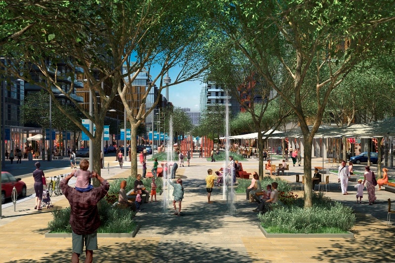
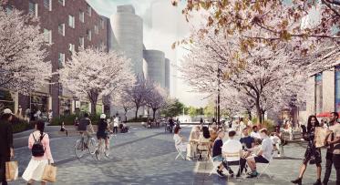
An artists' rendering of the Front Street Promenade in the West Don Lands depicts how new neighbourhoods along Toronto’s waterfront will create an eclectic urban environment for people to live, work and play.
Toronto’s downtown population on the other hand has grown four times faster than the rest of the city and its suburbs and shows no signs of slowing. And our economy has broad and diverse industry sectors including design, fashion, film, food and beverage, music, science and technology in addition to traditional business and financial services. It is this level of diversity that is attracting young talented people from around the world to Toronto in search of economic opportunity. They want to live and work in our downtown for its quality of life and unique urban lifestyle. They want access to jobs, cultural amenities, parks and restaurants.
Our waterfront is an unparalleled opportunity to establish new neighbourhoods that meet these demands. Building mixed-use communities enhances the economic, social and cultural vibrancy not only of our waterfront, but of our city. They also enable Toronto to compete aggressively with other world class cities for people, jobs and investment. Developed properly with our commitment to reserve 25 percent of revitalized lands for parks and open public spaces, we can have an accessible and active waterfront for everyone to enjoy. Why not have our cake and eat it too?
3. PUBLIC VS PRIVATE FUNDING
The reality is that all parks need funding. Some rely solely on public funding (like most Canadian parks and public spaces), while others receive generous private funding. Chicago no doubt has one of the world’s greatest waterfronts but many of its iconic parks could not have been possible without considerable private funding.
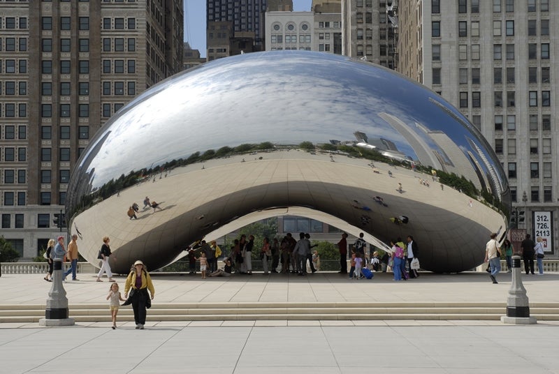
On the left: Millennium Park is a celebrated public space on the Chicago waterfront whose design and construction would have been impossible without a large investment from private donors (Image from Wibiti.com). On the Right: Cloud Gate, better known as The Bean, is one of the most popular and recognizable landmarks in Chicago (Image from the City of Chicago).
For example, Millennium Park opened in 2004 to a great deal of excitement and praise for its spectacular design and famous public art, including Cloud Gate, affectionately nicknamed “The Bean” by Chicagoans. Companies and wealthy citizens, many of whom were unimpressed with the modesty and small scale of the original design, agreed to contribute a whopping $235-million in order to replace the original design with an exceptional one that brought architecture, planning and art into the next millennium. The final price tag for Cloud Gate alone was $23-million. To the east of Millennium Park is Maggie Daley Park, which will reopen later this year after a $50-million redevelopment - $10-million of which was raised privately. There’s also the smaller Lakeshore East Park to the north which received private funding from neighbouring condominium buildings.
It’s also worth noting that the philanthropic culture in the United States is far more established than in Canada, and statistically speaking, we aren’t even close to competing. In 2012, America had roughly 12 times the number of millionaires than Canada, which means that sources for major donations are fewer and spread more thinly north of the border. There’s also research to suggest that our “giving” cultures are different at their core. For instance, citizens from nations with higher rates of taxation (like Canada) might see funding for parks and public spaces as a government responsibility and be more inclined to volunteer their time rather than making a financial contribution.
One interesting development that may begin to change things is the City of Toronto’s new program to encourage private developers to create Privately Owned Publically-Accessible Spaces. (POPS), as a way of creating more green spaces around the city. Public spaces like the Rose Garden at the Four Seasons Hotel and the TD Centre Plaza are providing new greenery in locations across the city. We’re also seeing organizations like Toronto Park People and Evergreen whose work is often focused on helping community members improve and activate sustainable parks and public spaces. Park People’s Parks Platform 2014, for example, outlines how new models of community engagement and stewardship could benefit parks, including through fundraising.
But ultimately, the majority of Toronto’s parks – including those along the waterfront – are funded by the municipal, provincial and federal governments. Waterfront Toronto was established by all three levels of government with $1.5 billion in seed money to begin transforming Toronto’s waterfront into beautiful, sustainable mixed-use communities and iconic waterfront parks that will deliver economic and social benefits to our city– places like Canada’s Sugar Beach, Corktown Common and Sherbourne Common.
But an excellent local example of what can be accomplished when resources are pooled together is Ireland Park – a once forgotten public space tucked behind the Canadian Malting silos next to the Portland Slip that has been transformed in recent years into a beloved public amenity thanks to donations from private partners.
4. LAND OWNERSHIP
As we mentioned before, Chicago was thinking about their waterfront long before us and land ownership was defended throughout the 19th century and settled early in the 20th century. A consolidated land transfer to the local parks commission allowed for large scale development and successful policies like the ban on tall buildings near the water’s edge.
Toronto’s post-industrial waterfront ownership, on the contrary, is a bit messier. Creating a cohesive waterfront vision was almost impossible throughout the 20th century thanks to a deeply fractured ownership structure.
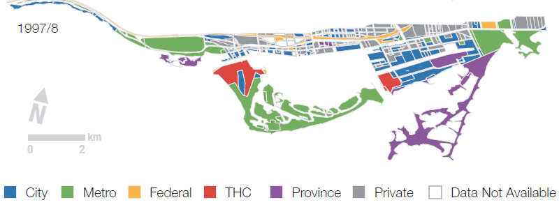
Geographic distribution of land ownership in Toronto in 1997/8 (Image from Landlocked: Politics, Property, and the Toronto Waterfront, 1960-2000)
What we have here is a case of too many cooks in the kitchen. Upwards of 20 different public departments, agencies, boards, and special purpose bodies that span across three levels of government have had some sort of hold on the waterfront at any given time, including the City of Toronto, Toronto Port Authority (now PortsToronto), Metro Toronto, The Harbour Commission, Canada Lands Company and even the LCBO. Regular changes in ownership coupled with substantial private land holdings since the 1950’s have been a major obstacle. Expropriating the land would be cost-prohibitive, and doubly difficult to justify when creating new parkland incurs future operational costs but doesn’t contribute directly to City revenues (parks do produce revenue indirectly, however).
As you can probably imagine, this fragmentation created a system with many conflicting interests, with each voice shouting over the other. This is one of the primary reasons Waterfront Toronto was created. The Toronto Waterfront Revitalization Act 2002 helped to consolidate a number of lands held by the three levels of government into a single plan. It gave us the ability to create a cohesive waterfront vision and accelerate revitalization over the past 13 years at a pace that was not previously achievable.
HONOURABLE MENTION
Success depends heavily on public support. Chicagoans praise their waterfront and everyone envies it, and why shouldn’t they? It’s a spectacular display of what can be accomplished with great vision and fortitude. But you know what? Ours is pretty spectacular as well. Toronto is known as a city within a park, and if you take a close look the waterfront is no exception. From the Humber River to the Rouge River, the water’s edge is full of impressive and delightful parks and public spaces for the entire city to enjoy. Sir Casimir Gzowski Park, Sunnyside Park and Marilyn Bell Park give almost uninterrupted access in the west end, while Tommy Thompson Park, the Toronto Beaches and Port Union Waterfront Park give east-enders heaps of space to enjoy the natural environment. Closer to the downtown core, popular spaces like Coronation Park, Little Norway Park, the Music Garden and Harbour Square Park are just a few of the green oases you can find tucked alongside the lake. And who can forget the Toronto Islands? As we continue to build out the water’s edge promenade and extend the Martin Goodman Trail, all of these hidden gems will be properly connected for the first time. Torontonians and tourists will be able to travel continuously across the entire downtown waterfront – from west of Bathurst to east of Parliament – with connecting trails to the city’s east and west ends.
Check out this Google Map showing all of Toronto's waterfront parks, from Mimico in the west to Port Union in the east:
So let’s not sell ourselves short. We’re in the midst of overcoming a century of adversity and have already forged a pretty remarkable waterfront that is only going to get better in the coming years.
...
Got a question about waterfront revitalization? Ask us. You can join the conversation using the #TOtheWaterfront hashtag and follow us on Twitter and Facebook.
For more information, visit our website and watch this video to see how the waterfront is changing. Even better, come down and see for yourself what’s happening on the waterfront.
What’s changing in the Villiers Island Precinct Plan?
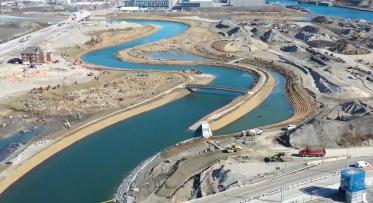
Take yourself on a tour of the Port Lands