Delivering What’s Needed Now

POSTED: APRIL 26, 2023
In this Blog:
- Our most recent Rolling Five-Year Strategic Plan 2023/24 - 2027/28 sets out our long-term strategic priorities with a specific focus on what we will achieve this fiscal year.
-
In addition to the thousands of residential units already built, we have more than 6,000 units in planning, design or construction stages.
-
In 2023–2024, we will seek Toronto City Council approval to advance the detailed design and secure funding for the Waterfront East Light Rail Transit (LRT) project.
-
Once flood protection in the Port Lands is complete, a large swath of land will become available to build new parks and housing, allowing the city to expand in a sustainable way.
-
This year, we will open the Cherry Street North and Commissioners Street Bridges, part of the family of four distinctive bridges that will connect future Villiers Island to the mainland.
Waterfront Toronto was purpose-built to advance vital public priorities by the lake. We’ve already enabled thousands of housing units, dozens of parks and new transportation routes. With flood protection work in the Port Lands nearing completion in 2024, we’re ready to bring more new neighbourhoods to life.
Our most recent Rolling Five-Year Strategic Plan 2023/24 - 2027/28 sets out our long-term strategic priorities with a specific focus on what we will achieve this fiscal year. This three-part blog series highlights Waterfront Toronto’s commitments and progress delivering on public priorities, beginning with plans to advance urgent projects that are needed now.
Housing
A critical part of Waterfront Toronto’s work is facilitating the creation of new homes on the waterfront. While we’ve already added more than 4,000 new homes, our approach is about more than simply adding units. We lay the foundations for complete communities, ensuring that new waterfront neighbourhoods are livable, sustainable and accessible — and that a significant share of new residential supply responds to the urgent need for affordable housing downtown.
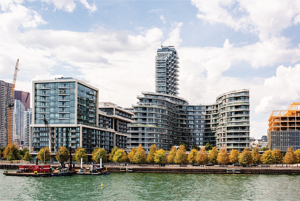
Aqualina and Aquavista are two of the four residential buildings developed by Hines/Tridel in Bayside, creating hundreds of housing units – including some affordable.
We’re doing our part to create much needed affordable and market housing in Toronto. In addition to the thousands of units already built, we have more than 6,000 units in planning, design or construction stages, including around 4,300 units at Quayside, and 1,868 units in Bayside and the West Don Lands. Learn more on page 18 of the Strategic Plan.
To address the urgent need for housing, in 2023–2024 we will work with the City of Toronto and our development partners in Bayside to create hundreds of purpose-built rental housing units, most of it affordable, and continue construction on Aqualuna the fourth and final residential building by Hines/Tridel in Bayside.
Transit
Public transportation is key to connecting people to the waterfront and the new homes we’re delivering. We are working closely with the City of Toronto and the Toronto Transit Commission (TTC) to advance design and delivery of a new Waterfront East LRT line that will run from Union Station south on Bay Street, along Queens Quay East and into the Port Lands.
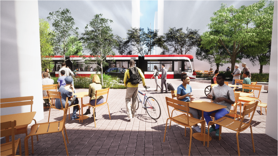
Connectivity is vital to the success of the thousands of housing units we’re set to deliver over the next several years, as well as to the growing workforce and new parks along the waterfront.
In 2023–2024, we will complete 30% design of the on-street portions of the Waterfront East LRT and seek Toronto City Council approval to advance the detailed design and secure funding. We also plan to complete the Transit Project Assessment Process and seek ministry approval to proceed with implementation of the Waterfront East LRT.
Learn more about this new transit connection to the eastern waterfront on page 21.
Increasing Climate Resilience Through Flood Protection
The Port Lands Flood Protection Project is one of the largest infrastructure projects of its kind ever undertaken in Canada. The initiative is designed to flood-protect 240 hectares (593 acres) of prime land by reshaping the mouth of the Don River, making the surrounding area newly available for housing, business and recreation.
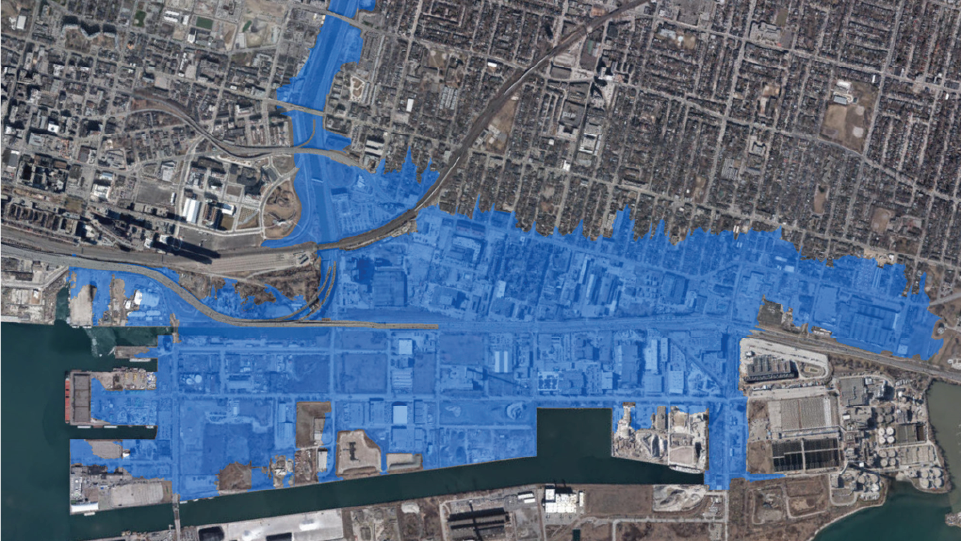
Once flood protection is complete, a large stretch of land that’s vulnerable to flooding, and currently cannot be developed, will become a place where we can build new homes, public spaces and parks, allowing the city to expand in a sustainable way.
In addition to unlocking enormous economic value and enhancing the downtown waterfront, this project stands to dramatically increase Toronto’s resilience to extreme weather events and flooding. It will also protect some existing residential areas to the east that face elevated risks from flooding. Learn more on page 26.
As this complex project proceeds through 2023–2024, we expect to:
-
Complete several portions of the reconfigured river valley and initiate the phased process of allowing the river to begin flowing along its new routes.
-
Complete and open Commissioners Street as well as New Cherry Street from Lake Shore Boulevard to the Ship Channel.
-
Open the Cherry Street North and Commissioners Street Bridges, part of the family of four distinctive bridges that will connect future Villiers Island to the mainland.
Learn more about these exciting projects and others in our 2023/24 Rolling Five-Year Strategic Plan.