What’s changing in the Villiers Island Precinct Plan?
POSTED: MAY 7, 2024
In This Blog:
-
We’re updating the precinct plan for Villiers Island to make it easier to build more homes, including affordable homes
-
The vision for this new community remains the same: A compact, walkable and affordable community with lively public spaces.
-
The changes we are making only apply to the building heights. The streets and other public spaces have not yet been designed.
Updating the precinct plan
Toronto City Council has taken action to urgently build more affordable homes, including directing staff to explore opportunities to achieve more affordable housing on ‘Villiers Island.’ The City of Toronto, CreateTO and Waterfront Toronto have been working on a Density Study to determine the best way to deliver more housing on the island.
At a public meeting in June 2023, we presented three approaches for increasing density on ‘Villiers Island’ and polled attendees to assess whether the priorities set by the 2017 Villiers Island Precinct Plan were still relevant. That meeting summary is available here. in March and May 2024, we reported back to the public with our proposed updates to the Precinct Plan.
The plans we presented are approximate, based on proposed changes to the built form, or what we call “massing” – the white boxes you’ll see on plans.
The materials should give you a sense of how we plan to shift the island from a predominantly mid-rise community to a dense, urban neighbourhood. We now project that over 15,000 people will live there and 3,000 will work there.
We also shared details about the overall process that gets us to a complete community on the island – things like added infrastructure and community amenities and design for public spaces and streets – and future opportunities to lend your voice to impact decisions throughout the process.
Changes to the precinct plan will ensure we take advantage of this opportunity to deliver:
-
More housing, including affordable housing
-
A greater investment in infrastructure, spaces and community amenities
-
Canada’s first climate-positive community
We’re not changing the vision for this new community.
Increasing densities on the island will help deliver the kind of community envisioned in the 2017 Precinct Plan. A compact, walkable and affordable community with lively public spaces.
Creating the foundation for a sustainable, livable urban neighbourhood.
The new mouth of the Don River was flooded in February 2024.
The foundation of this future neighbourhood is the innovative green space and imaginative parkland that is being completed now, through Port Lands Flood Protection, and set to open in 2025. The parks and river valley are going to be a unique ecological asset. This landscape will extend throughout the island, in streetscapes, public spaces and walkways. Low-impact design approaches have already been taken to make sure new Cherry and Commissioners Streets integrate with the landscaping that surrounds this neighbourhod.
This island is created by the rerouting of the Don River through the Port Lands. The island will be surrounded by water on all sides.
Workers planting one of the wetlands in the new river valley – part of an extensive network on greenspace that will surround the new island.
Imagining a new neighbourhood
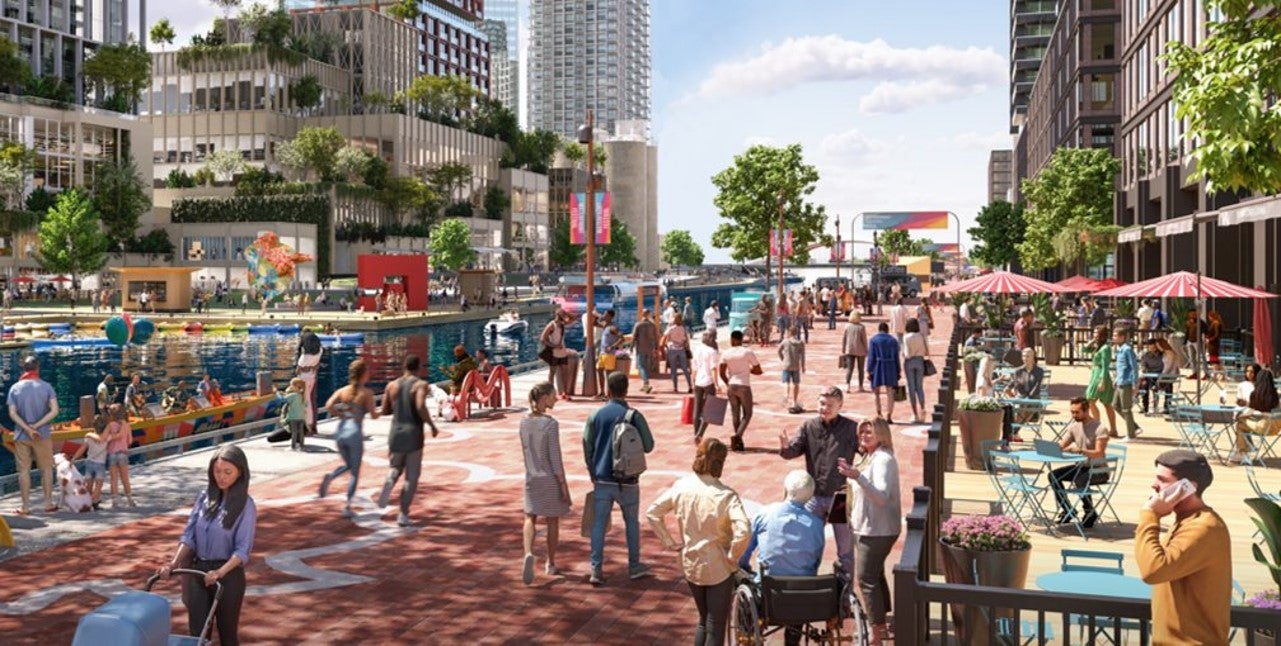
The northern edge of the island will be an urban boardwalk along the Keating Channel – the only place like it in Toronto. The Keating Channel will remain as an urban waterway, with the Water’s Edge Promenade along both sides of the channel. It will be an active public space where we envision shops, cafes and a tree-lined promenade connected to Quayside by a new pedestrian bridge.
There will be multiple connections between land and water. A fine-grain street network will support transit, walking and cycling to and within the island, with links to the city mainland to the north and the Port Lands to the east and south.
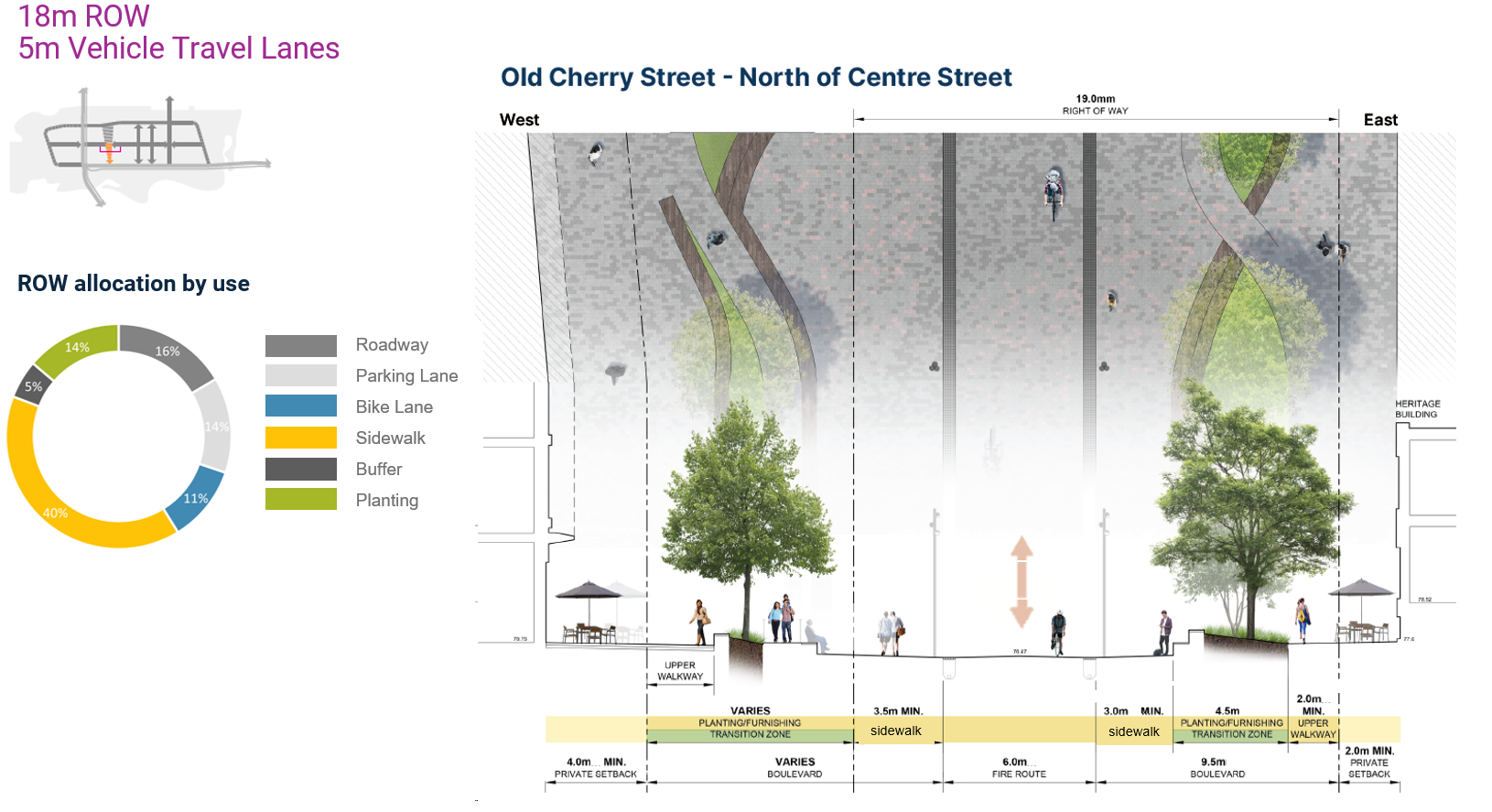
There is a hierarchy of streets that includes finer-grained local streets dedicated primarily to pedestrians. While other streets like Cherry, Commissioners and Munition are connecters with multi-modes. These streets include a maximum of one vehicular lane in each direction, plus space for:
- Transit (Cherry/Commissioners/Munition Street)
- Dedicated bikelanes (Cherry, Commissioners, Villiers, Munition)
- Generous Sidewalks
- Spill out space for sidewalk cafes
- Green Infrastructure and ecological planting to actively manage stormwater
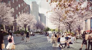
What does this look like?
Here’s how some of the neighbourhood streets could look, based on the scale and height of buildings proposed. These views will be shaped by the design of streets and architecture of buildings, work that has not yet started.
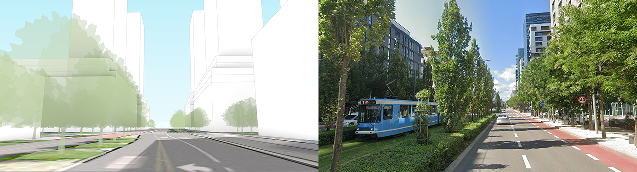
Left: New Cherry Street looking south just after crossing the new bridge and landing on the island shows a wider right-of-way to allow room for multi-modal travel onto and off of the island, including 2 vehicle lanes, separated bi-directional bike lanes and dedicated bi-directional streetcar tracks.
Right: In a higher-density mixed-use neighbourhood in central Oslo, this street allows for a mix of transportation modes including dedicated transit and cycle lanes, and the dense built form supports a variety of retail uses at grade.
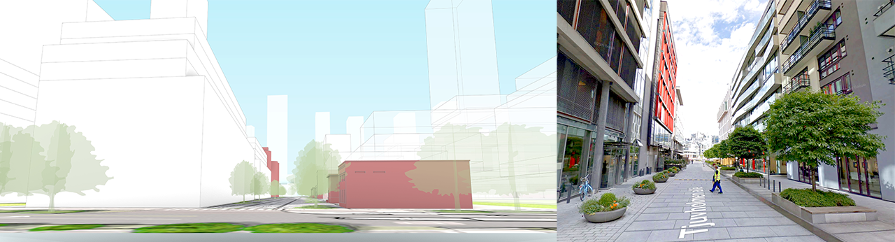
Left: Looking north along the Old Cherry heritage corridor from River Park North and Commissioners Street. Lowrise heritage buildings lining the eastern (right) side of the street with a view of the Essroc silos to the north.
Right: This examples from Oslo shows midrise buildings framing a pedestrian priority street with landscaping and heritage buildings.
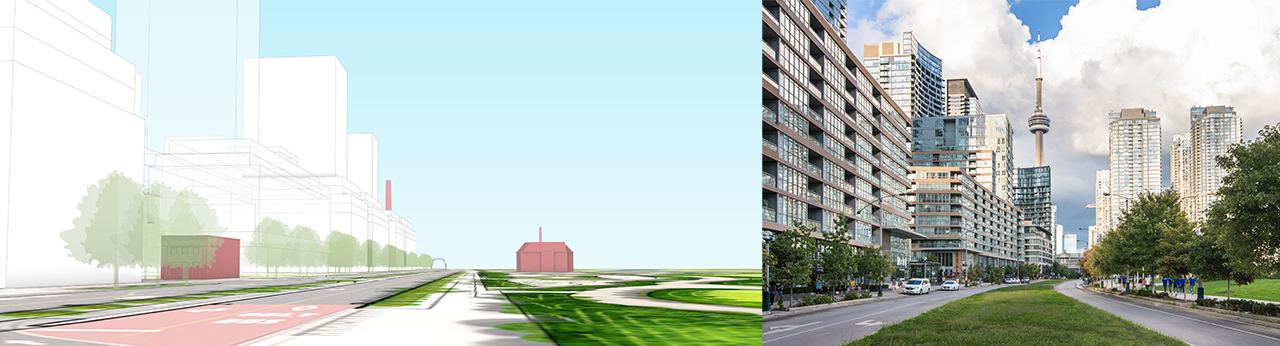
Left: Looking east along Commissioners Street with midrise base buildings and taller towers above parkland on the south (right) side of Commissioners Street. Two heritage buildings are highlighted in red: one at the southern base of the Old Cherry Street heritage corridor, as well as Fire Hall 30 now sits at the entrance to the park.
Right: Fort York Blvd. looking east in the CityPlace neighbourhood shows a consistent streetwall along the north (left) side of the wide landscaped street. Canoe Landing Park is located to the south (right) providing the central greenspace for the dense urban neighbourhood.
Are you interested in future consultation opportunities? Sign up for our monthly newsletter here.
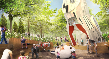
Larger-Than-Life Wildlife Coming to the Port Lands
Waterfront Toronto’s Design Review Panel Reviews Villiers Island Density and Massing Study